Cinnamon Creek Topo Map North Dakota
To zoom in, hover over the map of Cinnamon Creek
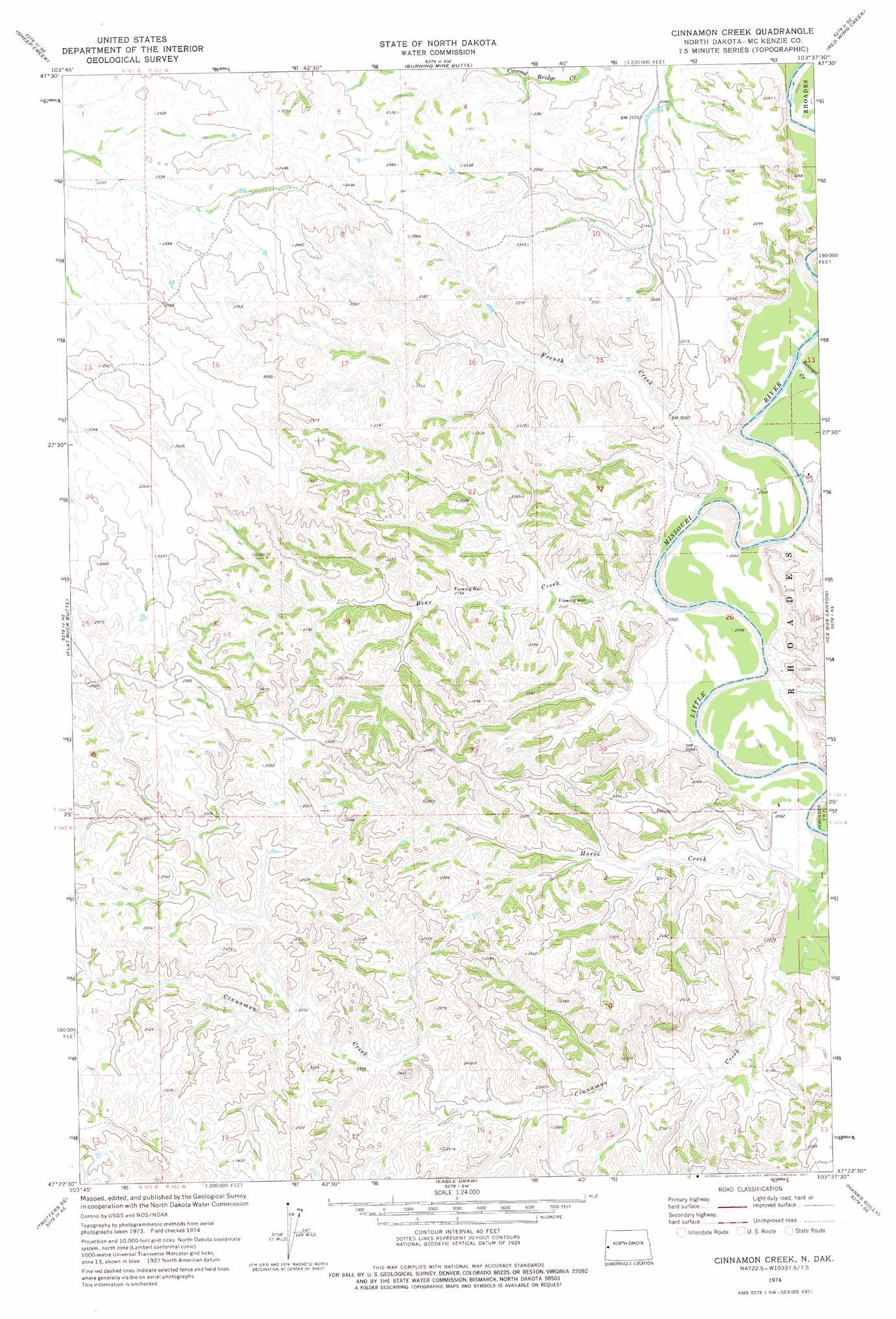
USGS Topo Quad 47103d6 - 1:24,000 scale
| Topo Map Name: | Cinnamon Creek |
| USGS Topo Quad ID: | 47103d6 |
| Print Size: | ca. 21 1/4" wide x 27" high |
| Southeast Coordinates: | 47.375° N latitude / 103.625° W longitude |
| Map Center Coordinates: | 47.4375° N latitude / 103.6875° W longitude |
| U.S. State: | ND |
| Filename: | O47103D6.jpg |
| Download Map JPG Image: | Cinnamon Creek topo map 1:24,000 scale |
| Map Type: | Topographic |
| Topo Series: | 7.5´ |
| Map Scale: | 1:24,000 |
| Source of Map Images: | United States Geological Survey (USGS) |
| Alternate Map Versions: |
Cinnamon Creek ND 1974, updated 1977 Download PDF Buy paper map Cinnamon Creek ND 1997, updated 2001 Download PDF Buy paper map Cinnamon Creek ND 2011 Download PDF Buy paper map Cinnamon Creek ND 2014 Download PDF Buy paper map |
| FStopo: | US Forest Service topo Cinnamon Creek is available: Download FStopo PDF Download FStopo TIF |
1:24,000 Topo Quads surrounding Cinnamon Creek
Horse Creek School |
Sather Lake |
Moline School |
Bear Butte |
Stocke Butte |
Phillip Spring |
Sheep Creek |
Burning Mine Butte |
Red Wing Creek |
Sperati Point |
Squaw Gap |
Flat Rock Butte |
Cinnamon Creek |
Ice Box Canyon |
Wolf Coulee |
Trotters |
Trotters Se |
Eagle Draw |
Hanks Gully |
Squaretop Butte |
Hootowl Creek West |
Hootowl Creek East |
Roosevelt Creek West |
Roosevelt Creek East |
Gorham Nw |
> Back to 47103a1 at 1:100,000 scale
> Back to 47102a1 at 1:250,000 scale
> Back to U.S. Topo Maps home
Cinnamon Creek topo map: Gazetteer
Cinnamon Creek: Streams
Bear Creek elevation 622m 2040′Beicegel Creek elevation 621m 2037′
French Creek elevation 622m 2040′
Horse Creek elevation 628m 2060′
Cinnamon Creek digital topo map on disk
Buy this Cinnamon Creek topo map showing relief, roads, GPS coordinates and other geographical features, as a high-resolution digital map file on DVD:
Eastern Montana & Western North Dakota
Buy digital topo maps: Eastern Montana & Western North Dakota