Briggs Coulee Topo Map Montana
To zoom in, hover over the map of Briggs Coulee
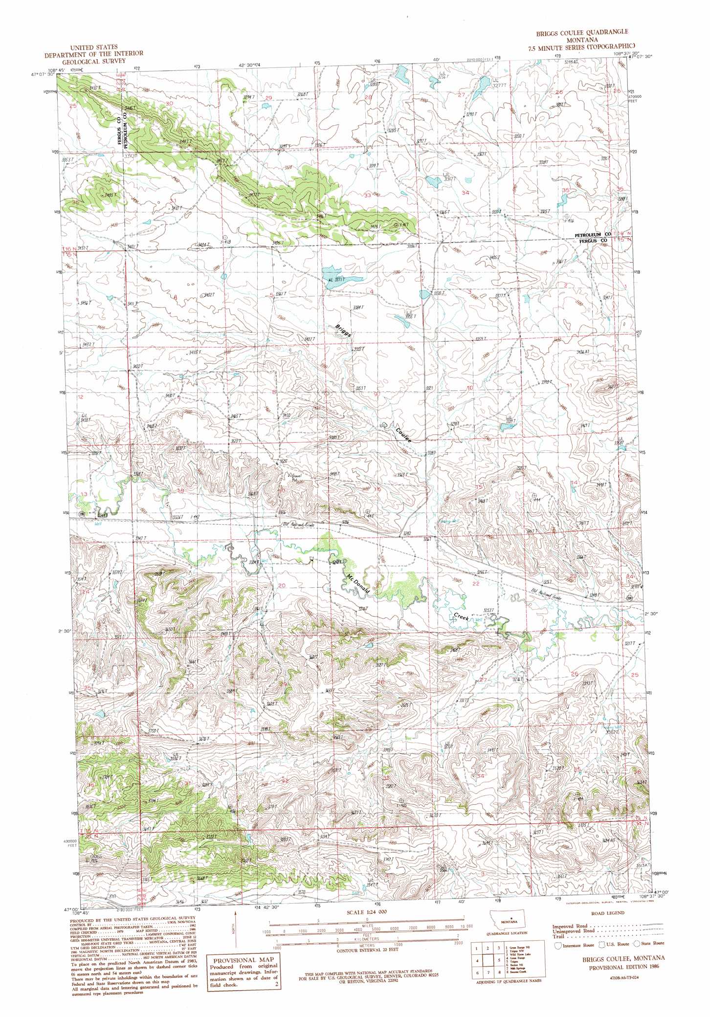
USGS Topo Quad 47108a6 - 1:24,000 scale
| Topo Map Name: | Briggs Coulee |
| USGS Topo Quad ID: | 47108a6 |
| Print Size: | ca. 21 1/4" wide x 27" high |
| Southeast Coordinates: | 47° N latitude / 108.625° W longitude |
| Map Center Coordinates: | 47.0625° N latitude / 108.6875° W longitude |
| U.S. State: | MT |
| Filename: | o47108a6.jpg |
| Download Map JPG Image: | Briggs Coulee topo map 1:24,000 scale |
| Map Type: | Topographic |
| Topo Series: | 7.5´ |
| Map Scale: | 1:24,000 |
| Source of Map Images: | United States Geological Survey (USGS) |
| Alternate Map Versions: |
Briggs Coulee MT 1986, updated 1986 Download PDF Buy paper map Briggs Coulee MT 2011 Download PDF Buy paper map Briggs Coulee MT 2014 Download PDF Buy paper map |
1:24,000 Topo Quads surrounding Briggs Coulee
Roy |
Bohemian Corners |
Bear Creek Reservoir |
Bear Creek Reservoir Se |
Valentine |
Grass Range Nw |
Grass Range Ne |
Teigen Nw |
Wild Horse Lake |
Dry Blood Creek West |
Fish Dam |
Grass Range |
Briggs Coulee |
Teigen |
Little Bear Lake |
Becket |
Becket Ne |
Milk Springs |
Snoose Creek |
Yellow Water Res. |
Bald Butte |
Tyler |
Pike Creek Hills W. |
Pike Creek Hills E. |
Flatwillow |
> Back to 47108a1 at 1:100,000 scale
> Back to 47108a1 at 1:250,000 scale
> Back to U.S. Topo Maps home
Briggs Coulee topo map: Gazetteer
Briggs Coulee: Dams
Lewis Brothers Dam elevation 1026m 3366′Lewis Dam Number 1 elevation 997m 3270′
Lewis Dam Number 2 elevation 1001m 3284′
Briggs Coulee: Post Offices
Doughty Post Office (historical) elevation 1009m 3310′Briggs Coulee: Valleys
Briggs Coulee elevation 996m 3267′Briggs Coulee: Wells
15N24E15CCCC01 Well elevation 1001m 3284′15N24E18CAA_01 Well elevation 1024m 3359′
15N24E20BDB_01 Well elevation 1008m 3307′
16N24E28AAC_01 Well elevation 1007m 3303′
Briggs Coulee digital topo map on disk
Buy this Briggs Coulee topo map showing relief, roads, GPS coordinates and other geographical features, as a high-resolution digital map file on DVD: