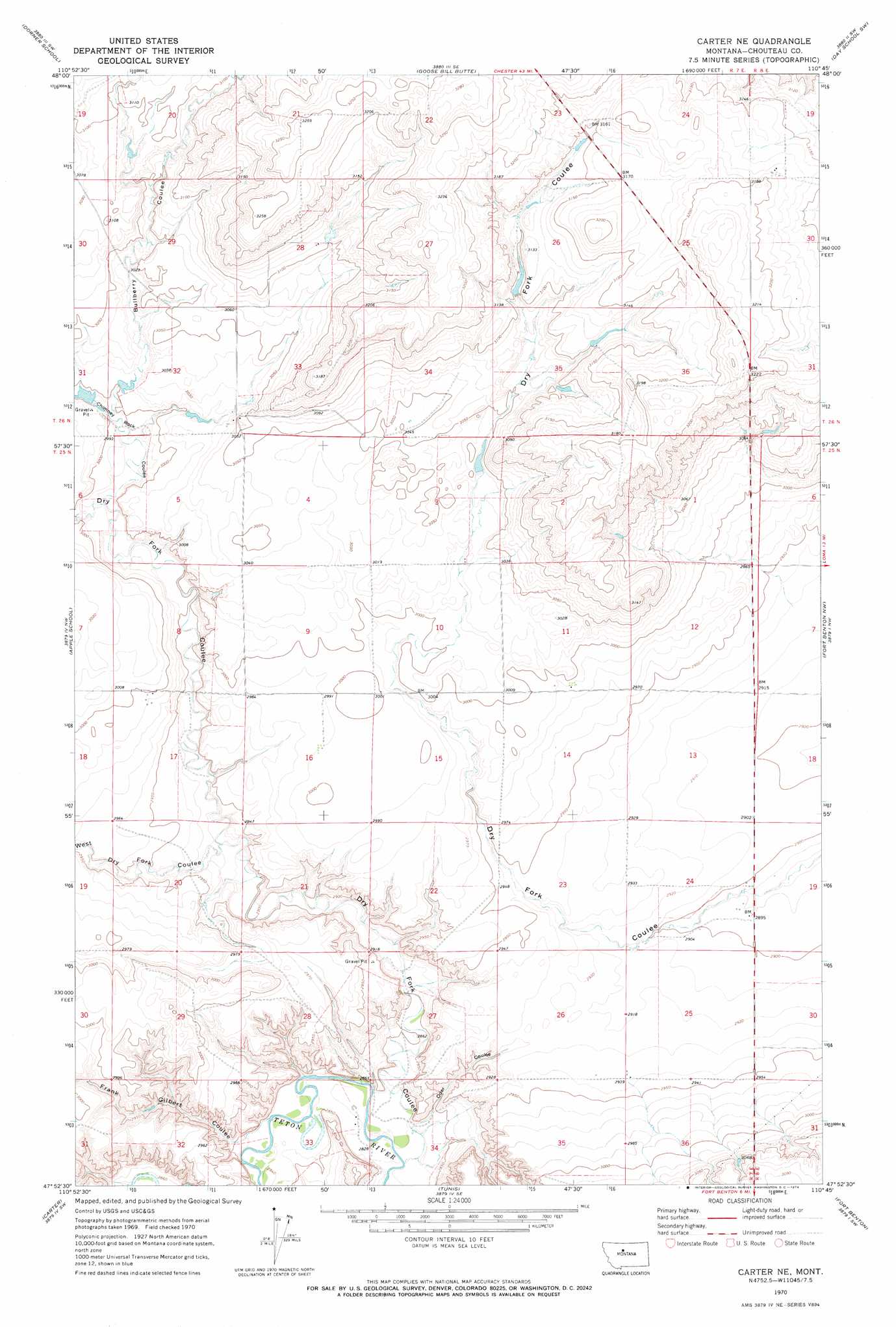
Carter Ne Topo Map Montana
To zoom in, hover over the map of Carter Ne
USGS Topo Quad 47110h7 - 1:24,000 scale
| Topo Map Name: | Carter Ne |
| USGS Topo Quad ID: | 47110h7 |
| Print Size: | ca. 21 1/4" wide x 27" high |
| Southeast Coordinates: | 47.875° N latitude / 110.75° W longitude |
| Map Center Coordinates: | 47.9375° N latitude / 110.8125° W longitude |
| U.S. State: | MT |
| Filename: | o47110h7.jpg |
| Download Map JPG Image: | Carter Ne topo map 1:24,000 scale |
| Map Type: | Topographic |
| Topo Series: | 7.5´ |
| Map Scale: | 1:24,000 |
| Source of Map Images: | United States Geological Survey (USGS) |
| Alternate Map Versions: |
Carter NE MT 1970, updated 1974 Download PDF Buy paper map Carter NE MT 2011 Download PDF Buy paper map Carter NE MT 2014 Download PDF Buy paper map |
1:24,000 Topo Quads surrounding Carter Ne
Uphill Creek |
Goose Bill Butte Nw |
Penzer School |
Dutch Henry Coulee |
Discovery Butte |
Russell Chapel |
Dorner School |
Goose Bill Butte |
Day School Sw |
Day School |
Dent Bridge Ne |
Apple School |
Carter Ne |
Fort Benton Nw |
Loma West |
Antelope Lake |
Carter |
Tunis |
Fort Benton |
O'Hanlon Coulee |
Floweree |
Lander Crossing |
Rice Reservoir |
Shonkin Nw |
Shonkin |
> Back to 47110e1 at 1:100,000 scale
> Back to 47110a1 at 1:250,000 scale
> Back to U.S. Topo Maps home
Carter Ne topo map: Gazetteer
Carter Ne: Dams
Joe Vielleux Dam elevation 931m 3054′Sweet Pea Dam elevation 943m 3093′
Carter Ne: Valleys
Bullberry Coulee elevation 912m 2992′Chimney Rock Coulee elevation 906m 2972′
Dry Fork Coulee elevation 860m 2821′
Frank Gilbert Coulee elevation 869m 2851′
Oder Coulee elevation 863m 2831′
West Dry Fork Coulee elevation 888m 2913′
Carter Ne digital topo map on disk
Buy this Carter Ne topo map showing relief, roads, GPS coordinates and other geographical features, as a high-resolution digital map file on DVD: