Day School Sw Topo Map Montana
To zoom in, hover over the map of Day School Sw
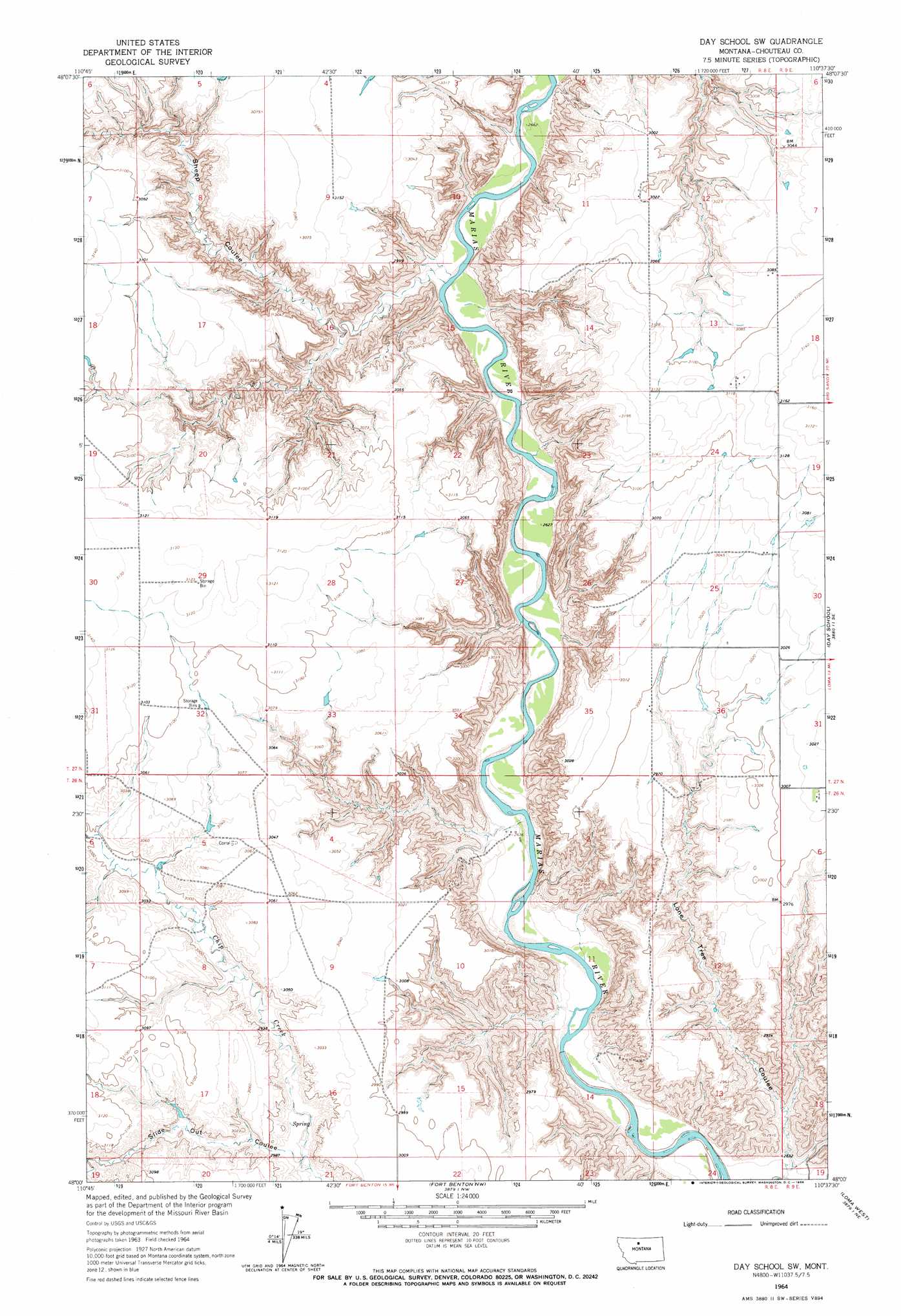
USGS Topo Quad 48110a6 - 1:24,000 scale
| Topo Map Name: | Day School Sw |
| USGS Topo Quad ID: | 48110a6 |
| Print Size: | ca. 21 1/4" wide x 27" high |
| Southeast Coordinates: | 48° N latitude / 110.625° W longitude |
| Map Center Coordinates: | 48.0625° N latitude / 110.6875° W longitude |
| U.S. State: | MT |
| Filename: | o48110a6.jpg |
| Download Map JPG Image: | Day School Sw topo map 1:24,000 scale |
| Map Type: | Topographic |
| Topo Series: | 7.5´ |
| Map Scale: | 1:24,000 |
| Source of Map Images: | United States Geological Survey (USGS) |
| Alternate Map Versions: |
Day School SW MT 1964, updated 1966 Download PDF Buy paper map Day School SW MT 2011 Download PDF Buy paper map Day School SW MT 2014 Download PDF Buy paper map |
1:24,000 Topo Quads surrounding Day School Sw
Circle Bridge |
Poverty Coulee Se |
Rocky Coulee Sw |
Rocky Coulee Se |
Fourteenmile Coulee Sw |
Goose Bill Butte Nw |
Penzer School |
Dutch Henry Coulee |
Discovery Butte |
Kenilworth |
Dorner School |
Goose Bill Butte |
Day School Sw |
Day School |
Kenilworth Sw |
Apple School |
Carter Ne |
Fort Benton Nw |
Loma West |
Loma East |
Carter |
Tunis |
Fort Benton |
O'Hanlon Coulee |
Rocky Lake |
> Back to 48110a1 at 1:100,000 scale
> Back to 48110a1 at 1:250,000 scale
> Back to U.S. Topo Maps home
Day School Sw topo map: Gazetteer
Day School Sw: Valleys
Lone Tree Coulee elevation 799m 2621′Sheep Coulee elevation 808m 2650′
Slide Out Coulee elevation 894m 2933′
Day School Sw digital topo map on disk
Buy this Day School Sw topo map showing relief, roads, GPS coordinates and other geographical features, as a high-resolution digital map file on DVD: