Almira Sw Topo Map Washington
To zoom in, hover over the map of Almira Sw
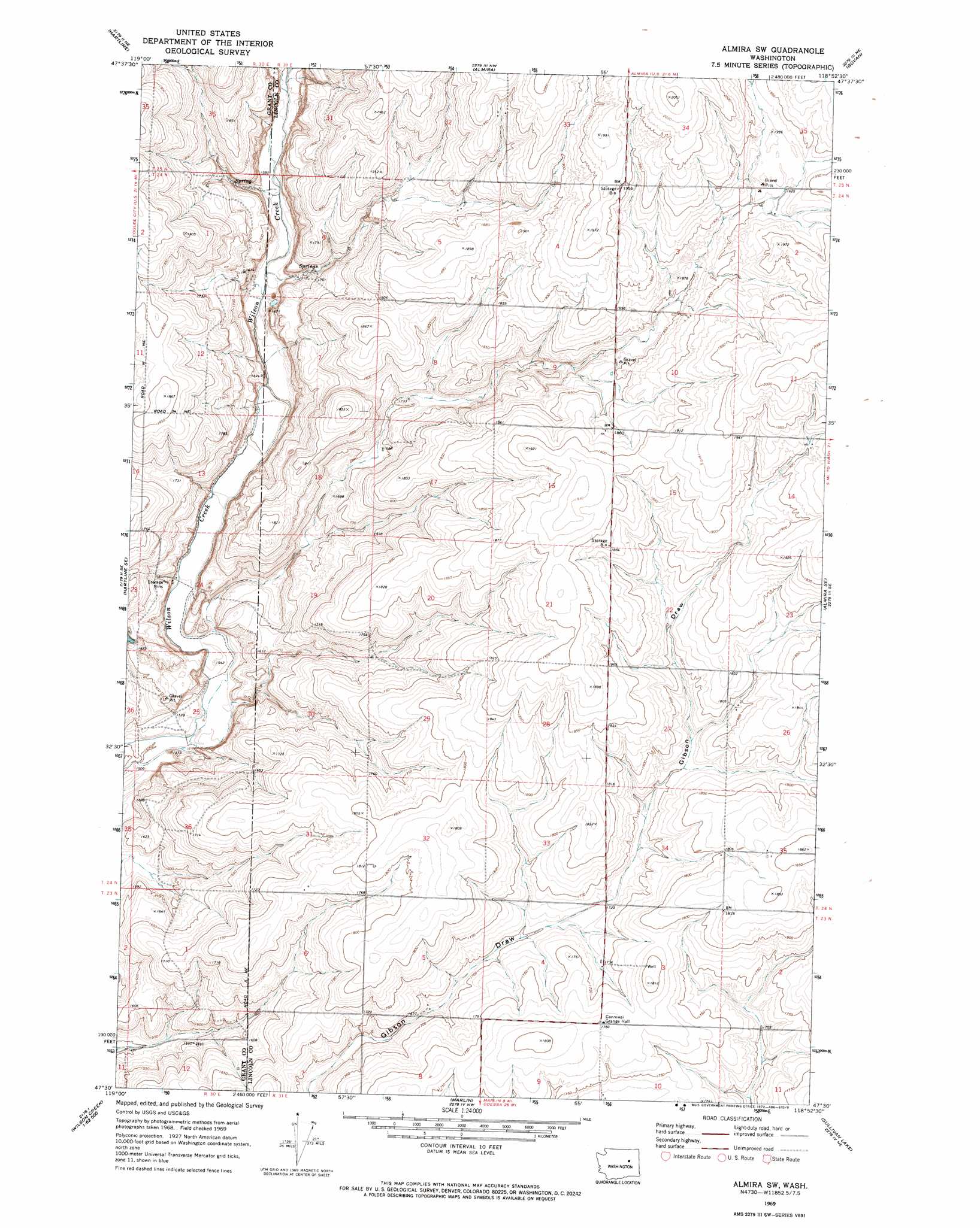
USGS Topo Quad 47118e8 - 1:24,000 scale
| Topo Map Name: | Almira Sw |
| USGS Topo Quad ID: | 47118e8 |
| Print Size: | ca. 21 1/4" wide x 27" high |
| Southeast Coordinates: | 47.5° N latitude / 118.875° W longitude |
| Map Center Coordinates: | 47.5625° N latitude / 118.9375° W longitude |
| U.S. State: | WA |
| Filename: | o47118e8.jpg |
| Download Map JPG Image: | Almira Sw topo map 1:24,000 scale |
| Map Type: | Topographic |
| Topo Series: | 7.5´ |
| Map Scale: | 1:24,000 |
| Source of Map Images: | United States Geological Survey (USGS) |
| Alternate Map Versions: |
Almira SW WA 1969, updated 1972 Download PDF Buy paper map Almira SW WA 2011 Download PDF Buy paper map Almira SW WA 2013 Download PDF Buy paper map |
1:24,000 Topo Quads surrounding Almira Sw
Steamboat Rock West |
Steamboat Rock East |
Jack Woods Butte |
Broadax Draw |
Wilbur |
Hartline Nw |
Hartline |
Almira |
Govan |
Wagner Lake |
Hartline Sw |
Hartline Se |
Almira Sw |
Almira Se |
Draper Lake |
Wilson Creek Nw |
Wilson Creek |
Marlin |
Sullivan Lake |
Pacific Lake |
Wilson Creek Sw |
Wilson Creek Se |
Marlin Sw |
Irby |
Odessa |
> Back to 47118e1 at 1:100,000 scale
> Back to 47118a1 at 1:250,000 scale
> Back to U.S. Topo Maps home
No gazetteer data is available for the Almira Sw topo map sheet.
Almira Sw digital topo map on disk
Buy this Almira Sw topo map showing relief, roads, GPS coordinates and other geographical features, as a high-resolution digital map file on DVD: