Fort Spokane Topo Map Washington
To zoom in, hover over the map of Fort Spokane
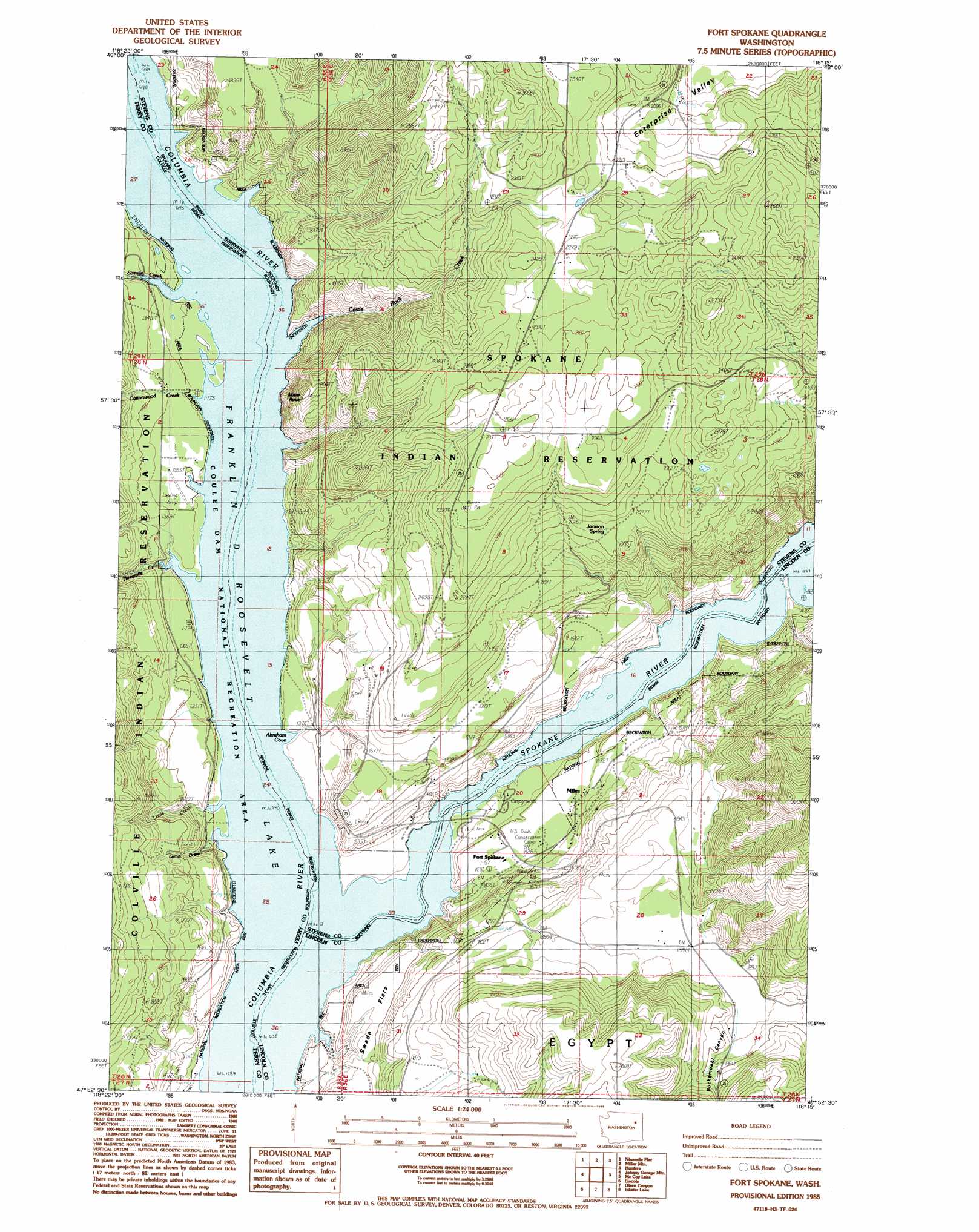
USGS Topo Quad 47118h3 - 1:24,000 scale
| Topo Map Name: | Fort Spokane |
| USGS Topo Quad ID: | 47118h3 |
| Print Size: | ca. 21 1/4" wide x 27" high |
| Southeast Coordinates: | 47.875° N latitude / 118.25° W longitude |
| Map Center Coordinates: | 47.9375° N latitude / 118.3125° W longitude |
| U.S. State: | WA |
| Filename: | o47118h3.jpg |
| Download Map JPG Image: | Fort Spokane topo map 1:24,000 scale |
| Map Type: | Topographic |
| Topo Series: | 7.5´ |
| Map Scale: | 1:24,000 |
| Source of Map Images: | United States Geological Survey (USGS) |
| Alternate Map Versions: |
Fort Spokane WA 1985, updated 1985 Download PDF Buy paper map Fort Spokane WA 2011 Download PDF Buy paper map Fort Spokane WA 2013 Download PDF Buy paper map |
1:24,000 Topo Quads surrounding Fort Spokane
Frosty Meadows |
Gold Mountain |
Kewa |
Cedonia |
Blackhorse Canyon |
Friedlander Meadows |
Ninemile Flat |
Miller Mountain |
Hunters |
Adams Mountain |
Whitestone Rock |
Johnny George Mountain |
Fort Spokane |
Mccoy Lake |
Turtle Lake |
Creston |
Lincoln |
Olsen Canyon |
Inkster Lake |
Benjamin Lake |
Creston Butte |
Telford |
Rocklyn |
Davenport |
Mondovi |
> Back to 47118e1 at 1:100,000 scale
> Back to 47118a1 at 1:250,000 scale
> Back to U.S. Topo Maps home
Fort Spokane topo map: Gazetteer
Fort Spokane: Bays
Abraham Cove elevation 397m 1302′Fort Spokane: Flats
Swede Flats elevation 478m 1568′Fort Spokane: Pillars
Mitre Rock elevation 598m 1961′Fort Spokane: Populated Places
Fort Spokane elevation 432m 1417′Miles elevation 440m 1443′
Fort Spokane: Springs
Jackson Spring elevation 621m 2037′Fort Spokane: Streams
Castle Rock Creek elevation 404m 1325′Cottonwood Creek elevation 399m 1309′
Louie Creek elevation 396m 1299′
Sixmile Creek elevation 399m 1309′
Spokane River elevation 394m 1292′
Spokane River elevation 394m 1292′
Threemile Creek elevation 398m 1305′
Fort Spokane: Summits
Castle Rock elevation 623m 2043′Fort Spokane: Valleys
Bockemuehl Canyon elevation 593m 1945′Denison Canyon elevation 404m 1325′
Lamb Draw elevation 402m 1318′
Sallie Draw elevation 396m 1299′
Fort Spokane digital topo map on disk
Buy this Fort Spokane topo map showing relief, roads, GPS coordinates and other geographical features, as a high-resolution digital map file on DVD: