Mica Mountain Topo Map Washington
To zoom in, hover over the map of Mica Mountain
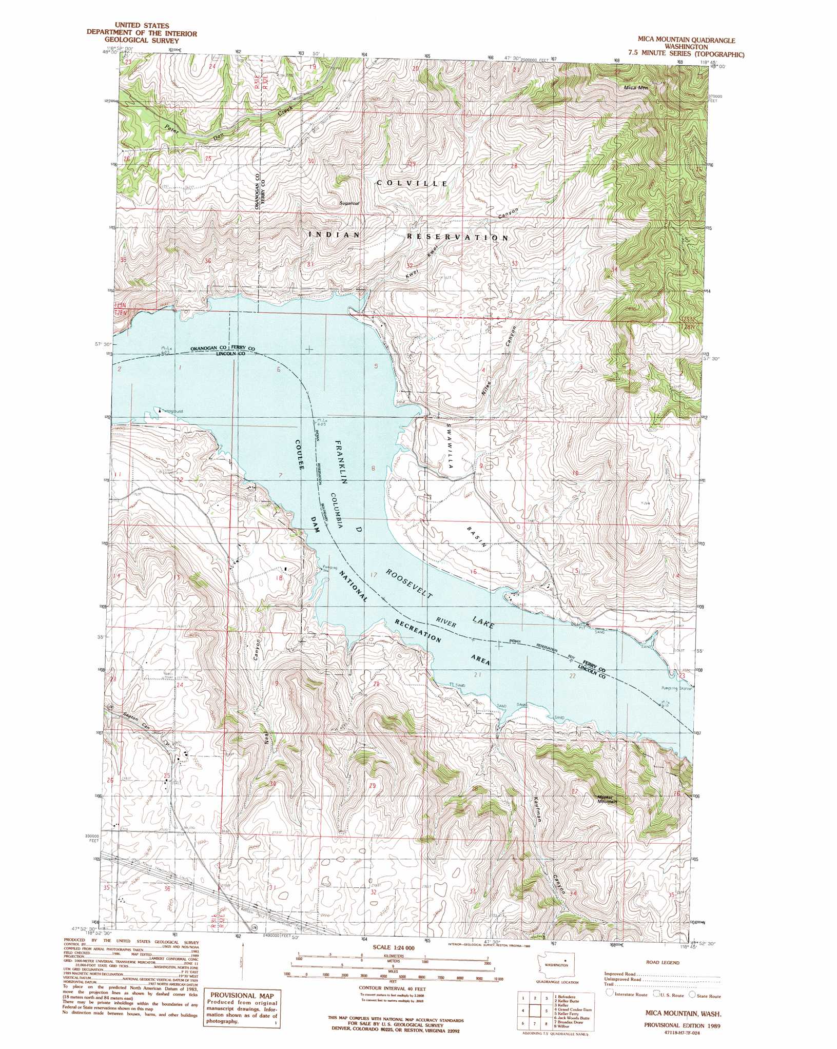
USGS Topo Quad 47118h7 - 1:24,000 scale
| Topo Map Name: | Mica Mountain |
| USGS Topo Quad ID: | 47118h7 |
| Print Size: | ca. 21 1/4" wide x 27" high |
| Southeast Coordinates: | 47.875° N latitude / 118.75° W longitude |
| Map Center Coordinates: | 47.9375° N latitude / 118.8125° W longitude |
| U.S. State: | WA |
| Filename: | o47118h7.jpg |
| Download Map JPG Image: | Mica Mountain topo map 1:24,000 scale |
| Map Type: | Topographic |
| Topo Series: | 7.5´ |
| Map Scale: | 1:24,000 |
| Source of Map Images: | United States Geological Survey (USGS) |
| Alternate Map Versions: |
Mica Mountain WA 1989, updated 1989 Download PDF Buy paper map Mica Mountain WA 2011 Download PDF Buy paper map Mica Mountain WA 2013 Download PDF Buy paper map |
1:24,000 Topo Quads surrounding Mica Mountain
Armstrong Creek |
Nespelem |
Nespelem Ne |
Louie Creek |
Frosty Meadows |
Sanderson Creek |
Belvedere |
Keller Butte |
Keller |
Friedlander Meadows |
Electric City |
Grand Coulee Dam |
Mica Mountain |
Keller Ferry |
Whitestone Rock |
Steamboat Rock East |
Jack Woods Butte |
Broadax Draw |
Wilbur |
Creston |
Hartline |
Almira |
Govan |
Wagner Lake |
Creston Butte |
> Back to 47118e1 at 1:100,000 scale
> Back to 47118a1 at 1:250,000 scale
> Back to U.S. Topo Maps home
Mica Mountain topo map: Gazetteer
Mica Mountain: Basins
Swawilla Basin elevation 442m 1450′Mica Mountain: Bays
Cayuse Bay elevation 394m 1292′Swawilla Cove elevation 394m 1292′
Wynhoff Cove elevation 394m 1292′
Mica Mountain: Capes
Plum Point elevation 394m 1292′Mica Mountain: Streams
Qui Qui Creek elevation 406m 1332′Mica Mountain: Summits
Meeker Mountain elevation 803m 2634′Mica Mountain elevation 1190m 3904′
Sugarloaf elevation 771m 2529′
Mica Mountain: Valleys
Kaufman Canyon elevation 399m 1309′Kwei Kwei Canyon elevation 399m 1309′
Neal Canyon elevation 399m 1309′
Niles Canyon elevation 395m 1295′
Mica Mountain digital topo map on disk
Buy this Mica Mountain topo map showing relief, roads, GPS coordinates and other geographical features, as a high-resolution digital map file on DVD: