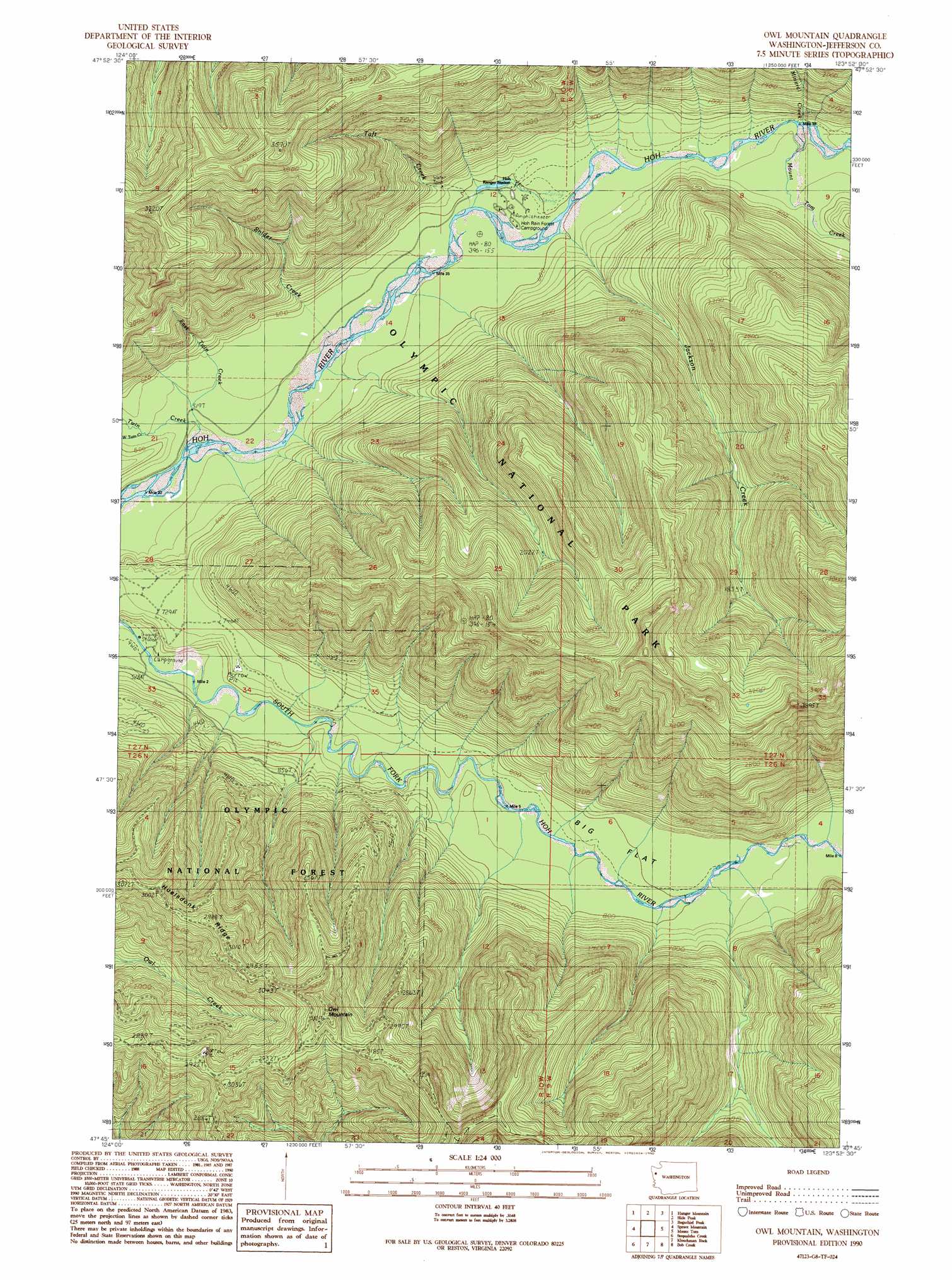
Owl Mountain Topo Map Washington
To zoom in, hover over the map of Owl Mountain
USGS Topo Quad 47123g8 - 1:24,000 scale
| Topo Map Name: | Owl Mountain |
| USGS Topo Quad ID: | 47123g8 |
| Print Size: | ca. 21 1/4" wide x 27" high |
| Southeast Coordinates: | 47.75° N latitude / 123.875° W longitude |
| Map Center Coordinates: | 47.8125° N latitude / 123.9375° W longitude |
| U.S. State: | WA |
| Filename: | o47123g8.jpg |
| Download Map JPG Image: | Owl Mountain topo map 1:24,000 scale |
| Map Type: | Topographic |
| Topo Series: | 7.5´ |
| Map Scale: | 1:24,000 |
| Source of Map Images: | United States Geological Survey (USGS) |
| Alternate Map Versions: |
Owl Mountain WA 1990, updated 1990 Download PDF Buy paper map Owl Mountain WA 2011 Download PDF Buy paper map Owl Mountain WA 2014 Download PDF Buy paper map |
1:24,000 Topo Quads surrounding Owl Mountain
Deadmans Hill |
Snider Peak |
Mount Muller |
Lake Crescent |
Lake Sutherland |
Indian Pass |
Hunger Mountain |
Slide Peak |
Bogachiel Peak |
Mount Carrie |
Winfield Creek |
Spruce Mountain |
Owl Mountain |
Mount Tom |
Mount Olympus |
Christmas Creek |
Stequaleho Creek |
Kloochman Rock |
Bob Creek |
Kimta Peak |
Salmon River West |
Salmon River East |
Matheny Ridge |
Finley Creek |
Bunch Lake |
> Back to 47123e1 at 1:100,000 scale
> Back to 47122a1 at 1:250,000 scale
> Back to U.S. Topo Maps home
Owl Mountain topo map: Gazetteer
Owl Mountain: Streams
East Twin Creek elevation 145m 475′Jackson Creek elevation 182m 597′
Mineral Creek elevation 206m 675′
Mount Tom Creek elevation 204m 669′
Snider Creek elevation 159m 521′
Taft Creek elevation 174m 570′
Twin Creek elevation 150m 492′
West Twin Creek elevation 163m 534′
Owl Mountain: Summits
Owl Mountain elevation 1024m 3359′Owl Mountain digital topo map on disk
Buy this Owl Mountain topo map showing relief, roads, GPS coordinates and other geographical features, as a high-resolution digital map file on DVD: