Forks Topo Map Washington
To zoom in, hover over the map of Forks
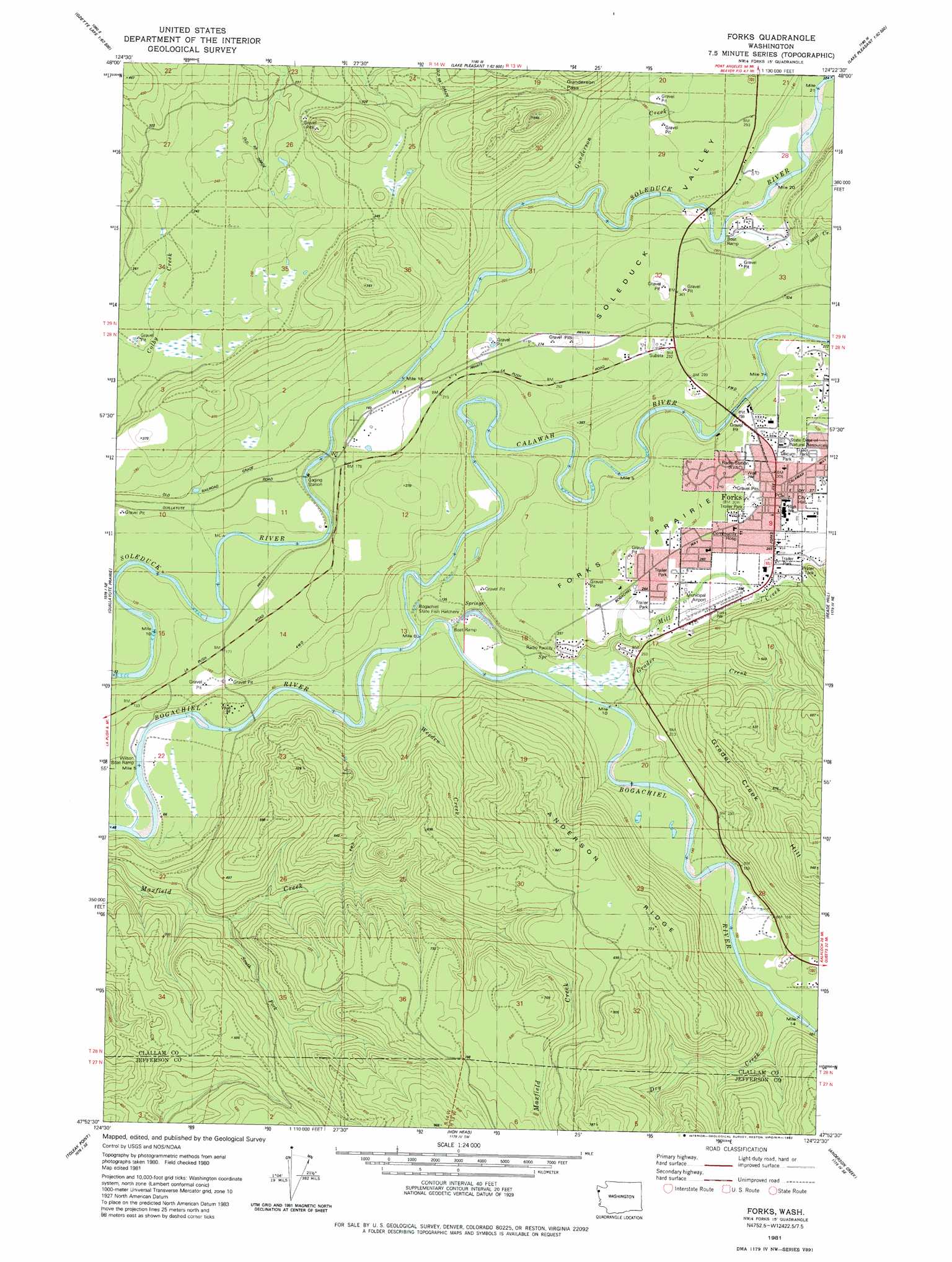
USGS Topo Quad 47124h4 - 1:24,000 scale
| Topo Map Name: | Forks |
| USGS Topo Quad ID: | 47124h4 |
| Print Size: | ca. 21 1/4" wide x 27" high |
| Southeast Coordinates: | 47.875° N latitude / 124.375° W longitude |
| Map Center Coordinates: | 47.9375° N latitude / 124.4375° W longitude |
| U.S. State: | WA |
| Filename: | o47124h4.jpg |
| Download Map JPG Image: | Forks topo map 1:24,000 scale |
| Map Type: | Topographic |
| Topo Series: | 7.5´ |
| Map Scale: | 1:24,000 |
| Source of Map Images: | United States Geological Survey (USGS) |
| Alternate Map Versions: |
Forks WA 1981, updated 1982 Download PDF Buy paper map Forks WA 2011 Download PDF Buy paper map Forks WA 2014 Download PDF Buy paper map |
| FStopo: | US Forest Service topo Forks is available: Download FStopo PDF Download FStopo TIF |
1:24,000 Topo Quads surrounding Forks
Ozette |
Umbrella Creek |
Hoko Falls |
Ellis Mountain |
West Of Pysht |
Allens Bay |
Dickey Lake |
Gunderson Mountain |
Lake Pleasant |
Deadmans Hill |
La Push |
Quillayute Prairie |
Forks |
Reade Hill |
Indian Pass |
Toleak Point |
Hoh Head |
Anderson Creek |
Winfield Creek |
|
Destruction Island |
Kalaoch Ridge |
Christmas Creek |
> Back to 47124e1 at 1:100,000 scale
> Back to 47124a1 at 1:250,000 scale
> Back to U.S. Topo Maps home
Forks topo map: Gazetteer
Forks: Airports
Department of Natural Resources Heliport elevation 93m 305′Forks Airport elevation 87m 285′
Forks: Dams
Forks Dam elevation 32m 104′Forks: Flats
Forks Prairie elevation 96m 314′Forks: Gaps
Gunderson Pass elevation 176m 577′Forks: Parks
Tilicum Park elevation 97m 318′Forks: Populated Places
Forks elevation 93m 305′Forks: Ridges
Anderson Ridge elevation 216m 708′Forks: Streams
Calawah River elevation 26m 85′Dry Creek elevation 53m 173′
Fossil Creek elevation 86m 282′
Grader Creek elevation 33m 108′
Gunderson Creek elevation 61m 200′
Mill Creek elevation 42m 137′
Ripple Creek elevation 70m 229′
South Fork Maxfield Creek elevation 48m 157′
Tassel Creek elevation 68m 223′
Weeden Creek elevation 25m 82′
Forks: Summits
Grader Creek Hill elevation 290m 951′Forks: Valleys
Sol Duc Valley elevation 61m 200′Forks digital topo map on disk
Buy this Forks topo map showing relief, roads, GPS coordinates and other geographical features, as a high-resolution digital map file on DVD: