Reade Hill Topo Map Washington
To zoom in, hover over the map of Reade Hill
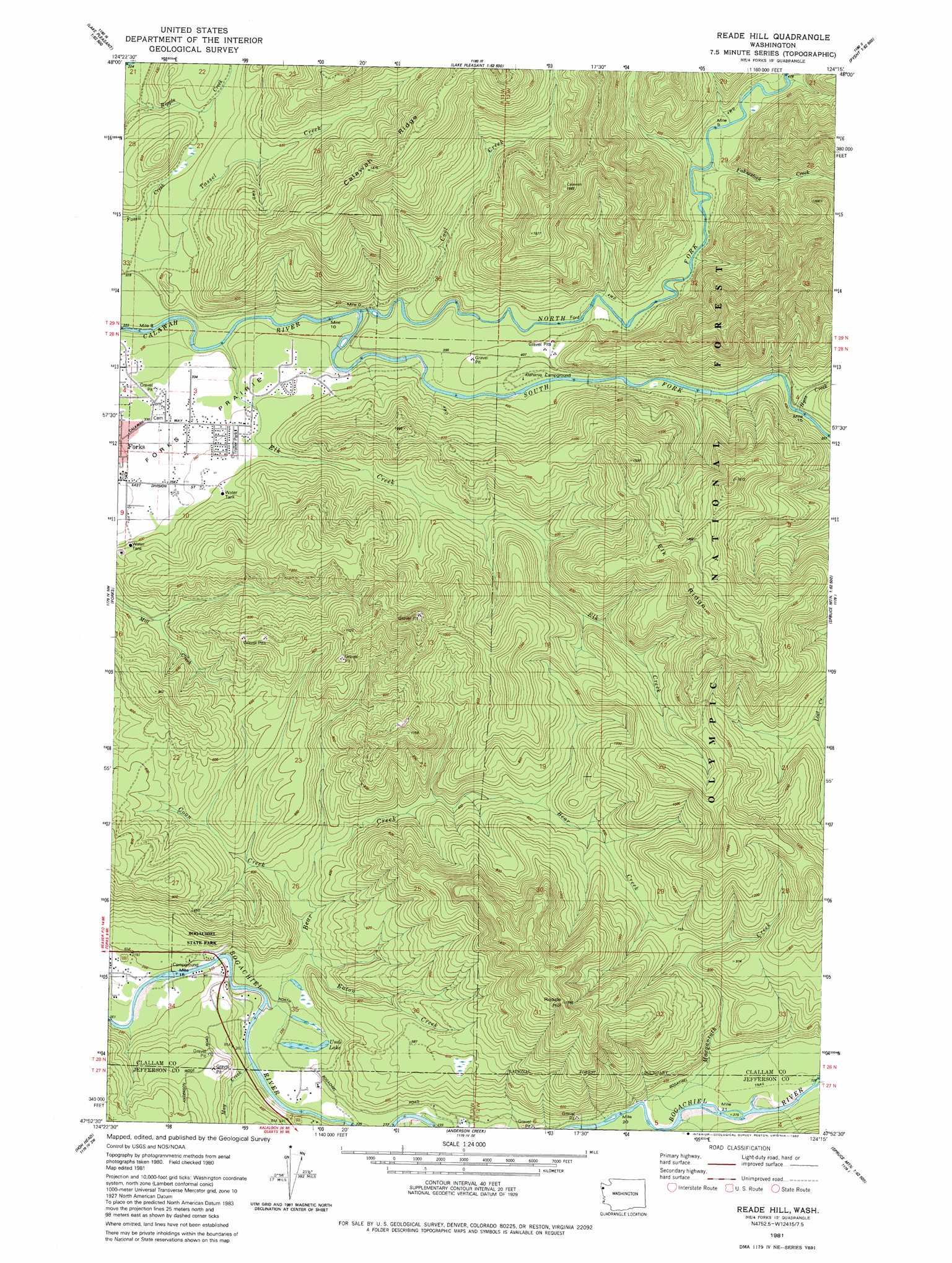
USGS Topo Quad 47124h3 - 1:24,000 scale
| Topo Map Name: | Reade Hill |
| USGS Topo Quad ID: | 47124h3 |
| Print Size: | ca. 21 1/4" wide x 27" high |
| Southeast Coordinates: | 47.875° N latitude / 124.25° W longitude |
| Map Center Coordinates: | 47.9375° N latitude / 124.3125° W longitude |
| U.S. State: | WA |
| Filename: | o47124h3.jpg |
| Download Map JPG Image: | Reade Hill topo map 1:24,000 scale |
| Map Type: | Topographic |
| Topo Series: | 7.5´ |
| Map Scale: | 1:24,000 |
| Source of Map Images: | United States Geological Survey (USGS) |
| Alternate Map Versions: |
Reade Hill WA 1981, updated 1982 Download PDF Buy paper map Reade Hill WA 2011 Download PDF Buy paper map Reade Hill WA 2014 Download PDF Buy paper map |
| FStopo: | US Forest Service topo Reade Hill is available: Download FStopo PDF Download FStopo TIF |
1:24,000 Topo Quads surrounding Reade Hill
Umbrella Creek |
Hoko Falls |
Ellis Mountain |
West Of Pysht |
Pysht |
Dickey Lake |
Gunderson Mountain |
Lake Pleasant |
Deadmans Hill |
Snider Peak |
Quillayute Prairie |
Forks |
Reade Hill |
Indian Pass |
Hunger Mountain |
Toleak Point |
Hoh Head |
Anderson Creek |
Winfield Creek |
Spruce Mountain |
Destruction Island |
Kalaoch Ridge |
Christmas Creek |
Stequaleho Creek |
> Back to 47124e1 at 1:100,000 scale
> Back to 47124a1 at 1:250,000 scale
> Back to U.S. Topo Maps home
Reade Hill topo map: Gazetteer
Reade Hill: Lakes
Undi Lake elevation 68m 223′Reade Hill: Parks
Bogachiel State Park elevation 120m 393′Reade Hill: Ridges
Elk Ridge elevation 480m 1574′Reade Hill: Streams
Bear Creek elevation 62m 203′Coon Creek elevation 81m 265′
Eaton Creek elevation 71m 232′
Elk Creek elevation 79m 259′
Fahnestock Creek elevation 132m 433′
Hyas Creek elevation 117m 383′
May Creek elevation 63m 206′
Morganroth Creek elevation 95m 311′
North Fork Calawah River elevation 83m 272′
South Fork Calawah River elevation 83m 272′
Upper Cool Creek elevation 131m 429′
Reade Hill: Summits
Reade Hill elevation 500m 1640′Reade Hill: Trails
Bogachiel Trail elevation 100m 328′Reade Hill digital topo map on disk
Buy this Reade Hill topo map showing relief, roads, GPS coordinates and other geographical features, as a high-resolution digital map file on DVD: