Minnewauken East Topo Map North Dakota
To zoom in, hover over the map of Minnewauken East
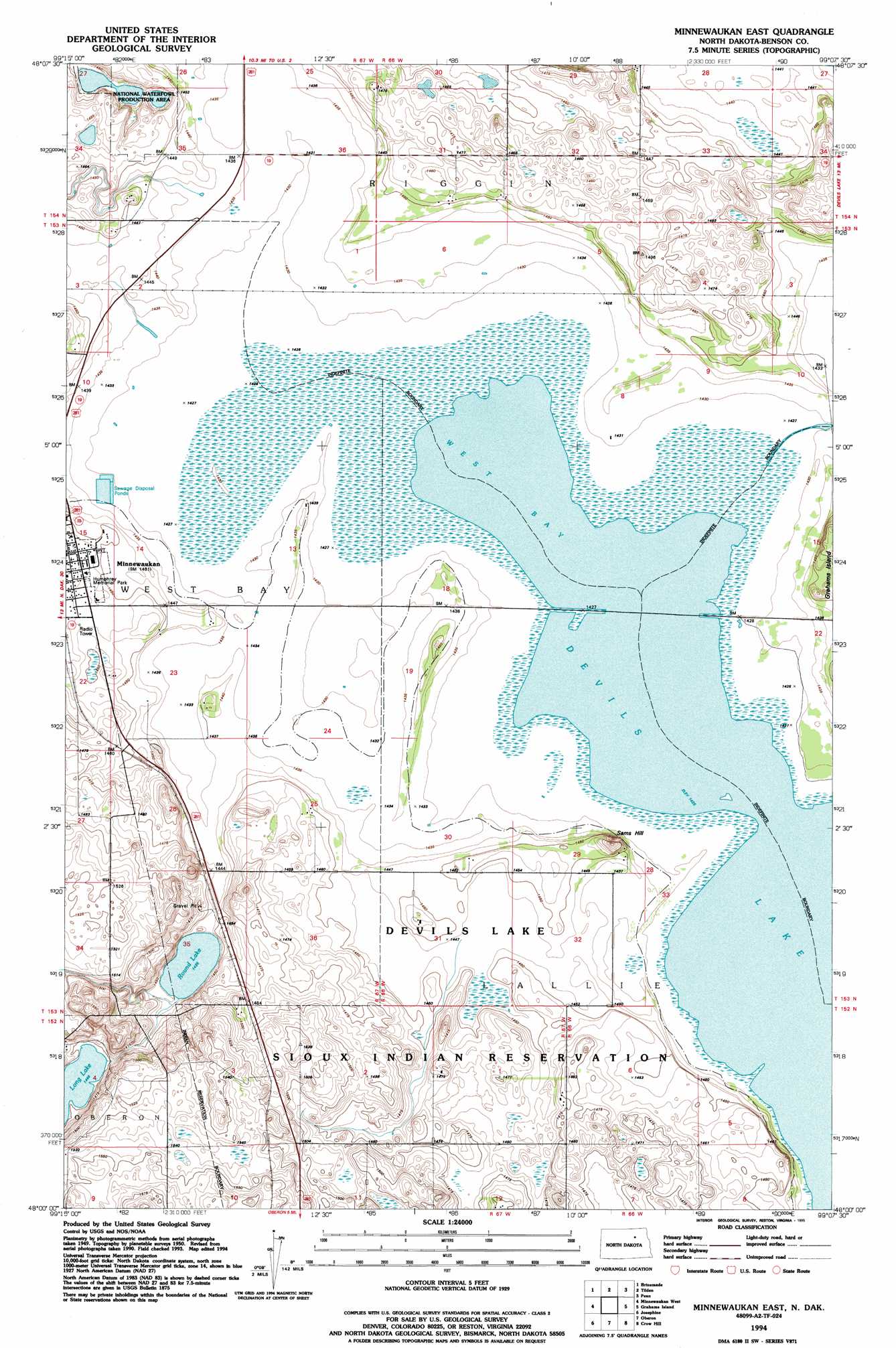
USGS Topo Quad 48099a2 - 1:24,000 scale
| Topo Map Name: | Minnewauken East |
| USGS Topo Quad ID: | 48099a2 |
| Print Size: | ca. 21 1/4" wide x 27" high |
| Southeast Coordinates: | 48° N latitude / 99.125° W longitude |
| Map Center Coordinates: | 48.0625° N latitude / 99.1875° W longitude |
| U.S. State: | ND |
| Filename: | O48099A2.jpg |
| Download Map JPG Image: | Minnewauken East topo map 1:24,000 scale |
| Map Type: | Topographic |
| Topo Series: | 7.5´ |
| Map Scale: | 1:24,000 |
| Source of Map Images: | United States Geological Survey (USGS) |
| Alternate Map Versions: |
Minnewaukan East ND 1951, updated 1951 Download PDF Buy paper map Minnewaukan East ND 1994, updated 1995 Download PDF Buy paper map Minnewaukan East ND 2011 Download PDF Buy paper map Minnewaukan East ND 2014 Download PDF Buy paper map |
1:24,000 Topo Quads surrounding Minnewauken East
Leeds |
Niles |
Churchs Ferry |
Cando Se |
Webster |
Comstock |
Brinsmade |
Tilden |
Penn |
Grand Harbor |
Brinsmade Sw |
Minnewaukan West |
Minnewauken East |
Grahams Island |
Camp Grafton |
Flora |
Josephine |
Oberon |
Crow Hill |
Fort Totten |
Black Hammer Hill |
Flora Se |
Oberon Sw |
Sheyenne |
Tokio Sw |
> Back to 48099a1 at 1:100,000 scale
> Back to 48098a1 at 1:250,000 scale
> Back to U.S. Topo Maps home
Minnewauken East topo map: Gazetteer
Minnewauken East: Dams
Round Lake Outlet Control Dam elevation 438m 1437′Minnewauken East: Flats
West Bay elevation 436m 1430′Minnewauken East: Lakes
Round Lake elevation 438m 1437′Minnewauken East: Summits
Sams Hill elevation 458m 1502′Minnewauken East digital topo map on disk
Buy this Minnewauken East topo map showing relief, roads, GPS coordinates and other geographical features, as a high-resolution digital map file on DVD:
Eastern North Dakota & Eastern South Dakota
Buy digital topo maps: Eastern North Dakota & Eastern South Dakota