Burlington Topo Map North Dakota
To zoom in, hover over the map of Burlington
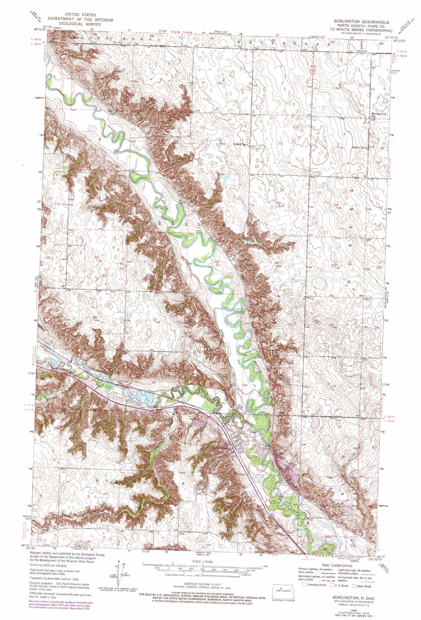
USGS Topo Quad 48101c4 - 1:24,000 scale
| Topo Map Name: | Burlington |
| USGS Topo Quad ID: | 48101c4 |
| Print Size: | ca. 21 1/4" wide x 27" high |
| Southeast Coordinates: | 48.25° N latitude / 101.375° W longitude |
| Map Center Coordinates: | 48.3125° N latitude / 101.4375° W longitude |
| U.S. State: | ND |
| Filename: | O48101C4.jpg |
| Download Map JPG Image: | Burlington topo map 1:24,000 scale |
| Map Type: | Topographic |
| Topo Series: | 7.5´ |
| Map Scale: | 1:24,000 |
| Source of Map Images: | United States Geological Survey (USGS) |
| Alternate Map Versions: |
Burlington ND 1948, updated 1948 Download PDF Buy paper map Burlington ND 1948, updated 1980 Download PDF Buy paper map Burlington ND 1950, updated 1950 Download PDF Buy paper map Burlington ND 2011 Download PDF Buy paper map Burlington ND 2014 Download PDF Buy paper map |
1:24,000 Topo Quads surrounding Burlington
Grano Sw |
Grano |
Lansford Sw |
Lansford Se |
Glenburn |
Carpio |
Carpio Ne |
Burlington Nw |
Burlington Ne |
Deering Nw |
Berthold |
Des Lacs |
Burlington |
Burlington Se |
Deering Sw |
Rice Lake Nw |
Mork Lake |
Minot Nw |
Minot |
Surrey |
Underdahl Lake |
Rice Lake |
Minot Sw |
South Prairie |
Sawyer Sw |
> Back to 48101a1 at 1:100,000 scale
> Back to 48100a1 at 1:250,000 scale
> Back to U.S. Topo Maps home
Burlington topo map: Gazetteer
Burlington: Dams
Burlington Dam Number 1 elevation 503m 1650′Burlington Dam Number 2 elevation 491m 1610′
Burlington: Populated Places
Burlington elevation 489m 1604′Burlington: Streams
Des Lacs River elevation 475m 1558′Burlington: Valleys
Larsons Coulee elevation 485m 1591′Lloyds Coulee elevation 488m 1601′
Burlington digital topo map on disk
Buy this Burlington topo map showing relief, roads, GPS coordinates and other geographical features, as a high-resolution digital map file on DVD:
Eastern North Dakota & Eastern South Dakota
Buy digital topo maps: Eastern North Dakota & Eastern South Dakota