Bush Lake Topo Map North Dakota
To zoom in, hover over the map of Bush Lake
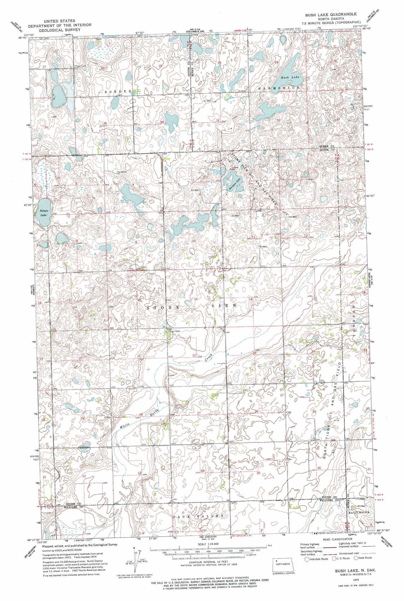
USGS Topo Quad 48102f8 - 1:24,000 scale
| Topo Map Name: | Bush Lake |
| USGS Topo Quad ID: | 48102f8 |
| Print Size: | ca. 21 1/4" wide x 27" high |
| Southeast Coordinates: | 48.625° N latitude / 102.875° W longitude |
| Map Center Coordinates: | 48.6875° N latitude / 102.9375° W longitude |
| U.S. State: | ND |
| Filename: | O48102F8.jpg |
| Download Map JPG Image: | Bush Lake topo map 1:24,000 scale |
| Map Type: | Topographic |
| Topo Series: | 7.5´ |
| Map Scale: | 1:24,000 |
| Source of Map Images: | United States Geological Survey (USGS) |
| Alternate Map Versions: |
Bush Lake ND 1974, updated 1978 Download PDF Buy paper map Bush Lake ND 2011 Download PDF Buy paper map Bush Lake ND 2014 Download PDF Buy paper map |
1:24,000 Topo Quads surrounding Bush Lake
Paulson |
Noonan |
Atacol |
Columbus |
Stampede |
Noonan Sw |
Noonan Se |
Columbus Sw |
Columbus Se |
Beaver Lake |
Wildrose |
Hamlet |
Bush Lake |
Grand View |
Grubb Lake |
Tom Berg Lake |
Big Meadow |
Mcgregor |
Battleview |
Powers Lake |
Ray Nw |
Temple |
Tioga |
White Earth |
Ross Nw |
> Back to 48102e1 at 1:100,000 scale
> Back to 48102a1 at 1:250,000 scale
> Back to U.S. Topo Maps home
Bush Lake topo map: Gazetteer
Bush Lake: Lakes
Bush Lake elevation 721m 2365′Nelson Lake elevation 694m 2276′
Norman Lake elevation 706m 2316′
Bush Lake: Oilfields
Stone View Oil and Gas Field elevation 714m 2342′Bush Lake digital topo map on disk
Buy this Bush Lake topo map showing relief, roads, GPS coordinates and other geographical features, as a high-resolution digital map file on DVD:
Eastern Montana & Western North Dakota
Buy digital topo maps: Eastern Montana & Western North Dakota