Rocky Coulee Sw Topo Map Montana
To zoom in, hover over the map of Rocky Coulee Sw
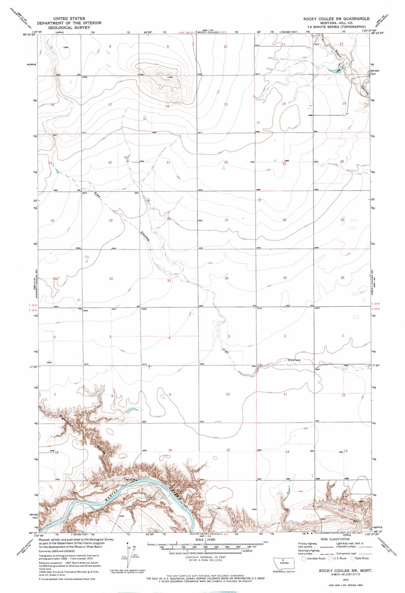
USGS Topo Quad 48110c6 - 1:24,000 scale
| Topo Map Name: | Rocky Coulee Sw |
| USGS Topo Quad ID: | 48110c6 |
| Print Size: | ca. 21 1/4" wide x 27" high |
| Southeast Coordinates: | 48.25° N latitude / 110.625° W longitude |
| Map Center Coordinates: | 48.3125° N latitude / 110.6875° W longitude |
| U.S. State: | MT |
| Filename: | o48110c6.jpg |
| Download Map JPG Image: | Rocky Coulee Sw topo map 1:24,000 scale |
| Map Type: | Topographic |
| Topo Series: | 7.5´ |
| Map Scale: | 1:24,000 |
| Source of Map Images: | United States Geological Survey (USGS) |
| Alternate Map Versions: |
Rocky Coulee SW MT 1970, updated 1973 Download PDF Buy paper map Rocky Coulee SW MT 2011 Download PDF Buy paper map Rocky Coulee SW MT 2014 Download PDF Buy paper map |
1:24,000 Topo Quads surrounding Rocky Coulee Sw
Chester |
Joplin |
Inverness |
Rudyard |
Hingham |
Poverty Coulee |
Poverty Coulee Ne |
Rocky Coulee |
Een School |
Fourteenmile Coulee Nw |
Circle Bridge |
Poverty Coulee Se |
Rocky Coulee Sw |
Rocky Coulee Se |
Fourteenmile Coulee Sw |
Goose Bill Butte Nw |
Penzer School |
Dutch Henry Coulee |
Discovery Butte |
Kenilworth |
Dorner School |
Goose Bill Butte |
Day School Sw |
Day School |
Kenilworth Sw |
> Back to 48110a1 at 1:100,000 scale
> Back to 48110a1 at 1:250,000 scale
> Back to U.S. Topo Maps home
Rocky Coulee Sw topo map: Gazetteer
Rocky Coulee Sw: Dams
Samantha Dam elevation 903m 2962′Rocky Coulee Sw: Populated Places
Brinkman (historical) elevation 881m 2890′Rocky Coulee Sw: Post Offices
Brinkman Post Office (historical) elevation 881m 2890′Rocky Coulee Sw: Valleys
Eightmile Coulee elevation 819m 2687′Rocky Coulee Sw: Wells
29N08E04AA__01 Well elevation 890m 2919′29N08E12AAAA01 Well elevation 881m 2890′
30N08E14CABD01 Well elevation 913m 2995′
30N08E32DC__01 Well elevation 896m 2939′
Rocky Coulee Sw digital topo map on disk
Buy this Rocky Coulee Sw topo map showing relief, roads, GPS coordinates and other geographical features, as a high-resolution digital map file on DVD: