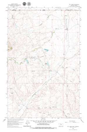
Fey Lakes Topo Map Montana
To zoom in, hover over the map of Fey Lakes
USGS Topo Quad 48111h4 - 1:24,000 scale
| Topo Map Name: | Fey Lakes |
| USGS Topo Quad ID: | 48111h4 |
| Print Size: | ca. 21 1/4" wide x 27" high |
| Southeast Coordinates: | 48.875° N latitude / 111.375° W longitude |
| Map Center Coordinates: | 48.9375° N latitude / 111.4375° W longitude |
| U.S. State: | MT |
| Filename: | o48111h4.jpg |
| Download Map JPG Image: | Fey Lakes topo map 1:24,000 scale |
| Map Type: | Topographic |
| Topo Series: | 7.5´ |
| Map Scale: | 1:24,000 |
| Source of Map Images: | United States Geological Survey (USGS) |
| Alternate Map Versions: |
Fey Lakes MT 1962, updated 1964 Download PDF Buy paper map Fey Lakes MT 2011 Download PDF Buy paper map Fey Lakes MT 2014 Download PDF Buy paper map |
1:24,000 Topo Quads surrounding Fey Lakes
> Back to 48111e1 at 1:100,000 scale
> Back to 48110a1 at 1:250,000 scale
> Back to U.S. Topo Maps home
Fey Lakes topo map: Gazetteer
Fey Lakes: Basins
The Deep Ground elevation 1218m 3996′Fey Lakes: Dams
A and A Fey Dam elevation 1083m 3553′Alkali Dam elevation 1133m 3717′
Big Lake Dam elevation 1242m 4074′
Him Dam elevation 1177m 3861′
The Pot Hole Dam elevation 1141m 3743′
Fey Lakes: Lakes
Alkali Lake elevation 1132m 3713′Big Lake elevation 1234m 4048′
Fey Lakes elevation 1187m 3894′
Jones Lake elevation 1171m 3841′
Moltz Lake elevation 1275m 4183′
Ruby Johnson Lake elevation 1180m 3871′
Swan Lake elevation 1177m 3861′
Twin Lakes elevation 1218m 3996′
Fey Lakes: Mines
Gold Butte Mine elevation 1470m 4822′Fey Lakes: Oilfields
Fred and George Creek Oil and Gas Field elevation 1220m 4002′Fey Lakes: Reservoirs
Alkali Lake elevation 1133m 3717′Big Lake elevation 1242m 4074′
The Pot Hole elevation 1141m 3743′
Fey Lakes: Springs
36N02E03DD01__ Spring elevation 1152m 3779′36N02E09DBDA01 Spring elevation 1137m 3730′
37N02E26DCDD01 Spring elevation 1146m 3759′
Fey Lakes: Streams
Eclipse Creek elevation 1124m 3687′Fred and George Creek elevation 1064m 3490′
North Creek elevation 1126m 3694′
Prichard Creek elevation 1061m 3480′
Spring Creek elevation 1258m 4127′
Fey Lakes: Valleys
Barnes Coulee elevation 1175m 3854′Dead Horse Coulee elevation 1114m 3654′
Eclipse Gulch elevation 1273m 4176′
Sam Ross Coulee elevation 1107m 3631′
Telephone Coulee elevation 1098m 3602′
Fey Lakes: Wells
36N02E01BCBA01 Well elevation 1184m 3884′36N02E03ADAB01 Well elevation 1152m 3779′
37N02E11DBBD01 Well elevation 1126m 3694′
37N02E23CDAC01 Well elevation 1159m 3802′
37N02E25BBA01_ Well elevation 1138m 3733′
37N02E25DDAB01 Well elevation 1122m 3681′
37N02E26BDAC01 Well elevation 1172m 3845′
37N02E26DDDB01 Well elevation 1123m 3684′
37N02E35AABA01 Well elevation 1128m 3700′
37N03E06CBD01_ Well elevation 1048m 3438′
37N03E07BBBA01 Well elevation 1058m 3471′
37N03E07CBAC01 Well elevation 1066m 3497′
37N03E07CBAC02 Well elevation 1068m 3503′
37N03E07CBCD01 Well elevation 1068m 3503′
37N03E19CBCC01 Well elevation 1095m 3592′
37N03E30BBAC01 Well elevation 1103m 3618′
Fey Lakes digital topo map on disk
Buy this Fey Lakes topo map showing relief, roads, GPS coordinates and other geographical features, as a high-resolution digital map file on DVD:


