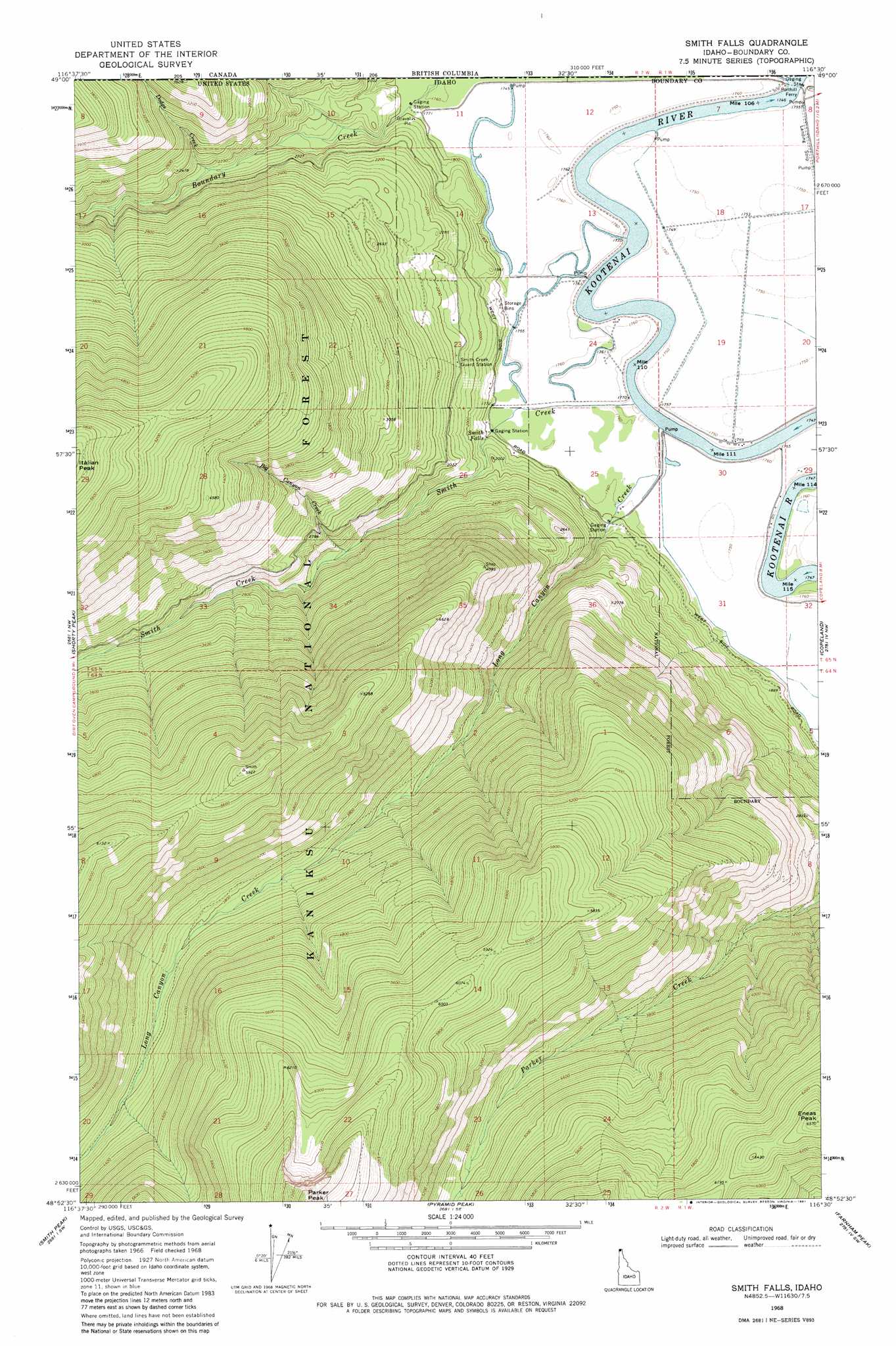
Smith Falls Topo Map Idaho
To zoom in, hover over the map of Smith Falls
USGS Topo Quad 48116h5 - 1:24,000 scale
| Topo Map Name: | Smith Falls |
| USGS Topo Quad ID: | 48116h5 |
| Print Size: | ca. 21 1/4" wide x 27" high |
| Southeast Coordinates: | 48.875° N latitude / 116.5° W longitude |
| Map Center Coordinates: | 48.9375° N latitude / 116.5625° W longitude |
| U.S. State: | ID |
| Filename: | o48116h5.jpg |
| Download Map JPG Image: | Smith Falls topo map 1:24,000 scale |
| Map Type: | Topographic |
| Topo Series: | 7.5´ |
| Map Scale: | 1:24,000 |
| Source of Map Images: | United States Geological Survey (USGS) |
| Alternate Map Versions: |
Smith Falls ID 1968, updated 1971 Download PDF Buy paper map Smith Falls ID 1968, updated 1981 Download PDF Buy paper map Smith Falls ID 1996, updated 1999 Download PDF Buy paper map Smith Falls ID 2011 Download PDF Buy paper map Smith Falls ID 2013 Download PDF Buy paper map |
| FStopo: | US Forest Service topo Smith Falls is available: Download FStopo PDF Download FStopo TIF |
1:24,000 Topo Quads surrounding Smith Falls
Grass Mountain |
Shorty Peak |
Smith Falls |
Copeland |
Hall Mountain |
Caribou Creek |
Smith Peak |
Pyramid Peak |
Farnham Peak |
Ritz |
Priest Lake Ne |
The Wigwams |
Roman Nose |
Moravia |
Bonners Ferry |
> Back to 48116e1 at 1:100,000 scale
> Back to 48116a1 at 1:250,000 scale
> Back to U.S. Topo Maps home
Smith Falls topo map: Gazetteer
Smith Falls: Airports
Eckhart International Airport elevation 536m 1758′Smith Falls: Falls
Smith Falls elevation 581m 1906′Smith Falls: Lakes
Canyon Lake elevation 1703m 5587′Smith Falls: Streams
Big Canyon Creek elevation 706m 2316′Boundary Creek elevation 533m 1748′
Dodge Creek elevation 649m 2129′
Long Canyon Creek elevation 535m 1755′
Smith Creek elevation 537m 1761′
Smith Falls: Summits
Eneas Peak elevation 2005m 6578′Smith Falls: Valleys
Purcell Trench elevation 541m 1774′Smith Falls digital topo map on disk
Buy this Smith Falls topo map showing relief, roads, GPS coordinates and other geographical features, as a high-resolution digital map file on DVD: