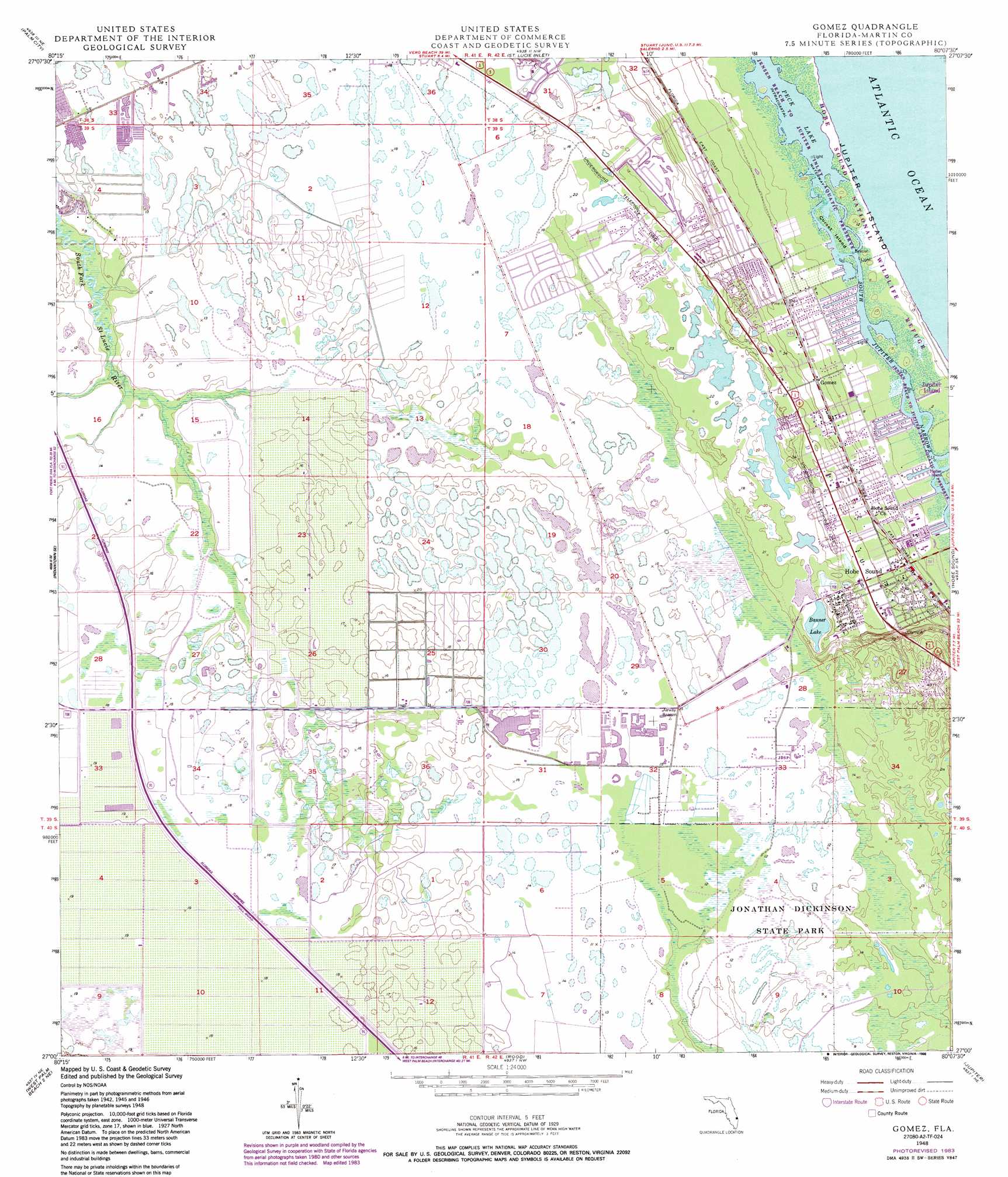
Gomez Topo Map Florida
To zoom in, hover over the map of Gomez
USGS Topo Quad 27080a2 - 1:24,000 scale
| Topo Map Name: | Gomez |
| USGS Topo Quad ID: | 27080a2 |
| Print Size: | ca. 21 1/4" wide x 27" high |
| Southeast Coordinates: | 27° N latitude / 80.125° W longitude |
| Map Center Coordinates: | 27.0625° N latitude / 80.1875° W longitude |
| U.S. State: | FL |
| Filename: | O27080A2.jpg |
| Download Map JPG Image: | Gomez topo map 1:24,000 scale |
| Map Type: | Topographic |
| Topo Series: | 7.5´ |
| Map Scale: | 1:24,000 |
| Source of Map Images: | United States Geological Survey (USGS) |
| Alternate Map Versions: |
Gomez FL 1948, updated 1958 Download PDF Buy paper map Gomez FL 1948, updated 1968 Download PDF Buy paper map Gomez FL 1948, updated 1973 Download PDF Buy paper map Gomez FL 1948, updated 1983 Download PDF Buy paper map Gomez FL 1948, updated 1988 Download PDF Buy paper map Gomez FL 1949 Download PDF Buy paper map Gomez FL 2012 Download PDF Buy paper map Gomez FL 2015 Download PDF Buy paper map |
1:24,000 Topo Quads surrounding Gomez
Fort Pierce Sw |
Ankona |
Eden |
||
Indian Town Nw |
Palm City |
Saint Lucie Inlet |
||
Indian Town |
Indiantown Se |
Gomez |
Hobe Sound |
|
West Palm Beach 2 Nw |
West Palm Beach 2 Ne |
Rood |
Jupiter |
|
Big Mound South |
West of Delta |
Delta |
Riviera Beach |
> Back to 27080a1 at 1:100,000 scale
> Back to 27080a1 at 1:250,000 scale
> Back to U.S. Topo Maps home
Gomez topo map: Gazetteer
Gomez: Channels
South Jupiter Narrows elevation 0m 0′Gomez: Islands
Corset Island elevation 0m 0′Gomez: Lakes
Banner Lake elevation 5m 16′Peck Lake elevation 0m 0′
Gomez: Parks
Jonathan Dickinson State Park elevation 1m 3′Reed Wilderness Seashore Sanctuary elevation 0m 0′
Gomez: Populated Places
Gomez elevation 6m 19′Hobe Sound elevation 6m 19′
Hobe Sound Mobile Home Park elevation 7m 22′
Hobe Village Mobile Home Park elevation 7m 22′
Pinelake Gardens Estates elevation 4m 13′
Seabreeze Mobile Manor elevation 9m 29′
Twin Rivers Mobile Home Park elevation 5m 16′
Gomez digital topo map on disk
Buy this Gomez topo map showing relief, roads, GPS coordinates and other geographical features, as a high-resolution digital map file on DVD: