Okeechobee 4 Ne Topo Map Florida
To zoom in, hover over the map of Okeechobee 4 Ne
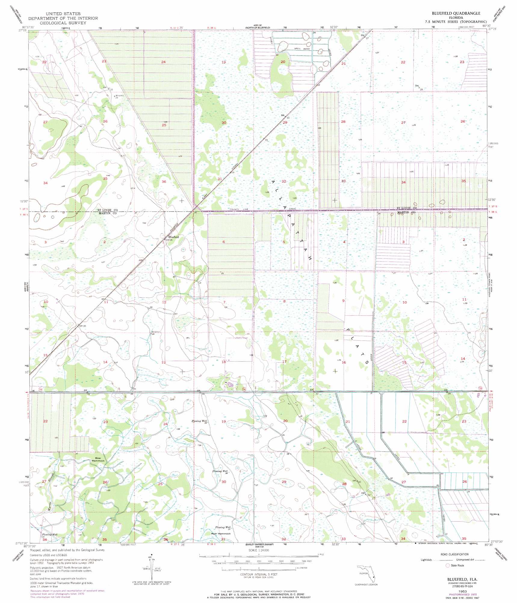
USGS Topo Quad 27080b5 - 1:24,000 scale
| Topo Map Name: | Okeechobee 4 Ne |
| USGS Topo Quad ID: | 27080b5 |
| Print Size: | ca. 21 1/4" wide x 27" high |
| Southeast Coordinates: | 27.125° N latitude / 80.5° W longitude |
| Map Center Coordinates: | 27.1875° N latitude / 80.5625° W longitude |
| U.S. State: | FL |
| Filename: | O27080B5.jpg |
| Download Map JPG Image: | Okeechobee 4 Ne topo map 1:24,000 scale |
| Map Type: | Topographic |
| Topo Series: | 7.5´ |
| Map Scale: | 1:24,000 |
| Source of Map Images: | United States Geological Survey (USGS) |
| Alternate Map Versions: |
Okeechobee 4 NE FL 1953, updated 1954 Download PDF Buy paper map Okeechobee 4 NE FL 1953, updated 1965 Download PDF Buy paper map Okeechobee 4 NE FL 1953, updated 1971 Download PDF Buy paper map Bluefield FL 1953, updated 1993 Download PDF Buy paper map Bluefield FL 2012 Download PDF Buy paper map Bluefield FL 2015 Download PDF Buy paper map |
1:24,000 Topo Quads surrounding Okeechobee 4 Ne
Taylor Creek Ne |
Okeechobee 1 Nw |
Okeechobee 1 Ne |
Fort Pierce Nw |
Fort Pierce |
Taylor Creek Se |
Okeechobee 1 Sw |
Okeechobee 1 Se |
Fort Pierce Sw |
Ankona |
Okeechobee |
Okeechobee 4 Nw |
Okeechobee 4 Ne |
Indian Town Nw |
Palm City |
Okeechobee Se |
Okeechobee 4 Sw |
Okeechobee 4 Se |
Indian Town |
Indiantown Se |
Port Mayaca |
West Palm Beach 2 Nw |
West Palm Beach 2 Ne |
> Back to 27080a1 at 1:100,000 scale
> Back to 27080a1 at 1:250,000 scale
> Back to U.S. Topo Maps home
Okeechobee 4 Ne topo map: Gazetteer
Okeechobee 4 Ne: Airports
Southern Fruit Groves Airport elevation 8m 26′Okeechobee 4 Ne: Flats
Allapattah Flats elevation 8m 26′Okeechobee 4 Ne: Guts
Myrtle Slough elevation 9m 29′Okeechobee 4 Ne: Islands
Boar Hammock elevation 9m 29′Myer Hammock elevation 10m 32′
Okeechobee 4 Ne: Populated Places
Bluefield elevation 9m 29′Okeechobee 4 Ne: Streams
Parker Branch elevation 8m 26′Okeechobee 4 Ne digital topo map on disk
Buy this Okeechobee 4 Ne topo map showing relief, roads, GPS coordinates and other geographical features, as a high-resolution digital map file on DVD: