Fort Pierce Nw Topo Map Florida
To zoom in, hover over the map of Fort Pierce Nw
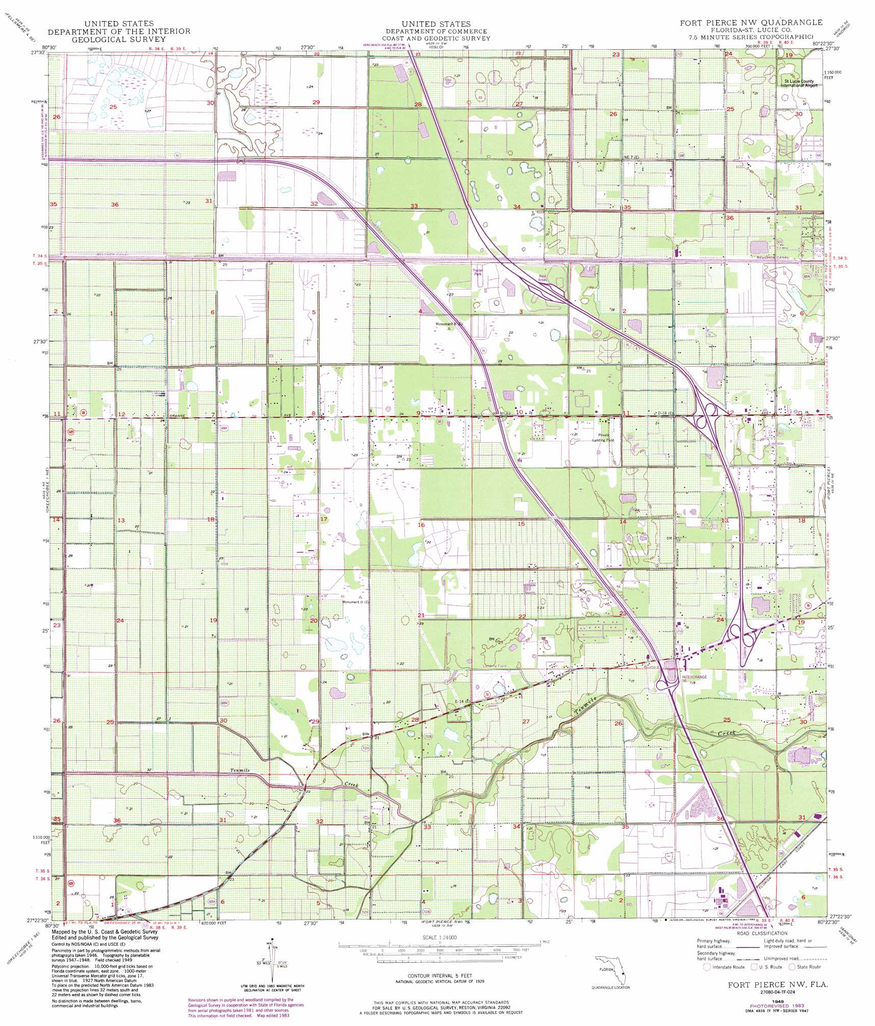
USGS Topo Quad 27080d4 - 1:24,000 scale
| Topo Map Name: | Fort Pierce Nw |
| USGS Topo Quad ID: | 27080d4 |
| Print Size: | ca. 21 1/4" wide x 27" high |
| Southeast Coordinates: | 27.375° N latitude / 80.375° W longitude |
| Map Center Coordinates: | 27.4375° N latitude / 80.4375° W longitude |
| U.S. State: | FL |
| Filename: | O27080D4.jpg |
| Download Map JPG Image: | Fort Pierce Nw topo map 1:24,000 scale |
| Map Type: | Topographic |
| Topo Series: | 7.5´ |
| Map Scale: | 1:24,000 |
| Source of Map Images: | United States Geological Survey (USGS) |
| Alternate Map Versions: |
Fort Pierce NW FL 1949, updated 1983 Download PDF Buy paper map Fort Pierce NW FL 1950 Download PDF Buy paper map Fort Pierce NW FL 1950, updated 1972 Download PDF Buy paper map Fort Pierce NW FL 2012 Download PDF Buy paper map Fort Pierce NW FL 2015 Download PDF Buy paper map |
1:24,000 Topo Quads surrounding Fort Pierce Nw
Fellsmere 4 Nw |
Fellsmere 4 Ne |
Vero Beach |
Riomar |
|
Fellsmere 4 Sw |
Fellsmere 4 Se |
Oslo |
Indrio |
|
Okeechobee 1 Nw |
Okeechobee 1 Ne |
Fort Pierce Nw |
Fort Pierce |
|
Okeechobee 1 Sw |
Okeechobee 1 Se |
Fort Pierce Sw |
Ankona |
Eden |
Okeechobee 4 Nw |
Okeechobee 4 Ne |
Indian Town Nw |
Palm City |
Saint Lucie Inlet |
> Back to 27080a1 at 1:100,000 scale
> Back to 27080a1 at 1:250,000 scale
> Back to U.S. Topo Maps home
Fort Pierce Nw topo map: Gazetteer
Fort Pierce Nw: Airports
Baggett Airfield elevation 1m 3′Williams Hawgwild Airport elevation 6m 19′
Fort Pierce Nw: Canals
Belcher Canal elevation 2m 6′Fort Pierce Nw: Lakes
Clayton Howard Pond elevation 5m 16′Fort Pierce Nw: Populated Places
Golden Ponds Mobile Home Park elevation 6m 19′Fort Pierce Nw: Post Offices
Fort Pierce Post Office elevation 5m 16′Fort Pierce Nw digital topo map on disk
Buy this Fort Pierce Nw topo map showing relief, roads, GPS coordinates and other geographical features, as a high-resolution digital map file on DVD: