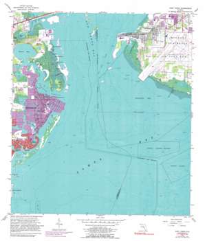
Port Tampa Topo Map Florida
To zoom in, hover over the map of Port Tampa
USGS Topo Quad 27082g5 - 1:24,000 scale
| Topo Map Name: | Port Tampa |
| USGS Topo Quad ID: | 27082g5 |
| Print Size: | ca. 21 1/4" wide x 27" high |
| Southeast Coordinates: | 27.75° N latitude / 82.5° W longitude |
| Map Center Coordinates: | 27.8125° N latitude / 82.5625° W longitude |
| U.S. State: | FL |
| Filename: | O27082G5.jpg |
| Download Map JPG Image: | Port Tampa topo map 1:24,000 scale |
| Map Type: | Topographic |
| Topo Series: | 7.5´ |
| Map Scale: | 1:24,000 |
| Source of Map Images: | United States Geological Survey (USGS) |
| Alternate Map Versions: |
Port Tampa FL 1947 Download PDF Buy paper map Port Tampa FL 1947 Download PDF Buy paper map Port Tampa FL 1956, updated 1957 Download PDF Buy paper map Port Tampa FL 1956, updated 1957 Download PDF Buy paper map Port Tampa FL 1956, updated 1970 Download PDF Buy paper map Port Tampa FL 1956, updated 1982 Download PDF Buy paper map Port Tampa FL 1956, updated 1990 Download PDF Buy paper map Port Tampa FL 1956, updated 1990 Download PDF Buy paper map Port Tampa FL 2012 Download PDF Buy paper map Port Tampa FL 2015 Download PDF Buy paper map |
1:24,000 Topo Quads surrounding Port Tampa
> Back to 27082e1 at 1:100,000 scale
> Back to 27082a1 at 1:250,000 scale
> Back to U.S. Topo Maps home
Port Tampa topo map: Gazetteer
Port Tampa: Bays
Bayou Grande elevation 0m 0′Masters Bayou elevation 0m 0′
Placido Bayou elevation 0m 0′
Riviera Bay elevation 0m 0′
Smacks Bayou elevation 0m 0′
Snell Island Harbor elevation 0m 0′
Port Tampa: Capes
Bay Point elevation 1m 3′Interbay Peninsula elevation 3m 9′
Mermaid Point elevation 0m 0′
Papys Point elevation 0m 0′
Port Tampa: Channels
Christmas Pass elevation 0m 0′Port Tampa Channel elevation 0m 0′
South Gandy Channel elevation 0m 0′
Tampa Bay Channel elevation 0m 0′
Port Tampa: Guts
Coon Hammock Creek elevation 0m 0′Picnic Island Creek elevation 0m 0′
Port Tampa: Harbors
Port Tampa Dock elevation 2m 6′Port Tampa: Islands
Benjamin Island elevation 0m 0′Christmas Island elevation 0m 0′
Eden island elevation 0m 0′
Googe Island elevation 0m 0′
Mud Hole Island elevation 0m 0′
Picnic Island elevation 0m 0′
Ross Island elevation 0m 0′
Snake Island elevation 0m 0′
Snell Isle elevation 1m 3′
Venetian Isles elevation 0m 0′
Weedon Hammock elevation 2m 6′
Weedon Island elevation 1m 3′
Port Tampa: Lakes
Butterfly Lake elevation 0m 0′Port Tampa: Parks
Arrowhead Park elevation 0m 0′Denver Park elevation 0m 0′
Edgemoor Park elevation 1m 3′
Flora Wylie Park elevation 1m 3′
Jack Puryear Park elevation 1m 3′
Shore Acres Mini Park elevation 0m 0′
Shore Acres Park elevation 0m 0′
Snell Isle Park elevation 1m 3′
Weedon Island State Preserve elevation 1m 3′
Port Tampa: Populated Places
Crescent Park elevation 3m 9′Gandy elevation 1m 3′
Land Lackey Estates elevation 2m 6′
Manors at Manhattan elevation 3m 9′
Monnette elevation 3m 9′
Palm Grove elevation 2m 6′
Pinewood elevation 3m 9′
Port Tampa elevation 2m 6′
Port Tampa Communities elevation 1m 3′
Port Tampa Point elevation 1m 3′
Robinson Heights elevation 3m 9′
Shore Acres elevation 0m 0′
Spitler Park elevation 3m 9′
Sunniland elevation 3m 9′
Sunset elevation 3m 9′
West Port elevation 1m 3′
Port Tampa: Post Offices
Port Tampa Post Office elevation 1m 3′Port Tampa digital topo map on disk
Buy this Port Tampa topo map showing relief, roads, GPS coordinates and other geographical features, as a high-resolution digital map file on DVD:


