Caiman Creek Nw Topo Map Texas
To zoom in, hover over the map of Caiman Creek Nw
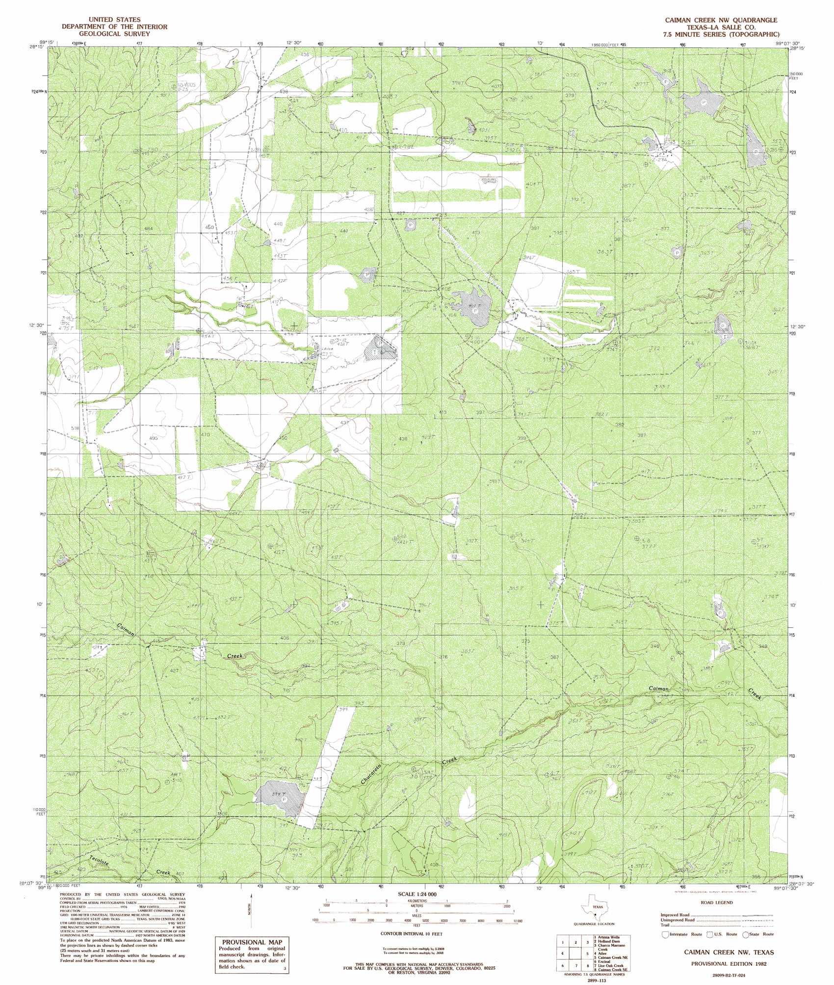
USGS Topo Quad 28099b2 - 1:24,000 scale
| Topo Map Name: | Caiman Creek Nw |
| USGS Topo Quad ID: | 28099b2 |
| Print Size: | ca. 21 1/4" wide x 27" high |
| Southeast Coordinates: | 28.125° N latitude / 99.125° W longitude |
| Map Center Coordinates: | 28.1875° N latitude / 99.1875° W longitude |
| U.S. State: | TX |
| Filename: | o28099b2.jpg |
| Download Map JPG Image: | Caiman Creek Nw topo map 1:24,000 scale |
| Map Type: | Topographic |
| Topo Series: | 7.5´ |
| Map Scale: | 1:24,000 |
| Source of Map Images: | United States Geological Survey (USGS) |
| Alternate Map Versions: |
Caiman Creek NW TX 1982, updated 1982 Download PDF Buy paper map Caiman Creek NW TX 2010 Download PDF Buy paper map Caiman Creek NW TX 2013 Download PDF Buy paper map Caiman Creek NW TX 2016 Download PDF Buy paper map |
1:24,000 Topo Quads surrounding Caiman Creek Nw
Flying W Ranch |
Harris Lake |
Cotulla |
Los Angeles |
Dull |
Blocker Tank |
Artesia Wells |
Holland Dam |
Charco Marrano Creek |
The White Kitchen |
Mesteno Creek North |
Atlee |
Caiman Creek Nw |
Caiman Creek Ne |
Piedra Creek Nw |
Mesteno Creek South |
Encinal |
Live Oak Creek |
Caiman Creek Se |
Piedra Creek Sw |
Callaghan Ranch North |
Venado Creek West |
Venado Creek East |
Alamito Creek Ne |
Biel Lake North |
> Back to 28099a1 at 1:100,000 scale
> Back to 28098a1 at 1:250,000 scale
> Back to U.S. Topo Maps home
Caiman Creek Nw topo map: Gazetteer
Caiman Creek Nw: Airports
Uno Mas Ranch Airport elevation 112m 367′Caiman Creek Nw: Dams
Joe Martin Lake Dam elevation 105m 344′Koehne Lake Dam elevation 123m 403′
Martin Lake Number 1 Dam elevation 108m 354′
Martin Lake Number 2 Dam elevation 113m 370′
Snowden Lake Dam elevation 120m 393′
Caiman Creek Nw: Reservoirs
Joe Martin Lake elevation 105m 344′Koehne Lake elevation 123m 403′
Martin Lake Number 1 elevation 108m 354′
Martin Lake Number 2 elevation 113m 370′
Snowden Lake elevation 120m 393′
Caiman Creek Nw: Streams
Chucareto Creek elevation 107m 351′Caiman Creek Nw digital topo map on disk
Buy this Caiman Creek Nw topo map showing relief, roads, GPS coordinates and other geographical features, as a high-resolution digital map file on DVD: