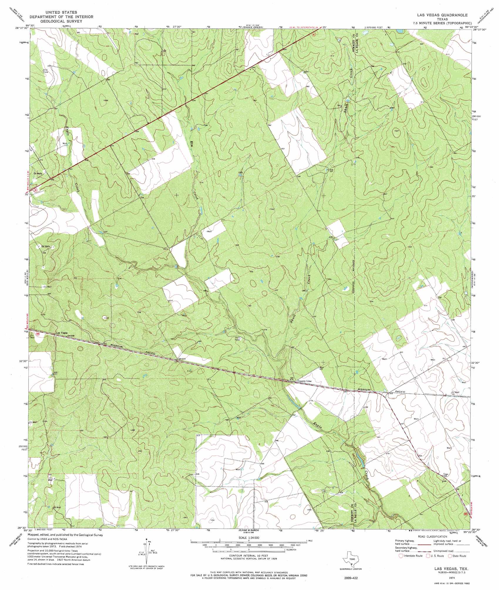
Las Vegas Topo Map Texas
To zoom in, hover over the map of Las Vegas
USGS Topo Quad 28099e4 - 1:24,000 scale
| Topo Map Name: | Las Vegas |
| USGS Topo Quad ID: | 28099e4 |
| Print Size: | ca. 21 1/4" wide x 27" high |
| Southeast Coordinates: | 28.5° N latitude / 99.375° W longitude |
| Map Center Coordinates: | 28.5625° N latitude / 99.4375° W longitude |
| U.S. State: | TX |
| Filename: | o28099e4.jpg |
| Download Map JPG Image: | Las Vegas topo map 1:24,000 scale |
| Map Type: | Topographic |
| Topo Series: | 7.5´ |
| Map Scale: | 1:24,000 |
| Source of Map Images: | United States Geological Survey (USGS) |
| Alternate Map Versions: |
Las Vegas TX 1974, updated 1977 Download PDF Buy paper map Las Vegas TX 2010 Download PDF Buy paper map Las Vegas TX 2013 Download PDF Buy paper map Las Vegas TX 2016 Download PDF Buy paper map |
1:24,000 Topo Quads surrounding Las Vegas
Batesville Sw |
Loma Vista |
West Ranch |
Divot |
Derby |
Woodard Lake |
Sugar Creek |
Snake Creek |
Woodward Ne |
Dilley |
Brundage |
Big Wells |
Las Vegas |
Woodward |
Millett |
Macdonald Lake |
Valley Wells |
Flying W Ranch |
Harris Lake |
Cotulla |
Dabney Tank |
Catarina |
Blocker Tank |
Artesia Wells |
Holland Dam |
> Back to 28099e1 at 1:100,000 scale
> Back to 28098a1 at 1:250,000 scale
> Back to U.S. Topo Maps home
Las Vegas topo map: Gazetteer
Las Vegas: Dams
Vesper Lake Dam elevation 141m 462′Las Vegas: Populated Places
Las Vegas elevation 170m 557′Las Vegas: Reservoirs
Vesper Lake elevation 141m 462′Las Vegas: Streams
Elm Creek elevation 149m 488′Skull Creek elevation 143m 469′
Las Vegas digital topo map on disk
Buy this Las Vegas topo map showing relief, roads, GPS coordinates and other geographical features, as a high-resolution digital map file on DVD: