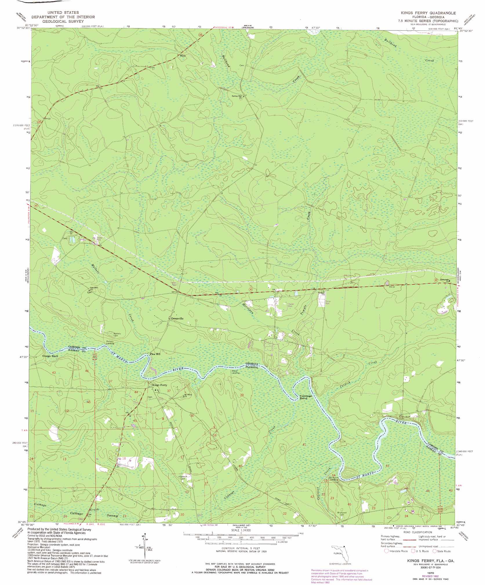
Kings Ferry Topo Map Georgia
To zoom in, hover over the map of Kings Ferry
USGS Topo Quad 30081g7 - 1:24,000 scale
| Topo Map Name: | Kings Ferry |
| USGS Topo Quad ID: | 30081g7 |
| Print Size: | ca. 21 1/4" wide x 27" high |
| Southeast Coordinates: | 30.75° N latitude / 81.75° W longitude |
| Map Center Coordinates: | 30.8125° N latitude / 81.8125° W longitude |
| U.S. States: | GA, FL |
| Filename: | o30081g7.jpg |
| Download Map JPG Image: | Kings Ferry topo map 1:24,000 scale |
| Map Type: | Topographic |
| Topo Series: | 7.5´ |
| Map Scale: | 1:24,000 |
| Source of Map Images: | United States Geological Survey (USGS) |
| Alternate Map Versions: |
Kings Ferry FL 1970, updated 1973 Download PDF Buy paper map Kings Ferry FL 1970, updated 1987 Download PDF Buy paper map Kings Ferry FL 1970, updated 1992 Download PDF Buy paper map Kings Ferry FL 2011 Download PDF Buy paper map Kings Ferry FL 2012 Download PDF Buy paper map Kings Ferry FL 2015 Download PDF Buy paper map |
1:24,000 Topo Quads surrounding Kings Ferry
Winokur |
Boons Lake |
Tarboro |
Waverly |
Dover Bluff |
Newell |
Burnt Fort |
Jerusalem |
Woodbine |
Kingsland Ne |
Folkston |
Boulogne |
Kings Ferry |
Kingsland |
Harrietts Bluff |
Toledo |
Hilliard |
Hilliard Ne |
Gross |
Saint Marys |
Saint George |
Hilliard Sw |
Callahan |
Italia |
Hedges |
> Back to 30081e1 at 1:100,000 scale
> Back to 30080a1 at 1:250,000 scale
> Back to U.S. Topo Maps home
Kings Ferry topo map: Gazetteer
Kings Ferry: Bends
Cabbage Bend elevation 0m 0′Kings Ferry: Cliffs
Merrles Bluff elevation 5m 16′Orange Bluff elevation 0m 0′
Kings Ferry: Crossings
Kings Ferry (historical) elevation 11m 36′Kings Ferry: Populated Places
Clarks Bluff elevation 6m 19′Flea Hill elevation 1m 3′
Germantown (historical) elevation 1m 3′
Greenville elevation 4m 13′
Kings Ferry elevation 4m 13′
Silco elevation 4m 13′
Kings Ferry: Streams
Cabbage Creek elevation 0m 0′Catfish Creek elevation 0m 0′
Cossiers Creek elevation 0m 0′
Horsepen Creek elevation 1m 3′
Mallets Creek elevation 1m 3′
Temple Creek elevation 1m 3′
Kings Ferry: Swamps
Cabbage Swamp elevation 4m 13′Kings Ferry digital topo map on disk
Buy this Kings Ferry topo map showing relief, roads, GPS coordinates and other geographical features, as a high-resolution digital map file on DVD: