Horse Mountain Topo Map Texas
To zoom in, hover over the map of Horse Mountain
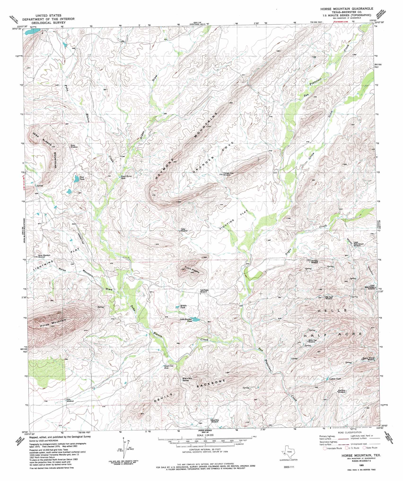
USGS Topo Quad 30103a1 - 1:24,000 scale
| Topo Map Name: | Horse Mountain |
| USGS Topo Quad ID: | 30103a1 |
| Print Size: | ca. 21 1/4" wide x 27" high |
| Southeast Coordinates: | 30° N latitude / 103° W longitude |
| Map Center Coordinates: | 30.0625° N latitude / 103.0625° W longitude |
| U.S. State: | TX |
| Filename: | o30103a1.jpg |
| Download Map JPG Image: | Horse Mountain topo map 1:24,000 scale |
| Map Type: | Topographic |
| Topo Series: | 7.5´ |
| Map Scale: | 1:24,000 |
| Source of Map Images: | United States Geological Survey (USGS) |
| Alternate Map Versions: |
Horse Mountain TX 1967, updated 1970 Download PDF Buy paper map Horse Mountain TX 1983, updated 1984 Download PDF Buy paper map Horse Mountain TX 2010 Download PDF Buy paper map Horse Mountain TX 2012 Download PDF Buy paper map Horse Mountain TX 2016 Download PDF Buy paper map |
1:24,000 Topo Quads surrounding Horse Mountain
Gilliland Peak |
Leonard Mountain |
Wolf Camp Hills |
Dimple Hills |
Cap Rock Butte |
Beckwith Hills |
Marathon |
Lightening Hills |
Housetop Mountains |
Tesnus Ne |
Simpson Springs Mountain |
Pena Blanca Mountains |
Horse Mountain |
Tesnus |
Tesnus Se |
Maravillas Gap |
Heart Mountain |
Hood Spring |
Pine Mountain West |
Pine Mountain East |
Ye Mesa |
Sosa Peak |
Hood Spring Se |
Yellow House Peak |
Dove Mountain |
> Back to 30103a1 at 1:100,000 scale
> Back to 30102a1 at 1:250,000 scale
> Back to U.S. Topo Maps home
Horse Mountain topo map: Gazetteer
Horse Mountain: Basins
Granger Cove elevation 1147m 3763′Horse Mountain: Flats
Fighting Flat elevation 1110m 3641′Lightning Flat elevation 1142m 3746′
Horse Mountain: Lakes
Dead Horse Hole elevation 1143m 3750′Horse Mountain: Populated Places
Bennett Place (historical) elevation 1162m 3812′Bennett Place (historical) elevation 1124m 3687′
Old Corbett Place elevation 1077m 3533′
Old Edith Lochausen Place elevation 1184m 3884′
Horse Mountain: Reservoirs
Catfish Tank elevation 1100m 3608′Dead Cow Hole elevation 1107m 3631′
Middle Tank elevation 1110m 3641′
Steel Tank elevation 1156m 3792′
Horse Mountain: Ridges
Devils Backbone elevation 1151m 3776′Horse Mountain: Streams
Negro Creek elevation 1092m 3582′Peña Blanca Creek elevation 1076m 3530′
Horse Mountain: Summits
Haymond Mountains elevation 1246m 4087′Hells Half Acre elevation 1205m 3953′
Horse Mountain elevation 1527m 5009′
Twin Peaks elevation 1240m 4068′
Horse Mountain: Valleys
Arden Draw elevation 1143m 3750′China Draw elevation 1127m 3697′
Horse Mountain Draw elevation 1120m 3674′
Water Canyon elevation 1121m 3677′
Horse Mountain digital topo map on disk
Buy this Horse Mountain topo map showing relief, roads, GPS coordinates and other geographical features, as a high-resolution digital map file on DVD: