San Estaban Lake Topo Map Texas
To zoom in, hover over the map of San Estaban Lake
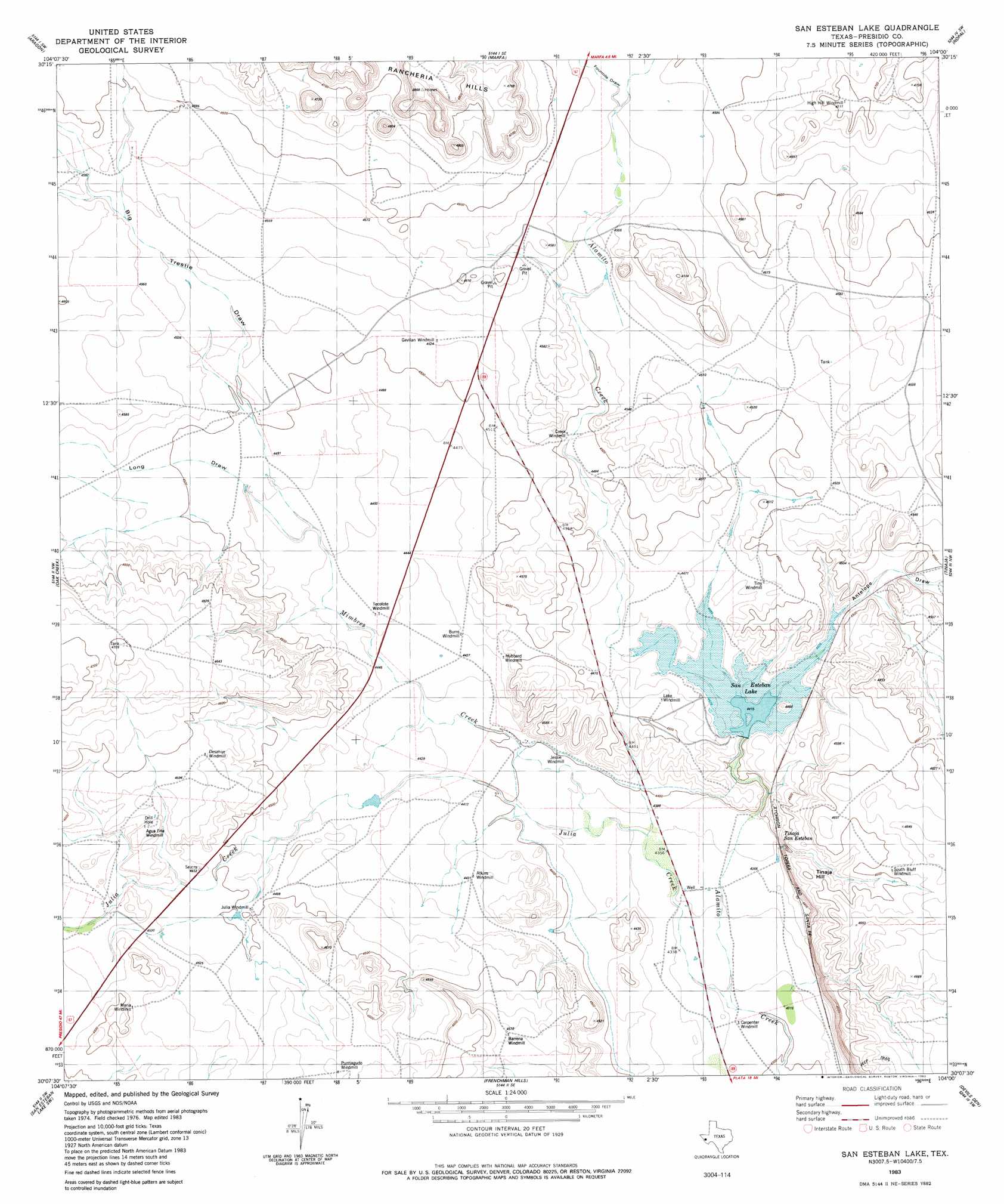
USGS Topo Quad 30104b1 - 1:24,000 scale
| Topo Map Name: | San Estaban Lake |
| USGS Topo Quad ID: | 30104b1 |
| Print Size: | ca. 21 1/4" wide x 27" high |
| Southeast Coordinates: | 30.125° N latitude / 104° W longitude |
| Map Center Coordinates: | 30.1875° N latitude / 104.0625° W longitude |
| U.S. State: | TX |
| Filename: | o30104b1.jpg |
| Download Map JPG Image: | San Estaban Lake topo map 1:24,000 scale |
| Map Type: | Topographic |
| Topo Series: | 7.5´ |
| Map Scale: | 1:24,000 |
| Source of Map Images: | United States Geological Survey (USGS) |
| Alternate Map Versions: |
San Esteban Lake TX 1983, updated 1983 Download PDF Buy paper map San Esteban Lake TX 2010 Download PDF Buy paper map San Esteban Lake TX 2012 Download PDF Buy paper map San Esteban Lake TX 2016 Download PDF Buy paper map |
1:24,000 Topo Quads surrounding San Estaban Lake
Ryan |
Burro Draw |
Smith Hills |
Mano Prieto Mountain |
Mitre Peak |
Oak Hills North |
Aragon |
Marfa |
Nopal |
Paisano |
Oak Hills South |
Oak Creek |
San Estaban Lake |
Tinaja |
Tinaja Ne |
Cuesta Del Burro East |
San Estaban Lake Sw |
Frenchman Hills |
Devils Den |
Cactus Flat |
Cieneguita |
Cerros Priestos |
Plata Ne |
Jordan Gap |
Paradise Draw |
> Back to 30104a1 at 1:100,000 scale
> Back to 30104a1 at 1:250,000 scale
> Back to U.S. Topo Maps home
San Estaban Lake topo map: Gazetteer
San Estaban Lake: Dams
San Esteban Lake Dam elevation 1346m 4416′San Estaban Lake: Reservoirs
San Estaban Lake elevation 1341m 4399′San Estaban Lake: Streams
Indian Creek elevation 1376m 4514′Julio Creek elevation 1360m 4461′
Savcito Creek elevation 1313m 4307′
San Estaban Lake: Summits
Rancheria Hills elevation 1471m 4826′San Estaban Lake: Valleys
Big Trestle Draw elevation 1360m 4461′Fourmile Draw elevation 1389m 4557′
Long Draw elevation 1360m 4461′
San Estaban Lake digital topo map on disk
Buy this San Estaban Lake topo map showing relief, roads, GPS coordinates and other geographical features, as a high-resolution digital map file on DVD: