Waycross Sw Topo Map Georgia
To zoom in, hover over the map of Waycross Sw
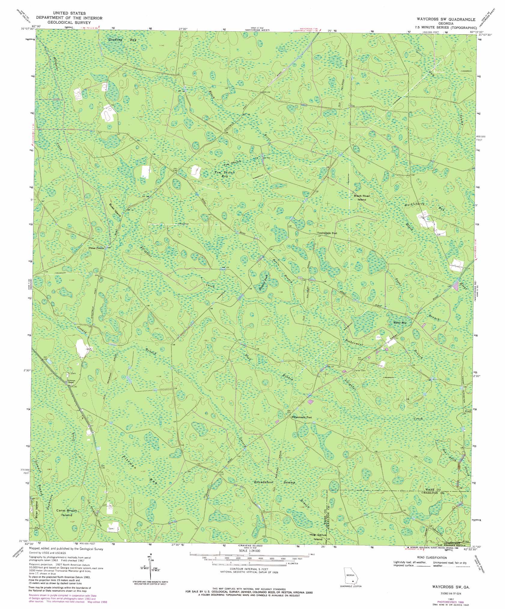
USGS Topo Quad 31082a4 - 1:24,000 scale
| Topo Map Name: | Waycross Sw |
| USGS Topo Quad ID: | 31082a4 |
| Print Size: | ca. 21 1/4" wide x 27" high |
| Southeast Coordinates: | 31° N latitude / 82.375° W longitude |
| Map Center Coordinates: | 31.0625° N latitude / 82.4375° W longitude |
| U.S. State: | GA |
| Filename: | o31082a4.jpg |
| Download Map JPG Image: | Waycross Sw topo map 1:24,000 scale |
| Map Type: | Topographic |
| Topo Series: | 7.5´ |
| Map Scale: | 1:24,000 |
| Source of Map Images: | United States Geological Survey (USGS) |
| Alternate Map Versions: |
Waycross SW GA 1967, updated 1969 Download PDF Buy paper map Waycross SW GA 2011 Download PDF Buy paper map Waycross SW GA 2014 Download PDF Buy paper map |
1:24,000 Topo Quads surrounding Waycross Sw
Axson |
Talmo |
Dixie Union |
Blackshear West |
Blackshear East |
Cogdell |
Pine Valley |
Waycross West |
Waycross East |
Hoboken West |
Homerville East |
Manor |
Waycross Sw |
Waycross Se |
Fort Mudge |
Midway |
Spooner |
Cravens Island |
Dinner Pond |
Double Lakes |
Headlight |
Colon |
The Pocket |
Billys Island |
Chase Prairie |
> Back to 31082a1 at 1:100,000 scale
> Back to 31082a1 at 1:250,000 scale
> Back to U.S. Topo Maps home
Waycross Sw topo map: Gazetteer
Waycross Sw: Islands
Black River Island elevation 40m 131′Briar Island elevation 43m 141′
Bush Island elevation 42m 137′
Cane Break Island elevation 41m 134′
Hog Gallus Island elevation 38m 124′
Waycross Sw: Lakes
District Pond elevation 40m 131′Water Bay elevation 38m 124′
Waycross Sw: Populated Places
Three Points elevation 42m 137′Waycross Sw: Streams
Botherment Branch elevation 38m 124′Buck Branch elevation 39m 127′
Davis Branch elevation 40m 131′
Stewart Branch elevation 41m 134′
Sugar Branch elevation 38m 124′
Tom Thumb Creek elevation 41m 134′
Waycross Sw: Swamps
Gooding Bay elevation 43m 141′Huckleberry Bay elevation 39m 127′
Pittman Bay elevation 41m 134′
Roundabout Swamp elevation 39m 127′
Tom Thumb Bay elevation 41m 134′
Waycross Sw digital topo map on disk
Buy this Waycross Sw topo map showing relief, roads, GPS coordinates and other geographical features, as a high-resolution digital map file on DVD: