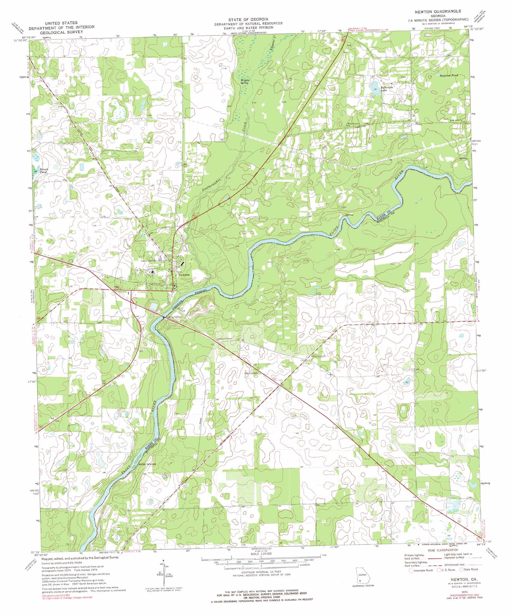
Newton Topo Map Georgia
To zoom in, hover over the map of Newton
USGS Topo Quad 31084c3 - 1:24,000 scale
| Topo Map Name: | Newton |
| USGS Topo Quad ID: | 31084c3 |
| Print Size: | ca. 21 1/4" wide x 27" high |
| Southeast Coordinates: | 31.25° N latitude / 84.25° W longitude |
| Map Center Coordinates: | 31.3125° N latitude / 84.3125° W longitude |
| U.S. State: | GA |
| Filename: | o31084c3.jpg |
| Download Map JPG Image: | Newton topo map 1:24,000 scale |
| Map Type: | Topographic |
| Topo Series: | 7.5´ |
| Map Scale: | 1:24,000 |
| Source of Map Images: | United States Geological Survey (USGS) |
| Alternate Map Versions: |
Newton GA 1974, updated 1976 Download PDF Buy paper map Newton GA 1974, updated 1991 Download PDF Buy paper map Newton GA 2011 Download PDF Buy paper map Newton GA 2014 Download PDF Buy paper map |
1:24,000 Topo Quads surrounding Newton
Morgan |
Holt |
Pretoria |
Albany West |
Albany East |
Leary |
Bermuda |
Red Store Crossroads |
Baconton North |
Putney |
Bethany |
Elmodel |
Newton |
Baconton South |
Sale City |
Cooktown |
Hopeful |
Branchville |
Camilla |
Cotton |
Steadhams Store |
Vada |
Gee Pond |
Pelham |
Meigs |
> Back to 31084a1 at 1:100,000 scale
> Back to 31084a1 at 1:250,000 scale
> Back to U.S. Topo Maps home
Newton topo map: Gazetteer
Newton: Bridges
James Henderson Hall Senior Bridge elevation 36m 118′Newton: Islands
Sister Islands elevation 35m 114′Newton: Lakes
Baptism Pond elevation 48m 157′Reflection Lake elevation 46m 150′
Newton: Populated Places
Newton elevation 43m 141′Newton: Springs
Wildcat Spring elevation 45m 147′Newton: Streams
Alligator Creek elevation 45m 147′Cooleewahee Creek elevation 36m 118′
Newton digital topo map on disk
Buy this Newton topo map showing relief, roads, GPS coordinates and other geographical features, as a high-resolution digital map file on DVD:
Gulf Coast (LA, MS, AL, FL) & Southwestern Georgia
Buy digital topo maps: Gulf Coast (LA, MS, AL, FL) & Southwestern Georgia
 & Southwestern Georgia map DVD")