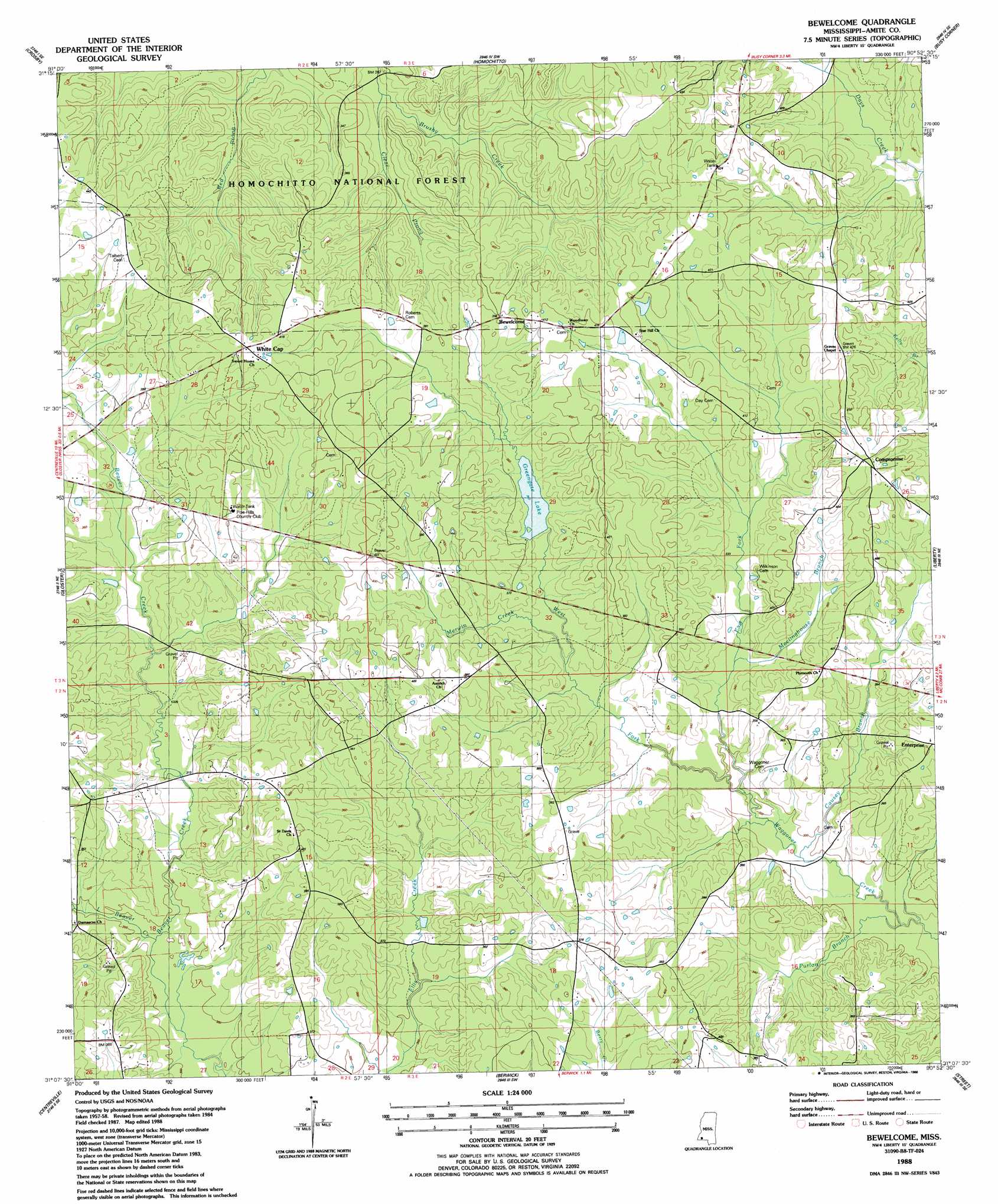
Bewelcome Topo Map Mississippi
To zoom in, hover over the map of Bewelcome
USGS Topo Quad 31090b8 - 1:24,000 scale
| Topo Map Name: | Bewelcome |
| USGS Topo Quad ID: | 31090b8 |
| Print Size: | ca. 21 1/4" wide x 27" high |
| Southeast Coordinates: | 31.125° N latitude / 90.875° W longitude |
| Map Center Coordinates: | 31.1875° N latitude / 90.9375° W longitude |
| U.S. State: | MS |
| Filename: | o31090b8.jpg |
| Download Map JPG Image: | Bewelcome topo map 1:24,000 scale |
| Map Type: | Topographic |
| Topo Series: | 7.5´ |
| Map Scale: | 1:24,000 |
| Source of Map Images: | United States Geological Survey (USGS) |
| Alternate Map Versions: |
Bewelcome MS 1988, updated 1988 Download PDF Buy paper map Bewelcome MS 2012 Download PDF Buy paper map Bewelcome MS 2015 Download PDF Buy paper map |
| FStopo: | US Forest Service topo Bewelcome is available: Download FStopo PDF Download FStopo TIF |
1:24,000 Topo Quads surrounding Bewelcome
Jeannette |
Knoxville |
Meadville |
Bude |
Little Springs |
Garden City |
Crosby |
Homochitto |
Busy Corner |
Smithdale |
Wilkinson |
Gloster |
Bewelcome |
Liberty |
Peoria |
Newtonia |
Centreville |
Berwick |
Street |
Gillsburg |
Rogillioville |
Wilson |
Woodland |
Chipola |
Liverpool |
> Back to 31090a1 at 1:100,000 scale
> Back to 31090a1 at 1:250,000 scale
> Back to U.S. Topo Maps home
Bewelcome topo map: Gazetteer
Bewelcome: Dams
Sansing Lake Dam elevation 103m 337′Bewelcome: Lakes
Greengate Lake elevation 104m 341′Bewelcome: Populated Places
Bewelcome elevation 118m 387′Compromise elevation 127m 416′
Enterprise elevation 116m 380′
White Cap elevation 128m 419′
Bewelcome: Post Offices
Lebanon Post Office (historical) elevation 114m 374′Bewelcome: Reservoirs
Greengate Lake elevation 104m 341′Bewelcome: Streams
Buckles Creek elevation 104m 341′Causey Branch elevation 89m 291′
Clear Prong elevation 79m 259′
East Fork Waggoner Creek elevation 92m 301′
Little Beaver Creek elevation 88m 288′
Meetinghouse Branch elevation 97m 318′
Merwin Creek elevation 109m 357′
Purlon Branch elevation 84m 275′
Tatum Creek elevation 90m 295′
West Fork Waggoner Creek elevation 92m 301′
Bewelcome digital topo map on disk
Buy this Bewelcome topo map showing relief, roads, GPS coordinates and other geographical features, as a high-resolution digital map file on DVD: