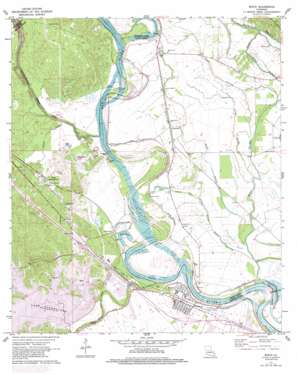
Boyce Topo Map Louisiana
To zoom in, hover over the map of Boyce
USGS Topo Quad 31092d6 - 1:24,000 scale
| Topo Map Name: | Boyce |
| USGS Topo Quad ID: | 31092d6 |
| Print Size: | ca. 21 1/4" wide x 27" high |
| Southeast Coordinates: | 31.375° N latitude / 92.625° W longitude |
| Map Center Coordinates: | 31.4375° N latitude / 92.6875° W longitude |
| U.S. State: | LA |
| Filename: | o31092d6.jpg |
| Download Map JPG Image: | Boyce topo map 1:24,000 scale |
| Map Type: | Topographic |
| Topo Series: | 7.5´ |
| Map Scale: | 1:24,000 |
| Source of Map Images: | United States Geological Survey (USGS) |
| Alternate Map Versions: |
Boyce LA 1971, updated 1973 Download PDF Buy paper map Boyce LA 1971, updated 1979 Download PDF Buy paper map Boyce LA 1971, updated 1992 Download PDF Buy paper map Boyce LA 2012 Download PDF Buy paper map Boyce LA 2015 Download PDF Buy paper map |
1:24,000 Topo Quads surrounding Boyce
> Back to 31092a1 at 1:100,000 scale
> Back to 31092a1 at 1:250,000 scale
> Back to U.S. Topo Maps home
Boyce topo map: Gazetteer
Boyce: Bends
Pontfield Bend elevation 23m 75′Boyce: Channels
McNeely Cut-Off elevation 22m 72′Boyce: Cliffs
Deloges Bluff elevation 33m 108′Boyce: Lakes
Bush Lake elevation 27m 88′Bush Lake (historical) elevation 28m 91′
Kateland Pond (historical) elevation 26m 85′
Mill Pond elevation 24m 78′
Shagafoot Lake elevation 28m 91′
Boyce: Populated Places
Boyce elevation 26m 85′Fairmount elevation 28m 91′
Kateland elevation 28m 91′
Oasis elevation 39m 127′
Ravencamp elevation 27m 88′
Rock elevation 29m 95′
Rodemacher elevation 43m 141′
Zimmerman elevation 28m 91′
Boyce: Reservoirs
Lake Rodemacher elevation 27m 88′Boyce: Streams
Bayou Darrow elevation 24m 78′Bayou Jean De Jean elevation 21m 68′
Bayou Patassa elevation 25m 82′
Bayou Taureau elevation 24m 78′
Boggy Bayou elevation 23m 75′
Boyce Branch elevation 23m 75′
Cane River-Red Bayou Diversion Canal elevation 21m 68′
Carnahan Creek elevation 24m 78′
Davis Creek elevation 22m 72′
Griffth Creek elevation 30m 98′
Irish Ditch elevation 30m 98′
Labourne Bayou elevation 26m 85′
Little Sandy Bayou elevation 24m 78′
Sams Bayou elevation 24m 78′
Sandy Bayou elevation 25m 82′
Sneed Creek elevation 21m 68′
White Branch elevation 30m 98′
Boyce: Swamps
Boyce Lake elevation 30m 98′Castor Lake elevation 30m 98′
Clear Lake elevation 27m 88′
Long Bridge Lake elevation 27m 88′
Boyce digital topo map on disk
Buy this Boyce topo map showing relief, roads, GPS coordinates and other geographical features, as a high-resolution digital map file on DVD:


