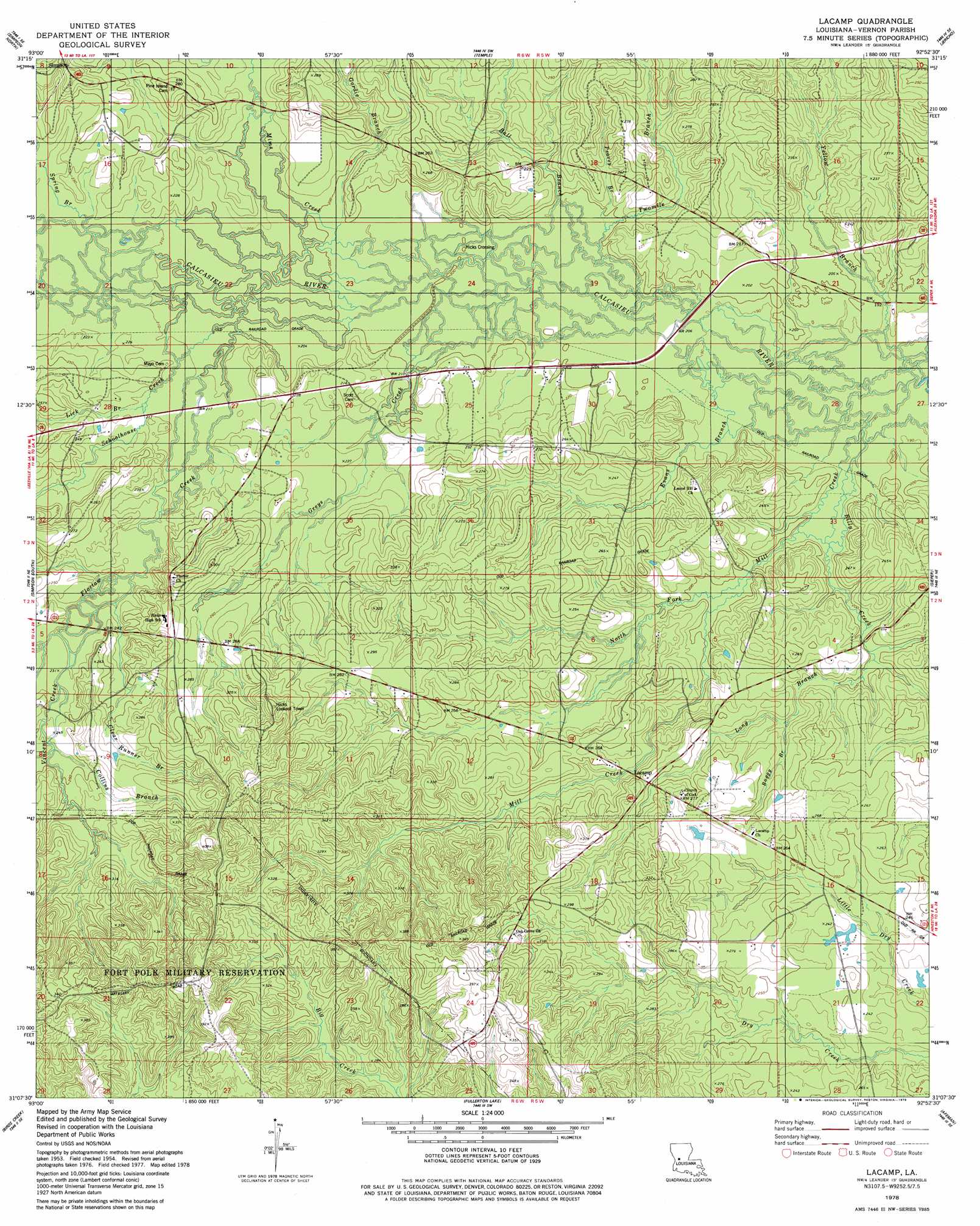
Lacamp Topo Map Louisiana
To zoom in, hover over the map of Lacamp
USGS Topo Quad 31092b8 - 1:24,000 scale
| Topo Map Name: | Lacamp |
| USGS Topo Quad ID: | 31092b8 |
| Print Size: | ca. 21 1/4" wide x 27" high |
| Southeast Coordinates: | 31.125° N latitude / 92.875° W longitude |
| Map Center Coordinates: | 31.1875° N latitude / 92.9375° W longitude |
| U.S. State: | LA |
| Filename: | o31092b8.jpg |
| Download Map JPG Image: | Lacamp topo map 1:24,000 scale |
| Map Type: | Topographic |
| Topo Series: | 7.5´ |
| Map Scale: | 1:24,000 |
| Source of Map Images: | United States Geological Survey (USGS) |
| Alternate Map Versions: |
Lacamp LA 1954, updated 1959 Download PDF Buy paper map Lacamp LA 1978, updated 1979 Download PDF Buy paper map Lacamp LA 2012 Download PDF Buy paper map Lacamp LA 2015 Download PDF Buy paper map |
1:24,000 Topo Quads surrounding Lacamp
Kisatchie |
Bayou Livrogne |
Gorum |
Lena |
Boyce |
Kurthwood |
Simpson North |
Temple |
Jericho |
Gardner |
Slagle |
Simpson South |
Lacamp |
Sieper |
Elmer |
Fort Polk |
Birds Creek |
Fullerton Lake |
Afeman |
Melder |
Hurricane Branch |
Sugrue |
Pitkin |
Steep Gully |
Pawnee |
> Back to 31092a1 at 1:100,000 scale
> Back to 31092a1 at 1:250,000 scale
> Back to U.S. Topo Maps home
Lacamp topo map: Gazetteer
Lacamp: Populated Places
Hicks Crossing elevation 60m 196′Lacamp elevation 80m 262′
Lacamp: Post Offices
Lacamp Post Office elevation 78m 255′Lacamp: Streams
Ball Branch elevation 59m 193′Billy Creek elevation 55m 180′
Boggy Branch elevation 64m 209′
Clear Runner Branch elevation 68m 223′
Collins Branch elevation 74m 242′
Evans Branch elevation 56m 183′
Floctaw Creek elevation 61m 200′
Gordie Branch elevation 61m 200′
Greys Creek elevation 60m 196′
Lick Branch elevation 65m 213′
Long Branch elevation 61m 200′
Mill Creek elevation 56m 183′
Mims Creek elevation 60m 196′
North Fork Mill Creek elevation 60m 196′
Peavey Branch elevation 60m 196′
Schoolhouse Creek elevation 63m 206′
Spring Branch elevation 63m 206′
Twomile Branch elevation 57m 187′
Vincent Creek elevation 67m 219′
Yellow Branch elevation 56m 183′
Lacamp digital topo map on disk
Buy this Lacamp topo map showing relief, roads, GPS coordinates and other geographical features, as a high-resolution digital map file on DVD: