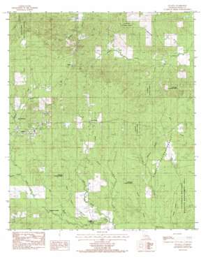
Atlanta Topo Map Louisiana
To zoom in, hover over the map of Atlanta
USGS Topo Quad 31092g6 - 1:24,000 scale
| Topo Map Name: | Atlanta |
| USGS Topo Quad ID: | 31092g6 |
| Print Size: | ca. 21 1/4" wide x 27" high |
| Southeast Coordinates: | 31.75° N latitude / 92.625° W longitude |
| Map Center Coordinates: | 31.8125° N latitude / 92.6875° W longitude |
| U.S. State: | LA |
| Filename: | o31092g6.jpg |
| Download Map JPG Image: | Atlanta topo map 1:24,000 scale |
| Map Type: | Topographic |
| Topo Series: | 7.5´ |
| Map Scale: | 1:24,000 |
| Source of Map Images: | United States Geological Survey (USGS) |
| Alternate Map Versions: |
Atlanta LA 1984, updated 1985 Download PDF Buy paper map Atlanta LA 2003, updated 2005 Download PDF Buy paper map Atlanta LA 2012 Download PDF Buy paper map Atlanta LA 2015 Download PDF Buy paper map |
| FStopo: | US Forest Service topo Atlanta is available: Download FStopo PDF Download FStopo TIF |
1:24,000 Topo Quads surrounding Atlanta
> Back to 31092e1 at 1:100,000 scale
> Back to 31092a1 at 1:250,000 scale
> Back to U.S. Topo Maps home
Atlanta topo map: Gazetteer
Atlanta: Lakes
Old Mill Pond elevation 58m 190′Atlanta: Oilfields
Atlanta Gas Field elevation 80m 262′Five Forks Gas Field elevation 71m 232′
Iatt Creek Oil Field elevation 41m 134′
Sulphur Creek Gas Field elevation 60m 196′
Atlanta: Populated Places
Alonzo (historical) elevation 57m 187′Atlanta elevation 70m 229′
Beal Crossing elevation 39m 127′
Five Forks elevation 67m 219′
Prairie Home (historical) elevation 65m 213′
Sardis elevation 85m 278′
Whitford elevation 65m 213′
Worsham Crossing elevation 46m 150′
Atlanta: Post Offices
Atlanta Post Office elevation 71m 232′Atlanta: Streams
Bell Creek elevation 36m 118′Bulger Creek elevation 49m 160′
Cow Creek elevation 57m 187′
Cruie Creek elevation 40m 131′
Hill Bayou elevation 43m 141′
Lawrence Branch elevation 46m 150′
Marlin Branch elevation 44m 144′
Ninth Ward School (historical) elevation 43m 141′
Ratton Creek elevation 36m 118′
Redland Creek elevation 52m 170′
Rhoe Creek elevation 39m 127′
Sulphur Creek elevation 34m 111′
Atlanta digital topo map on disk
Buy this Atlanta topo map showing relief, roads, GPS coordinates and other geographical features, as a high-resolution digital map file on DVD:


