Georgetown Topo Map Louisiana
To zoom in, hover over the map of Georgetown
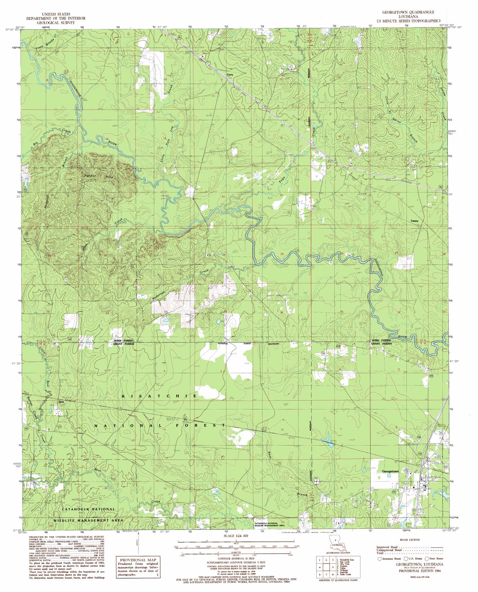
USGS Topo Quad 31092g4 - 1:24,000 scale
| Topo Map Name: | Georgetown |
| USGS Topo Quad ID: | 31092g4 |
| Print Size: | ca. 21 1/4" wide x 27" high |
| Southeast Coordinates: | 31.75° N latitude / 92.375° W longitude |
| Map Center Coordinates: | 31.8125° N latitude / 92.4375° W longitude |
| U.S. State: | LA |
| Filename: | o31092g4.jpg |
| Download Map JPG Image: | Georgetown topo map 1:24,000 scale |
| Map Type: | Topographic |
| Topo Series: | 7.5´ |
| Map Scale: | 1:24,000 |
| Source of Map Images: | United States Geological Survey (USGS) |
| Alternate Map Versions: |
Georgetown LA 1984, updated 1985 Download PDF Buy paper map Georgetown LA 2003, updated 2005 Download PDF Buy paper map Georgetown LA 2012 Download PDF Buy paper map Georgetown LA 2015 Download PDF Buy paper map |
| FStopo: | US Forest Service topo Georgetown is available: Download FStopo PDF Download FStopo TIF |
1:24,000 Topo Quads surrounding Georgetown
Dodson |
Hudson |
Sikes |
Cotton Plant |
Clark |
Winnfield West |
Winnfield East |
Flat Creek |
Fords Creek |
Olla East |
Atlanta |
Packton |
Georgetown |
Tullas |
Summerville |
Savage Creek |
Williana |
Mudville |
Little Creek |
Jena West |
Colfax |
Dry Prong |
Pollock |
Fishville |
Nebo |
> Back to 31092e1 at 1:100,000 scale
> Back to 31092a1 at 1:250,000 scale
> Back to U.S. Topo Maps home
Georgetown topo map: Gazetteer
Georgetown: Crossings
Maxwells Old Ferry (historical) elevation 16m 52′Georgetown: Dams
Louisiana Noname Number 57 Dam elevation 21m 68′Georgetown: Oilfields
Little Creek Oil Field elevation 26m 85′Little Creek-Summerville Oil and Gas Field elevation 28m 91′
Salt Oil Field elevation 25m 82′
Georgetown: Populated Places
Curry elevation 28m 91′Georgetown elevation 29m 95′
Salt (historical) elevation 42m 137′
Tansey elevation 28m 91′
Zion elevation 36m 118′
Georgetown: Post Offices
Georgetown Post Office elevation 28m 91′Georgetown: Streams
Anderson Creek elevation 14m 45′Big Creek elevation 18m 59′
Hemphill Branch elevation 17m 55′
Little Bear Creek elevation 28m 91′
Little Pole Log Creek elevation 17m 55′
Little Saline Branch elevation 21m 68′
Mine Creek elevation 18m 59′
Piney Woods Creek elevation 21m 68′
Pope Creek elevation 17m 55′
Rattan Creek elevation 29m 95′
Georgetown: Summits
Pardon Hills elevation 27m 88′Georgetown digital topo map on disk
Buy this Georgetown topo map showing relief, roads, GPS coordinates and other geographical features, as a high-resolution digital map file on DVD: