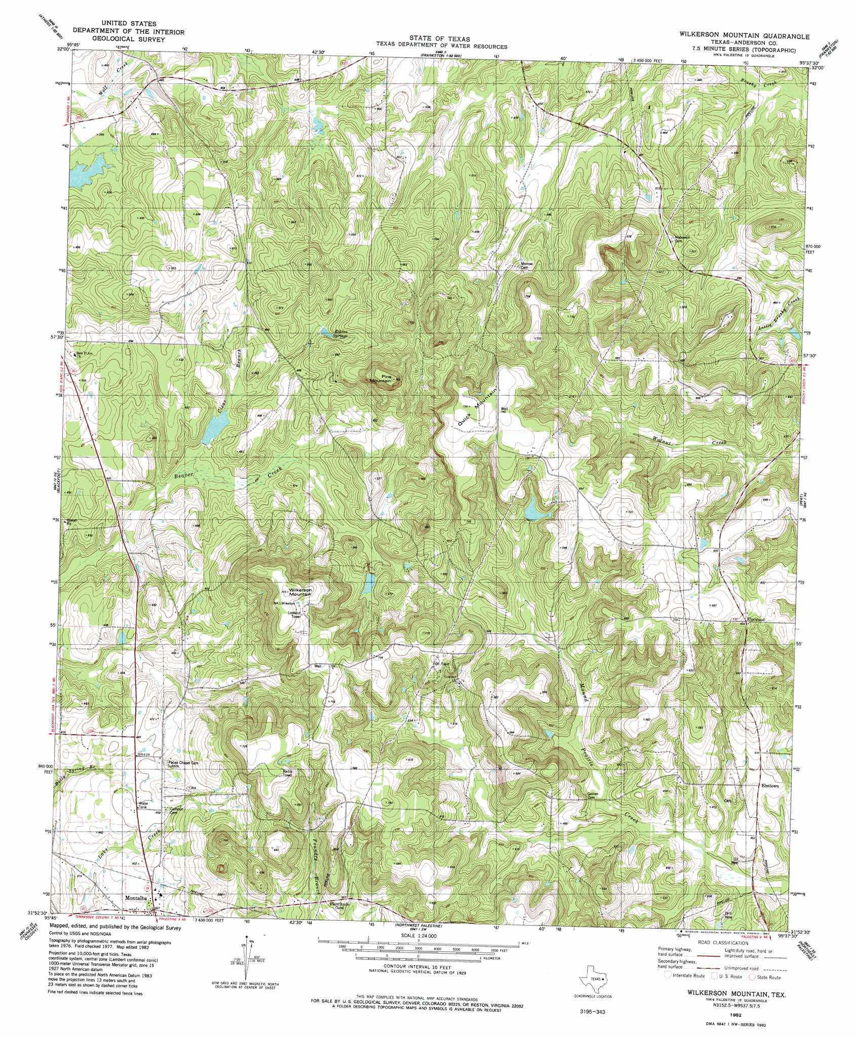
Wilkerson Mountain Topo Map Texas
To zoom in, hover over the map of Wilkerson Mountain
USGS Topo Quad 31095h6 - 1:24,000 scale
| Topo Map Name: | Wilkerson Mountain |
| USGS Topo Quad ID: | 31095h6 |
| Print Size: | ca. 21 1/4" wide x 27" high |
| Southeast Coordinates: | 31.875° N latitude / 95.625° W longitude |
| Map Center Coordinates: | 31.9375° N latitude / 95.6875° W longitude |
| U.S. State: | TX |
| Filename: | o31095h6.jpg |
| Download Map JPG Image: | Wilkerson Mountain topo map 1:24,000 scale |
| Map Type: | Topographic |
| Topo Series: | 7.5´ |
| Map Scale: | 1:24,000 |
| Source of Map Images: | United States Geological Survey (USGS) |
| Alternate Map Versions: |
Wilkerson Mountain TX 1982, updated 1982 Download PDF Buy paper map Wilkerson Mountain TX 2010 Download PDF Buy paper map Wilkerson Mountain TX 2013 Download PDF Buy paper map Wilkerson Mountain TX 2016 Download PDF Buy paper map |
1:24,000 Topo Quads surrounding Wilkerson Mountain
Mallard Hill |
Athens |
Leagueville |
Moore Station |
Saline Bay |
Cross Roads |
Coon Creek Lake |
La Rue |
Poynor |
Berryville |
Cayuga |
Blackfoot |
Wilkerson Mountain |
Pert |
Todd City |
Yard |
Tennessee Colony |
Northwest Palestine |
Northeast Palestine |
Neches |
Butler |
Long Lake |
Southwest Palestine |
Southeast Palestine |
Slocum |
> Back to 31095e1 at 1:100,000 scale
> Back to 31094a1 at 1:250,000 scale
> Back to U.S. Topo Maps home
Wilkerson Mountain topo map: Gazetteer
Wilkerson Mountain: Dams
John B Jones Lake Dam elevation 124m 406′Wilkerson Mountain: Populated Places
Elmtown elevation 149m 488′Elmwood elevation 189m 620′
Montalba elevation 130m 426′
Wilkerson Mountain: Reservoirs
John B Jones Lake elevation 124m 406′Wilkerson Mountain: Summits
Pine Mountain elevation 231m 757′Wilkerson Mountain: Swamps
Beaver Marsh elevation 129m 423′Evergreen Marsh elevation 127m 416′
Wilkerson Mountain digital topo map on disk
Buy this Wilkerson Mountain topo map showing relief, roads, GPS coordinates and other geographical features, as a high-resolution digital map file on DVD: