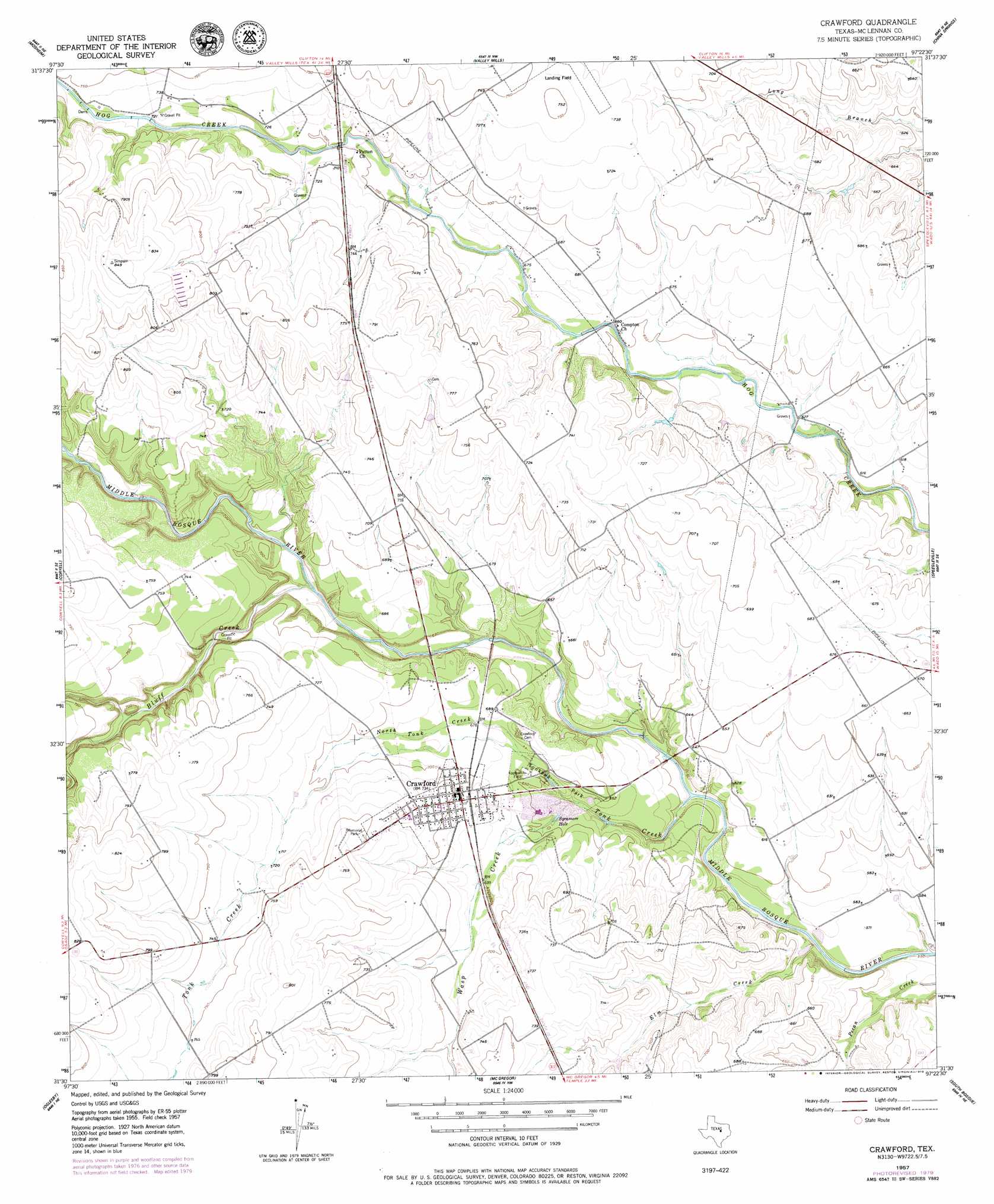
Crawford Topo Map Texas
To zoom in, hover over the map of Crawford
USGS Topo Quad 31097e4 - 1:24,000 scale
| Topo Map Name: | Crawford |
| USGS Topo Quad ID: | 31097e4 |
| Print Size: | ca. 21 1/4" wide x 27" high |
| Southeast Coordinates: | 31.5° N latitude / 97.375° W longitude |
| Map Center Coordinates: | 31.5625° N latitude / 97.4375° W longitude |
| U.S. State: | TX |
| Filename: | o31097e4.jpg |
| Download Map JPG Image: | Crawford topo map 1:24,000 scale |
| Map Type: | Topographic |
| Topo Series: | 7.5´ |
| Map Scale: | 1:24,000 |
| Source of Map Images: | United States Geological Survey (USGS) |
| Alternate Map Versions: |
Crawford TX 1957, updated 1957 Download PDF Buy paper map Crawford TX 1957, updated 1957 Download PDF Buy paper map Crawford TX 2010 Download PDF Buy paper map Crawford TX 2012 Download PDF Buy paper map Crawford TX 2016 Download PDF Buy paper map |
1:24,000 Topo Quads surrounding Crawford
Sugarloaf Mountain |
Clifton |
Laguna Park |
Smiths Bend |
Aquilla |
Hurst Spring |
Mosheim |
Valley Mills |
China Springs |
Gholson |
Turnersville |
Coryell |
Crawford |
Speegleville |
Waco West |
Gatesville East |
Oglesby |
Mcgregor |
South Bosque |
Lorena |
North Fort Hood |
Leon Junction |
Eagle Springs |
Moody |
Bruceville |
> Back to 31097e1 at 1:100,000 scale
> Back to 31096a1 at 1:250,000 scale
> Back to U.S. Topo Maps home
Crawford topo map: Gazetteer
Crawford: Airports
Valley Mills Municipal Airport elevation 229m 751′Crawford: Lakes
Sycamore Hole elevation 191m 626′Crawford: Parks
Tonkawa Park elevation 196m 643′Crawford: Populated Places
Crawford elevation 210m 688′Crawford: Streams
Bluff Creek elevation 190m 623′Elm Creek elevation 169m 554′
North Tonk Creek elevation 175m 574′
Tonk Creek elevation 175m 574′
Wasp Creek elevation 188m 616′
Crawford digital topo map on disk
Buy this Crawford topo map showing relief, roads, GPS coordinates and other geographical features, as a high-resolution digital map file on DVD: