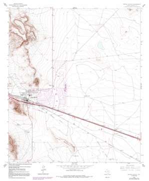
Sierra Blanca Topo Map Texas
To zoom in, hover over the map of Sierra Blanca
USGS Topo Quad 31105b3 - 1:24,000 scale
| Topo Map Name: | Sierra Blanca |
| USGS Topo Quad ID: | 31105b3 |
| Print Size: | ca. 21 1/4" wide x 27" high |
| Southeast Coordinates: | 31.125° N latitude / 105.25° W longitude |
| Map Center Coordinates: | 31.1875° N latitude / 105.3125° W longitude |
| U.S. State: | TX |
| Filename: | o31105b3.jpg |
| Download Map JPG Image: | Sierra Blanca topo map 1:24,000 scale |
| Map Type: | Topographic |
| Topo Series: | 7.5´ |
| Map Scale: | 1:24,000 |
| Source of Map Images: | United States Geological Survey (USGS) |
| Alternate Map Versions: |
Sierra Blanca TX 1964, updated 1967 Download PDF Buy paper map Sierra Blanca TX 1964, updated 1979 Download PDF Buy paper map Sierra Blanca TX 1964, updated 1992 Download PDF Buy paper map Sierra Blanca TX 2010 Download PDF Buy paper map Sierra Blanca TX 2013 Download PDF Buy paper map Sierra Blanca TX 2016 Download PDF Buy paper map |
1:24,000 Topo Quads surrounding Sierra Blanca
> Back to 31105a1 at 1:100,000 scale
> Back to 31104a1 at 1:250,000 scale
> Back to U.S. Topo Maps home
Sierra Blanca topo map: Gazetteer
Sierra Blanca: Airports
Sierra Blanca Heliport elevation 1404m 4606′Sierra Blanca: Populated Places
Arispe elevation 1335m 4379′Sierra Blanca elevation 1380m 4527′
Sierra Blanca: Reservoirs
Blount Tank elevation 1344m 4409′Corner Tank elevation 1361m 4465′
Cross Tracks Tank elevation 1322m 4337′
Gladys Tank elevation 1343m 4406′
Stray Tank elevation 1378m 4520′
Stray Tank elevation 1370m 4494′
Sierra Blanca: Summits
Sand Mountain elevation 1370m 4494′Texan Mountain elevation 1532m 5026′
Sierra Blanca digital topo map on disk
Buy this Sierra Blanca topo map showing relief, roads, GPS coordinates and other geographical features, as a high-resolution digital map file on DVD:


