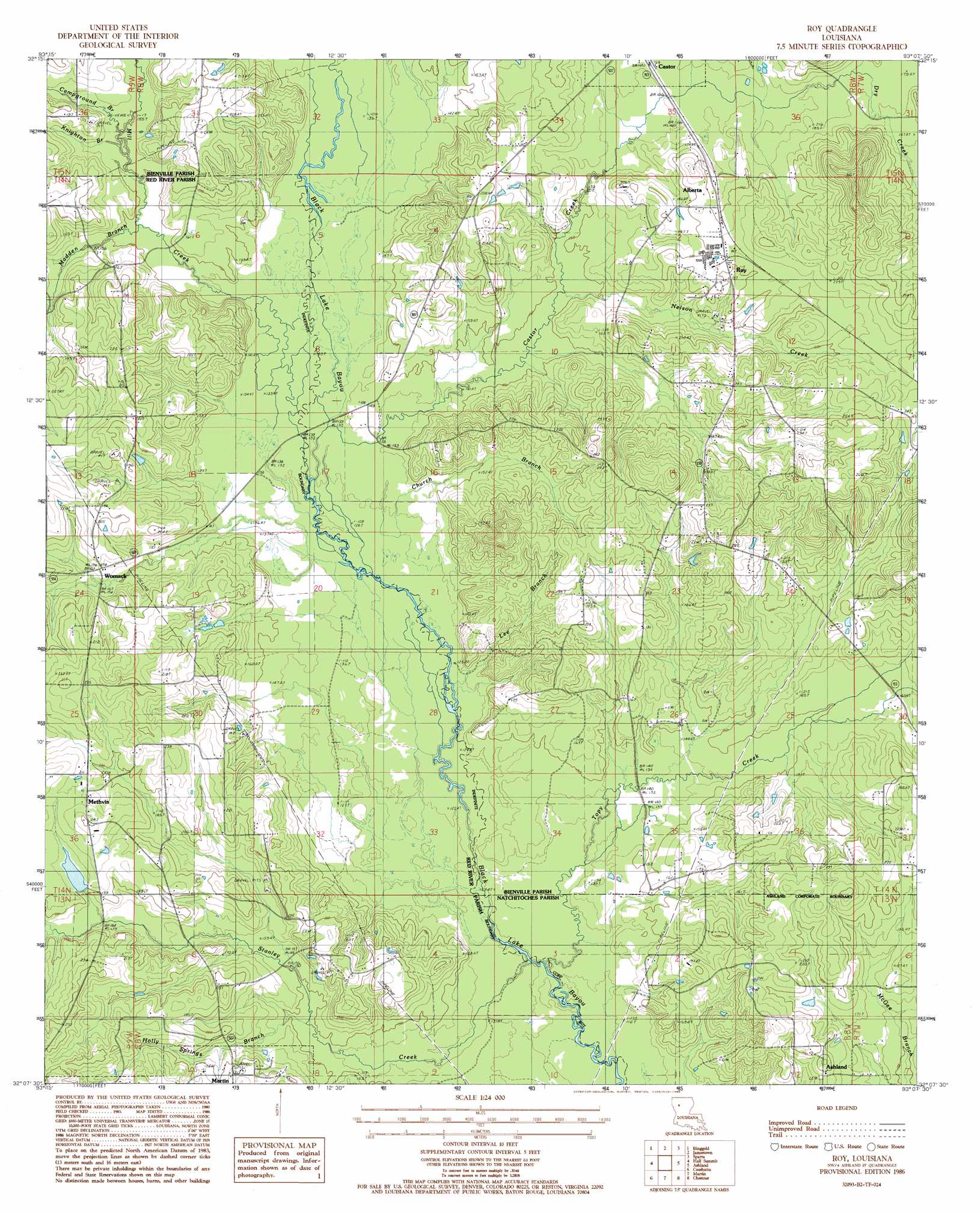
Troy Topo Map Louisiana
To zoom in, hover over the map of Troy
USGS Topo Quad 32093b2 - 1:24,000 scale
| Topo Map Name: | Troy |
| USGS Topo Quad ID: | 32093b2 |
| Print Size: | ca. 21 1/4" wide x 27" high |
| Southeast Coordinates: | 32.125° N latitude / 93.125° W longitude |
| Map Center Coordinates: | 32.1875° N latitude / 93.1875° W longitude |
| U.S. State: | LA |
| Filename: | o32093b2.jpg |
| Download Map JPG Image: | Troy topo map 1:24,000 scale |
| Map Type: | Topographic |
| Topo Series: | 7.5´ |
| Map Scale: | 1:24,000 |
| Source of Map Images: | United States Geological Survey (USGS) |
| Alternate Map Versions: |
Roy LA 1986, updated 1986 Download PDF Buy paper map Roy LA 2012 Download PDF Buy paper map Roy LA 2015 Download PDF Buy paper map |
1:24,000 Topo Quads surrounding Troy
Koran |
Heflin |
Fryeburg |
Sailes |
Bryceland |
Bossier Point |
Ringgold |
Jamestown |
Sparta |
Bienville |
East Point |
Hall Summit |
Troy |
Ashland |
Saline |
Harmon |
Coushatta |
Martin |
Chestnut |
Goldonna |
Evelyn |
Hanna |
Messick |
Campti |
Coup Point |
> Back to 32093a1 at 1:100,000 scale
> Back to 32092a1 at 1:250,000 scale
> Back to U.S. Topo Maps home
Troy topo map: Gazetteer
Troy: Bridges
Foster Bridge (historical) elevation 36m 118′Troy: Oilfields
Ashland Oil Field elevation 68m 223′Madden Branch Gas Field elevation 47m 154′
Topy Creek Oil Field elevation 42m 137′
Troy: Populated Places
Alberta elevation 59m 193′Ebenezer elevation 79m 259′
Methvin elevation 64m 209′
Roy elevation 61m 200′
Womack elevation 54m 177′
Troy: Streams
Campground Branch elevation 47m 154′Castor Creek elevation 41m 134′
Church Branch elevation 39m 127′
Dry Creek elevation 54m 177′
Holly Springs Branch elevation 45m 147′
Knighton Branch elevation 46m 150′
Lee Branch elevation 38m 124′
Madden Branch elevation 45m 147′
Mill Creek elevation 41m 134′
Nelson Creek elevation 45m 147′
Stanley Creek elevation 38m 124′
Topy Creek elevation 37m 121′
Troy digital topo map on disk
Buy this Troy topo map showing relief, roads, GPS coordinates and other geographical features, as a high-resolution digital map file on DVD: