Coushatta Topo Map Louisiana
To zoom in, hover over the map of Coushatta
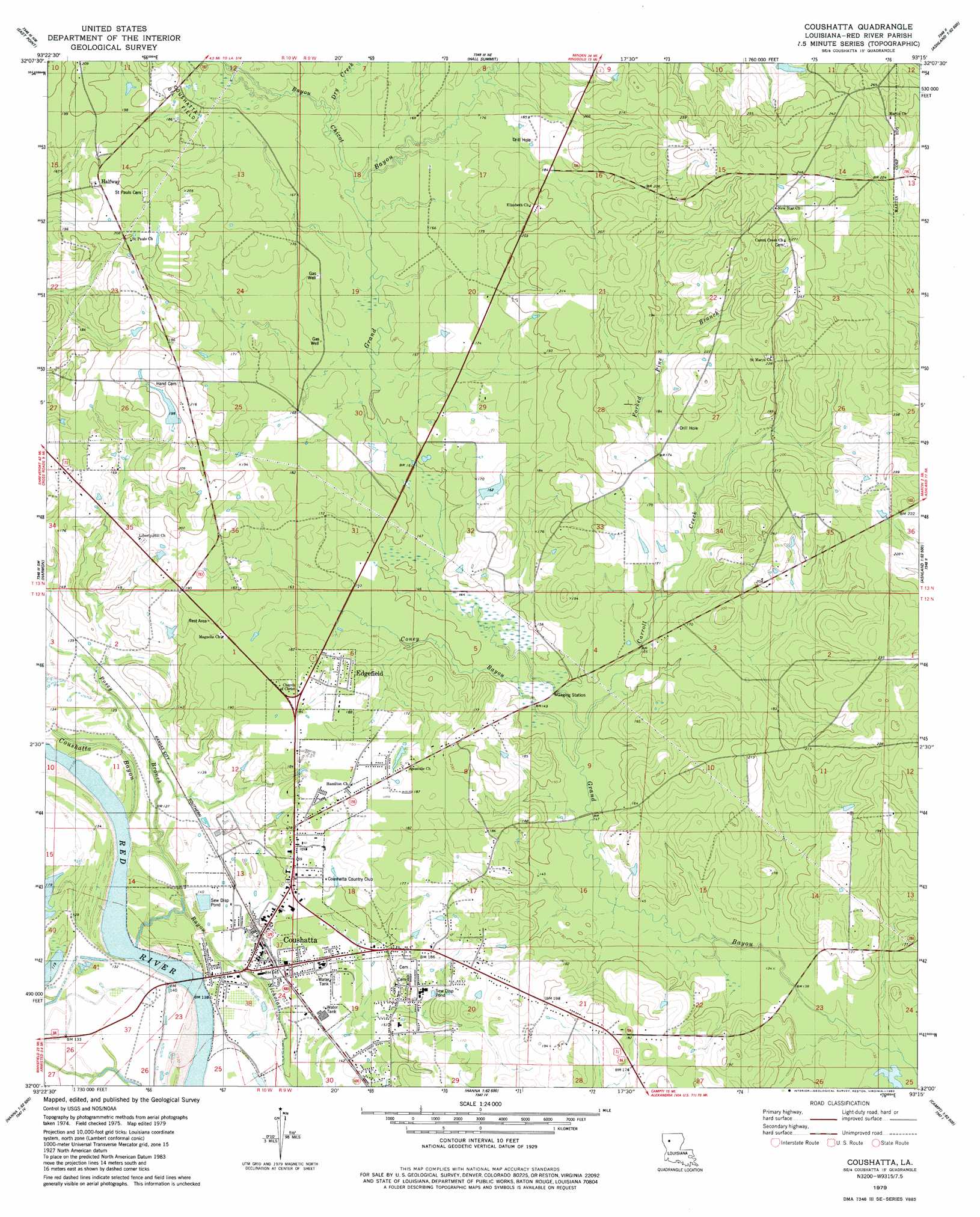
USGS Topo Quad 32093a3 - 1:24,000 scale
| Topo Map Name: | Coushatta |
| USGS Topo Quad ID: | 32093a3 |
| Print Size: | ca. 21 1/4" wide x 27" high |
| Southeast Coordinates: | 32° N latitude / 93.25° W longitude |
| Map Center Coordinates: | 32.0625° N latitude / 93.3125° W longitude |
| U.S. State: | LA |
| Filename: | o32093a3.jpg |
| Download Map JPG Image: | Coushatta topo map 1:24,000 scale |
| Map Type: | Topographic |
| Topo Series: | 7.5´ |
| Map Scale: | 1:24,000 |
| Source of Map Images: | United States Geological Survey (USGS) |
| Alternate Map Versions: |
Coushatta LA 1979, updated 1980 Download PDF Buy paper map Coushatta LA 2012 Download PDF Buy paper map Coushatta LA 2015 Download PDF Buy paper map |
1:24,000 Topo Quads surrounding Coushatta
Elm Grove |
Bossier Point |
Ringgold |
Jamestown |
Sparta |
Clear Lake |
East Point |
Hall Summit |
Troy |
Ashland |
Bayou Pierre Lake |
Harmon |
Coushatta |
Martin |
Chestnut |
Pelican |
Evelyn |
Hanna |
Messick |
Campti |
Pleasant Hill |
Hollis Creek |
Allen |
Powhatan |
Natchitoches North |
> Back to 32093a1 at 1:100,000 scale
> Back to 32092a1 at 1:250,000 scale
> Back to U.S. Topo Maps home
Coushatta topo map: Gazetteer
Coushatta: Dams
Adcock Pond Dam elevation 53m 173′Hand Pond Dam elevation 61m 200′
Coushatta: Oilfields
Coushatta Oil Field elevation 56m 183′Coushatta: Populated Places
Coushatta elevation 44m 144′Edgefield elevation 55m 180′
Halfway elevation 64m 209′
Hammell (historical) elevation 42m 137′
Coushatta: Streams
Bayou Chicot elevation 48m 157′Carroll Creek elevation 43m 141′
Coney Bayou elevation 43m 141′
Dry Creek elevation 50m 164′
Forked Pine Branch elevation 50m 164′
Posey Branch elevation 37m 121′
Coushatta digital topo map on disk
Buy this Coushatta topo map showing relief, roads, GPS coordinates and other geographical features, as a high-resolution digital map file on DVD: