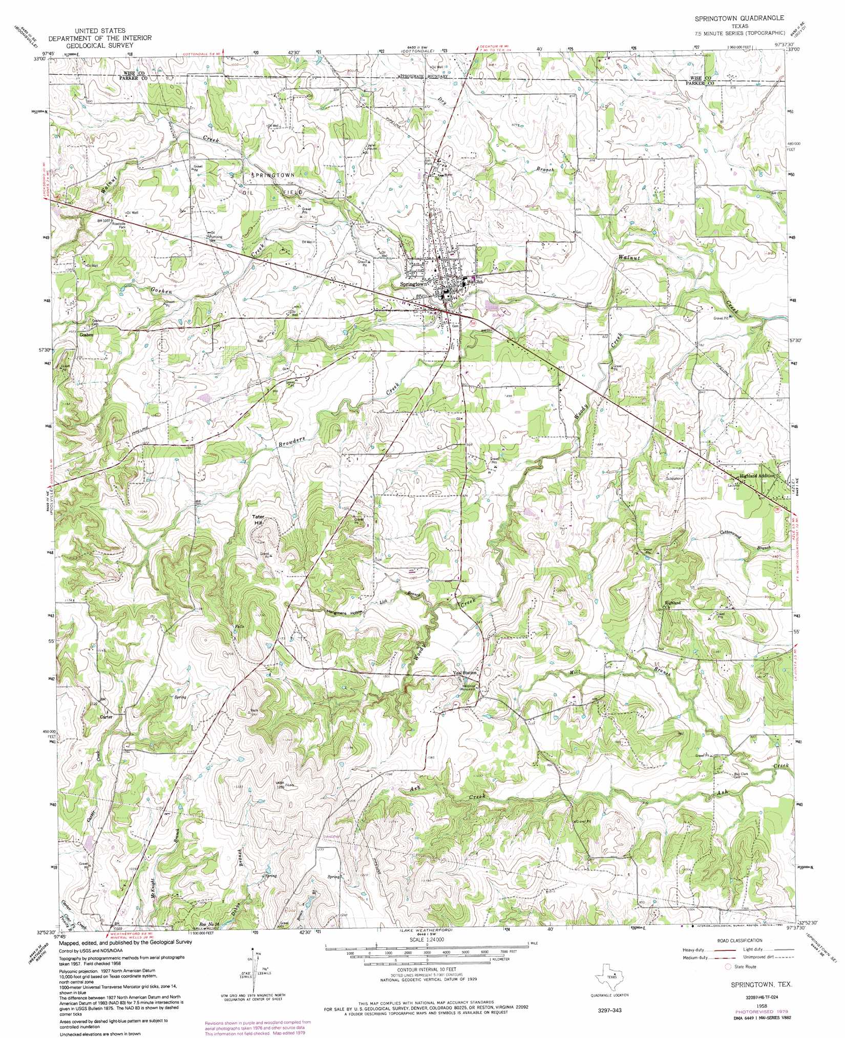
Springtown Topo Map Texas
To zoom in, hover over the map of Springtown
USGS Topo Quad 32097h6 - 1:24,000 scale
| Topo Map Name: | Springtown |
| USGS Topo Quad ID: | 32097h6 |
| Print Size: | ca. 21 1/4" wide x 27" high |
| Southeast Coordinates: | 32.875° N latitude / 97.625° W longitude |
| Map Center Coordinates: | 32.9375° N latitude / 97.6875° W longitude |
| U.S. State: | TX |
| Filename: | o32097h6.jpg |
| Download Map JPG Image: | Springtown topo map 1:24,000 scale |
| Map Type: | Topographic |
| Topo Series: | 7.5´ |
| Map Scale: | 1:24,000 |
| Source of Map Images: | United States Geological Survey (USGS) |
| Alternate Map Versions: |
Springtown TX 1958, updated 1960 Download PDF Buy paper map Springtown TX 1958, updated 1974 Download PDF Buy paper map Springtown TX 1958, updated 1979 Download PDF Buy paper map Springtown TX 1958, updated 1992 Download PDF Buy paper map Springtown TX 2010 Download PDF Buy paper map Springtown TX 2012 Download PDF Buy paper map Springtown TX 2016 Download PDF Buy paper map |
1:24,000 Topo Quads surrounding Springtown
Wizard Wells |
Bridgeport West |
Bridgeport East |
Decatur |
Bluett |
Gibtown |
Boonsville |
Cottondale |
Boyd |
Rhome |
Adell |
Poolville |
Springtown |
Azle |
Avondale |
Garner |
Weatherford North |
Lake Weatherford |
Springtown Se |
Lake Worth |
Brock |
Weatherford South |
Anneta |
Aledo |
Benbrook |
> Back to 32097e1 at 1:100,000 scale
> Back to 32096a1 at 1:250,000 scale
> Back to U.S. Topo Maps home
Springtown topo map: Gazetteer
Springtown: Airports
Koontz Heliport Heliport elevation 236m 774′Springtown: Oilfields
Springtown Oil Field elevation 279m 915′Springtown: Parks
Porcupine Stadium elevation 280m 918′Springtown: Populated Places
Carter elevation 332m 1089′Goshen elevation 329m 1079′
Highland Addition elevation 274m 898′
Springtown elevation 262m 859′
Springtown: Streams
Browders Creek elevation 247m 810′Dry Branch elevation 232m 761′
Goshen Creek elevation 268m 879′
Lick Branch elevation 283m 928′
Mill Branch elevation 253m 830′
Woody Creek elevation 232m 761′
Springtown: Summits
Tater Hill elevation 343m 1125′Springtown: Valleys
Hangmans Hollow elevation 300m 984′Springtown digital topo map on disk
Buy this Springtown topo map showing relief, roads, GPS coordinates and other geographical features, as a high-resolution digital map file on DVD: