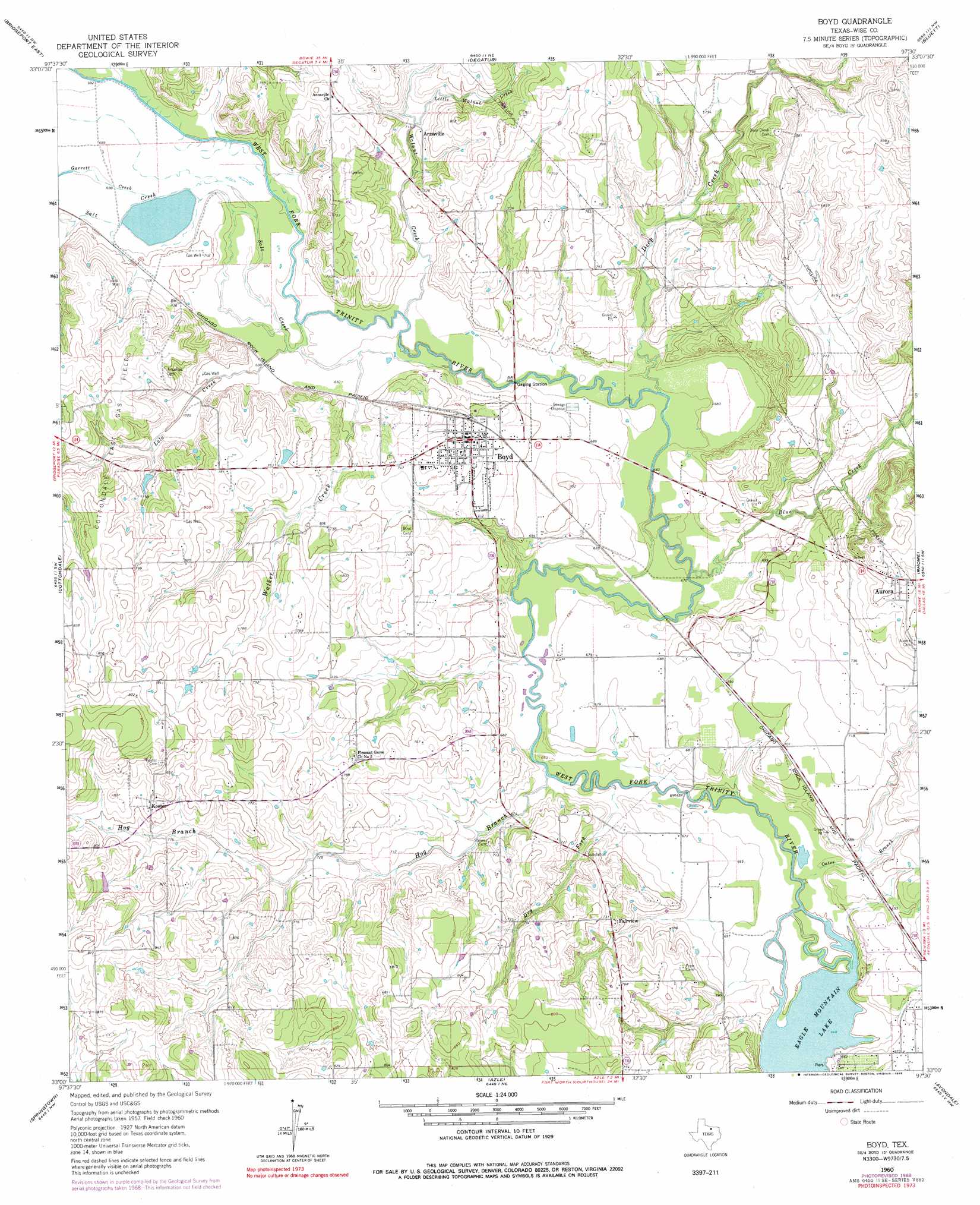
Boyd Topo Map Texas
To zoom in, hover over the map of Boyd
USGS Topo Quad 33097a5 - 1:24,000 scale
| Topo Map Name: | Boyd |
| USGS Topo Quad ID: | 33097a5 |
| Print Size: | ca. 21 1/4" wide x 27" high |
| Southeast Coordinates: | 33° N latitude / 97.5° W longitude |
| Map Center Coordinates: | 33.0625° N latitude / 97.5625° W longitude |
| U.S. State: | TX |
| Filename: | o33097a5.jpg |
| Download Map JPG Image: | Boyd topo map 1:24,000 scale |
| Map Type: | Topographic |
| Topo Series: | 7.5´ |
| Map Scale: | 1:24,000 |
| Source of Map Images: | United States Geological Survey (USGS) |
| Alternate Map Versions: |
Boyd TX 1960, updated 1961 Download PDF Buy paper map Boyd TX 1960, updated 1969 Download PDF Buy paper map Boyd TX 1960, updated 1978 Download PDF Buy paper map Boyd TX 2010 Download PDF Buy paper map Boyd TX 2013 Download PDF Buy paper map Boyd TX 2016 Download PDF Buy paper map |
1:24,000 Topo Quads surrounding Boyd
Chico |
Alvord |
Pecan Creek |
Slidell |
Era Se |
Bridgeport West |
Bridgeport East |
Decatur |
Bluett |
Ponder |
Boonsville |
Cottondale |
Boyd |
Rhome |
Justin |
Poolville |
Springtown |
Azle |
Avondale |
Keller |
Weatherford North |
Lake Weatherford |
Springtown Se |
Lake Worth |
Haltom City |
> Back to 33097a1 at 1:100,000 scale
> Back to 33096a1 at 1:250,000 scale
> Back to U.S. Topo Maps home
Boyd topo map: Gazetteer
Boyd: Oilfields
Cottondale East Gas Field elevation 234m 767′Boyd: Parks
Yellowjacket Stadium elevation 232m 761′Boyd: Populated Places
Annaville elevation 220m 721′Aurora elevation 249m 816′
Boyd elevation 222m 728′
Fairview elevation 224m 734′
Keeter elevation 251m 823′
Boyd: Streams
Blue Creek elevation 199m 652′Deep Creek elevation 202m 662′
Dry Fork elevation 198m 649′
Garrett Creek elevation 209m 685′
Hog Branch elevation 200m 656′
Little Walnut Creek elevation 216m 708′
Lola Creek elevation 207m 679′
Oates Branch elevation 198m 649′
Salt Creek elevation 207m 679′
Walker Creek elevation 203m 666′
Walnut Creek elevation 207m 679′
Boyd digital topo map on disk
Buy this Boyd topo map showing relief, roads, GPS coordinates and other geographical features, as a high-resolution digital map file on DVD: