San Ignacio Ranch Topo Map Arizona
To zoom in, hover over the map of San Ignacio Ranch
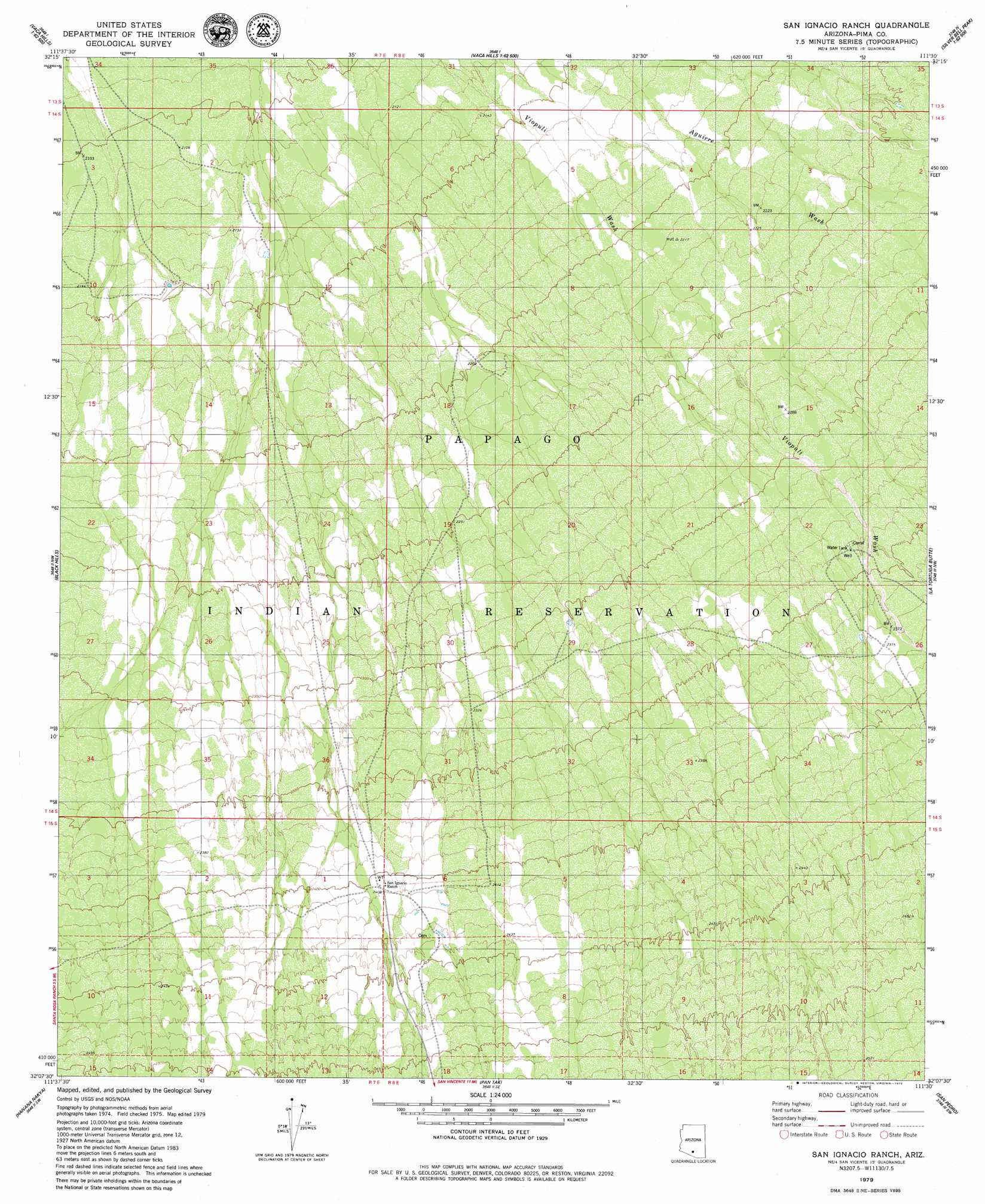
USGS Topo Quad 32111b5 - 1:24,000 scale
| Topo Map Name: | San Ignacio Ranch |
| USGS Topo Quad ID: | 32111b5 |
| Print Size: | ca. 21 1/4" wide x 27" high |
| Southeast Coordinates: | 32.125° N latitude / 111.5° W longitude |
| Map Center Coordinates: | 32.1875° N latitude / 111.5625° W longitude |
| U.S. State: | AZ |
| Filename: | o32111b5.jpg |
| Download Map JPG Image: | San Ignacio Ranch topo map 1:24,000 scale |
| Map Type: | Topographic |
| Topo Series: | 7.5´ |
| Map Scale: | 1:24,000 |
| Source of Map Images: | United States Geological Survey (USGS) |
| Alternate Map Versions: |
San Ignacio Ranch AZ 1996, updated 2002 Download PDF Buy paper map San Ignacio Ranch AZ 2011 Download PDF Buy paper map San Ignacio Ranch AZ 2014 Download PDF Buy paper map |
1:24,000 Topo Quads surrounding San Ignacio Ranch
Santa Rosa Mountains Ne |
Gap Tank |
Silver Bell West |
Silver Bell East |
West Of Marana |
Santa Rosa Mountains Se |
Queens Well |
Koht Kohl Hill |
Waterman Peak |
West Of Avra |
Sil Nakya |
Black Hills |
San Ignacio Ranch |
La Tortuga Butte |
Cocoraque Butte |
Comobabi |
Haivana Nakya |
Pan Tak |
San Pedro |
Three Points |
Sells East |
San Juan Spring |
Kitt Peak |
Palo Alto Ranch |
Stevens Mountain |
> Back to 32111a1 at 1:100,000 scale
> Back to 32110a1 at 1:250,000 scale
> Back to U.S. Topo Maps home
No gazetteer data is available for the San Ignacio Ranch topo map sheet.
San Ignacio Ranch digital topo map on disk
Buy this San Ignacio Ranch topo map showing relief, roads, GPS coordinates and other geographical features, as a high-resolution digital map file on DVD: