Lake Sinclair East Topo Map Georgia
To zoom in, hover over the map of Lake Sinclair East
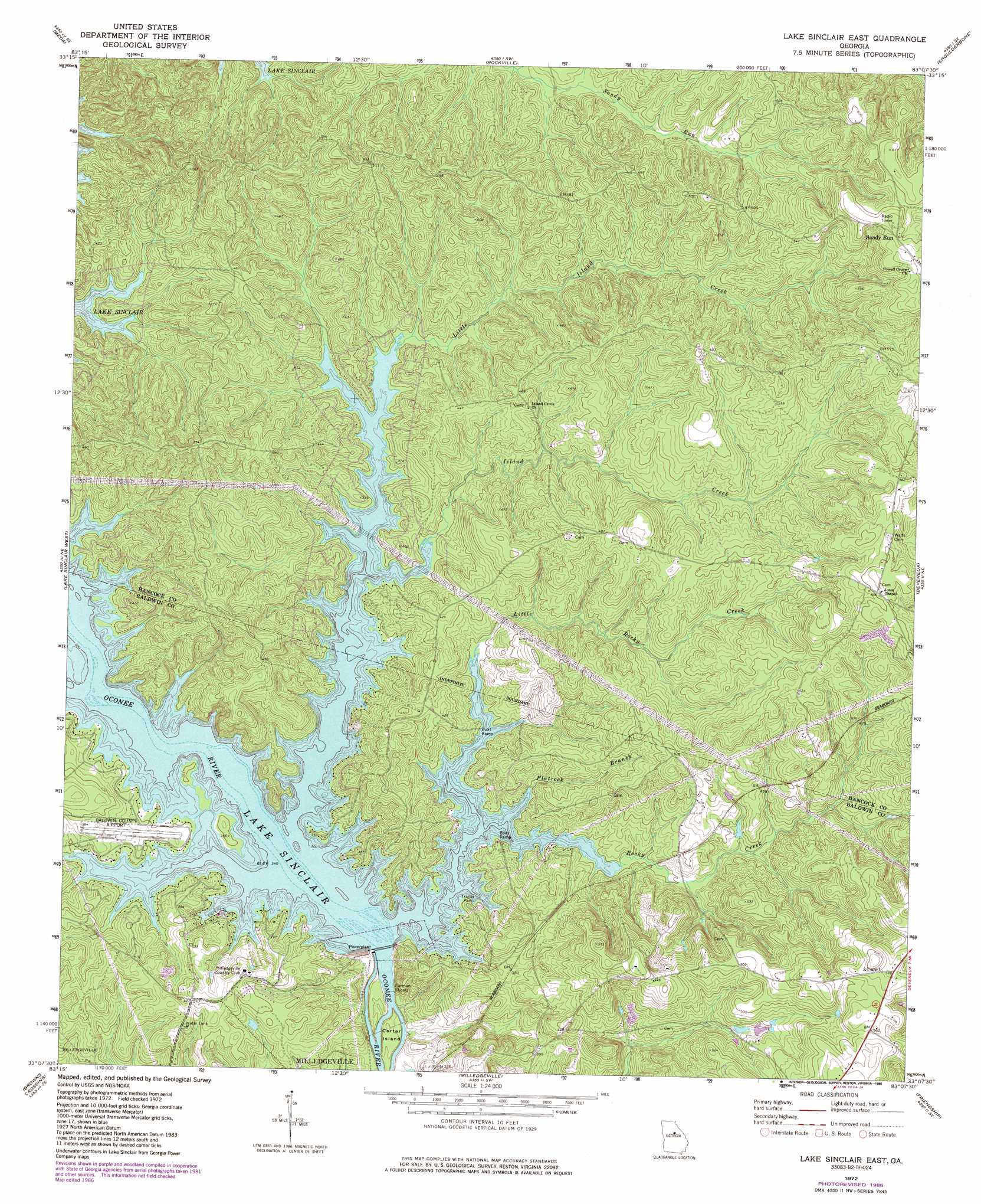
USGS Topo Quad 33083b2 - 1:24,000 scale
| Topo Map Name: | Lake Sinclair East |
| USGS Topo Quad ID: | 33083b2 |
| Print Size: | ca. 21 1/4" wide x 27" high |
| Southeast Coordinates: | 33.125° N latitude / 83.125° W longitude |
| Map Center Coordinates: | 33.1875° N latitude / 83.1875° W longitude |
| U.S. State: | GA |
| Filename: | o33083b2.jpg |
| Download Map JPG Image: | Lake Sinclair East topo map 1:24,000 scale |
| Map Type: | Topographic |
| Topo Series: | 7.5´ |
| Map Scale: | 1:24,000 |
| Source of Map Images: | United States Geological Survey (USGS) |
| Alternate Map Versions: |
Lake Sinclair East GA 1972, updated 1975 Download PDF Buy paper map Lake Sinclair East GA 1972, updated 1986 Download PDF Buy paper map Lake Sinclair East GA 2011 Download PDF Buy paper map Lake Sinclair East GA 2014 Download PDF Buy paper map |
1:24,000 Topo Quads surrounding Lake Sinclair East
Rock Eagle Lake |
Harmony |
Liberty |
White Plains |
Sparta Nw |
Eatonton |
Meda |
Rockville |
Shoulderbone |
Sparta |
Resseaus Crossroads |
Lake Sinclair West |
Lake Sinclair East |
Devereux |
Warthen Nw |
Haddock |
Browns Crossing |
Milledgeville |
Friendship |
Deepstep |
James |
Gordon |
Napier Pond |
Gumm Pond |
Tabernacle |
> Back to 33083a1 at 1:100,000 scale
> Back to 33082a1 at 1:250,000 scale
> Back to U.S. Topo Maps home
Lake Sinclair East topo map: Gazetteer
Lake Sinclair East: Airports
Baldwin County Airport elevation 114m 374′Lake Sinclair East: Bars
Furman Shoals elevation 75m 246′Lake Sinclair East: Islands
Carter Island elevation 81m 265′Collins Island (historical) elevation 103m 337′
Lake Sinclair East: Populated Places
Buckhead (historical) elevation 135m 442′Sandtown elevation 175m 574′
Sandy Run elevation 184m 603′
Lake Sinclair East: Rapids
Fraley Shoals (historical) elevation 103m 337′Lake Sinclair East: Springs
Moran Spring elevation 142m 465′Lake Sinclair East: Streams
Ferry Branch elevation 103m 337′Flatrock Branch elevation 103m 337′
Island Creek elevation 103m 337′
Little Island Creek elevation 103m 337′
Little Rocky Creek elevation 103m 337′
Nancy Branch elevation 103m 337′
Reedy Branch elevation 103m 337′
Rocky Creek elevation 103m 337′
Lake Sinclair East digital topo map on disk
Buy this Lake Sinclair East topo map showing relief, roads, GPS coordinates and other geographical features, as a high-resolution digital map file on DVD:
South Carolina, Western North Carolina & Northeastern Georgia
Buy digital topo maps: South Carolina, Western North Carolina & Northeastern Georgia