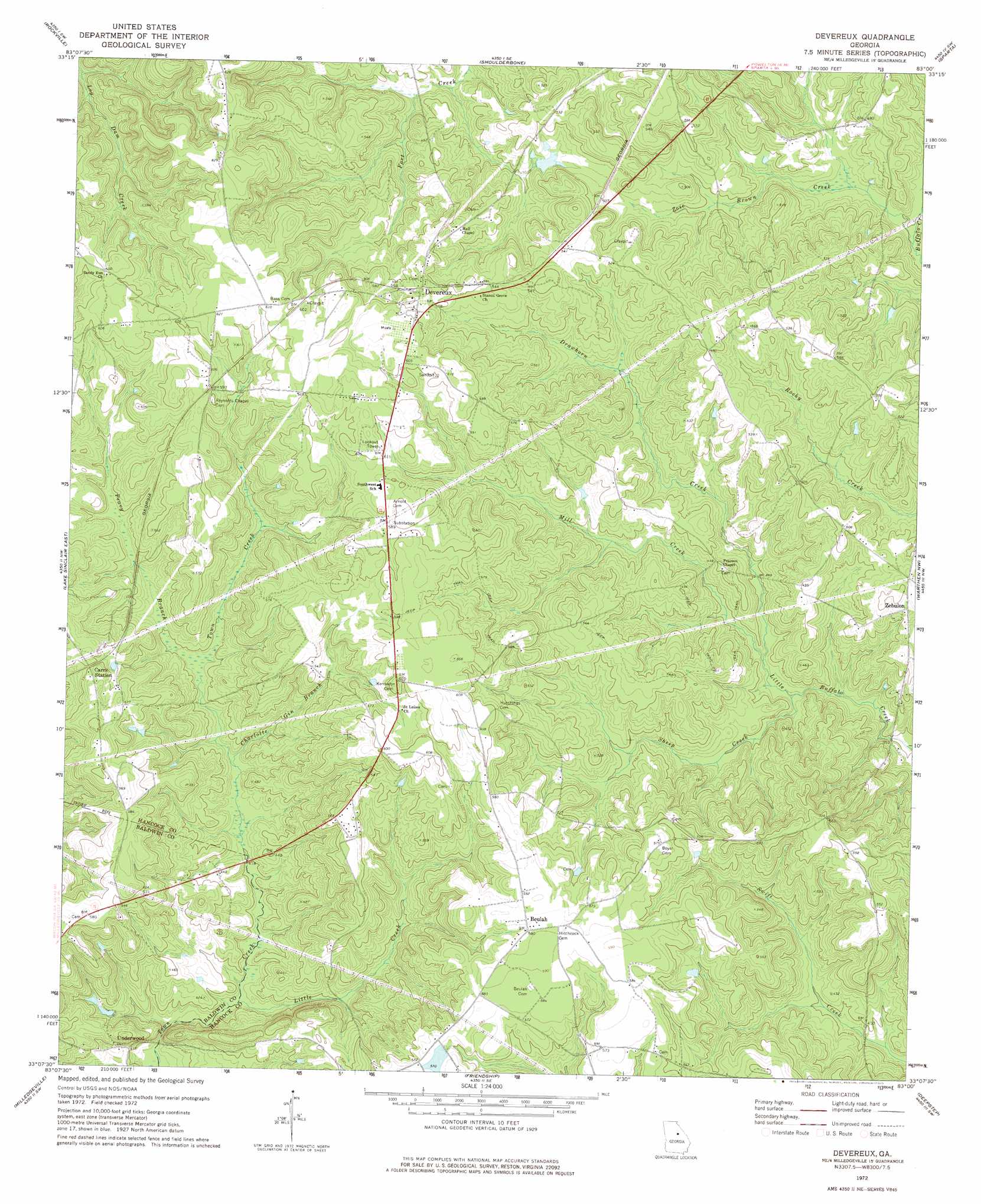
Devereux Topo Map Georgia
To zoom in, hover over the map of Devereux
USGS Topo Quad 33083b1 - 1:24,000 scale
| Topo Map Name: | Devereux |
| USGS Topo Quad ID: | 33083b1 |
| Print Size: | ca. 21 1/4" wide x 27" high |
| Southeast Coordinates: | 33.125° N latitude / 83° W longitude |
| Map Center Coordinates: | 33.1875° N latitude / 83.0625° W longitude |
| U.S. State: | GA |
| Filename: | o33083b1.jpg |
| Download Map JPG Image: | Devereux topo map 1:24,000 scale |
| Map Type: | Topographic |
| Topo Series: | 7.5´ |
| Map Scale: | 1:24,000 |
| Source of Map Images: | United States Geological Survey (USGS) |
| Alternate Map Versions: |
Devereux GA 1972, updated 1975 Download PDF Buy paper map Devereux GA 2011 Download PDF Buy paper map Devereux GA 2014 Download PDF Buy paper map |
1:24,000 Topo Quads surrounding Devereux
Harmony |
Liberty |
White Plains |
Sparta Nw |
Sparta Ne |
Meda |
Rockville |
Shoulderbone |
Sparta |
Jewell |
Lake Sinclair West |
Lake Sinclair East |
Devereux |
Warthen Nw |
Warthen Ne |
Browns Crossing |
Milledgeville |
Friendship |
Deepstep |
Warthen |
Gordon |
Napier Pond |
Gumm Pond |
Tabernacle |
Sandersville |
> Back to 33083a1 at 1:100,000 scale
> Back to 33082a1 at 1:250,000 scale
> Back to U.S. Topo Maps home
Devereux topo map: Gazetteer
Devereux: Dams
Ray Lake Dam elevation 173m 567′Devereux: Populated Places
Beulah elevation 178m 583′Devereux elevation 177m 580′
Harpertown (historical) elevation 148m 485′
Underwood elevation 128m 419′
Zebulon elevation 143m 469′
Devereux: Reservoirs
Ray Lake elevation 173m 567′Devereux: Streams
Charlotte Gin Branch elevation 127m 416′Drawhorn Creek elevation 115m 377′
Little Creek elevation 115m 377′
Mill Creek elevation 115m 377′
Peavy Branch elevation 133m 436′
Sheep Creek elevation 112m 367′
Zioe Brown Creek elevation 121m 396′
Devereux digital topo map on disk
Buy this Devereux topo map showing relief, roads, GPS coordinates and other geographical features, as a high-resolution digital map file on DVD:
South Carolina, Western North Carolina & Northeastern Georgia
Buy digital topo maps: South Carolina, Western North Carolina & Northeastern Georgia