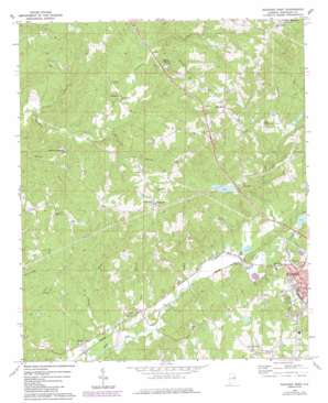
Roanoke West Topo Map Alabama
To zoom in, hover over the map of Roanoke West
USGS Topo Quad 33085b4 - 1:24,000 scale
| Topo Map Name: | Roanoke West |
| USGS Topo Quad ID: | 33085b4 |
| Print Size: | ca. 21 1/4" wide x 27" high |
| Southeast Coordinates: | 33.125° N latitude / 85.375° W longitude |
| Map Center Coordinates: | 33.1875° N latitude / 85.4375° W longitude |
| U.S. State: | AL |
| Filename: | o33085b4.jpg |
| Download Map JPG Image: | Roanoke West topo map 1:24,000 scale |
| Map Type: | Topographic |
| Topo Series: | 7.5´ |
| Map Scale: | 1:24,000 |
| Source of Map Images: | United States Geological Survey (USGS) |
| Alternate Map Versions: |
Roanoke West AL 1969, updated 1973 Download PDF Buy paper map Roanoke West AL 1969, updated 1984 Download PDF Buy paper map Roanoke West AL 2011 Download PDF Buy paper map Roanoke West AL 2014 Download PDF Buy paper map |
1:24,000 Topo Quads surrounding Roanoke West
> Back to 33085a1 at 1:100,000 scale
> Back to 33084a1 at 1:250,000 scale
> Back to U.S. Topo Maps home
Roanoke West topo map: Gazetteer
Roanoke West: Dams
High Pine Creek Watershed Dam Number 2 elevation 245m 803′High Pine Creek Watershed Dam Number 4 elevation 282m 925′
High Pine Creek Watershed Dam Number 5 elevation 286m 938′
High Pine Creek Watershed Dam Number 6 elevation 273m 895′
McMurray Dam elevation 241m 790′
Roanoke City Reservoir Dam elevation 215m 705′
Roanoke West: Lakes
Crystal Lake elevation 259m 849′Roanoke West: Populated Places
Broughton elevation 318m 1043′Cornhouse elevation 257m 843′
Dickert elevation 211m 692′
Friendship elevation 308m 1010′
Harmon Crossroads elevation 270m 885′
Mount Olive elevation 268m 879′
Mount Zion elevation 261m 856′
Peavy elevation 231m 757′
White Signboard Crossroad elevation 402m 1318′
Roanoke West: Rapids
Horton Shoal elevation 282m 925′Roanoke West: Reservoirs
High Pine Creek Lake Number 2 elevation 245m 803′High Pine Creek Lake Number 4 elevation 282m 925′
High Pine Creek Lake Number 5 elevation 286m 938′
High Pine Creek Lake Number 6 elevation 273m 895′
McMurray Lake elevation 241m 790′
Roanoke City Lake elevation 215m 705′
Roanoke West: Streams
Boatner Creek elevation 199m 652′Gaston Branch elevation 237m 777′
Graves Creek elevation 224m 734′
Griswold Creek elevation 274m 898′
Horton Shoal Branch elevation 255m 836′
Jack Branch elevation 202m 662′
Jones Creek elevation 213m 698′
Liles Branch elevation 210m 688′
Town Creek elevation 213m 698′
Roanoke West digital topo map on disk
Buy this Roanoke West topo map showing relief, roads, GPS coordinates and other geographical features, as a high-resolution digital map file on DVD:


