Winfield Se Topo Map Alabama
To zoom in, hover over the map of Winfield Se
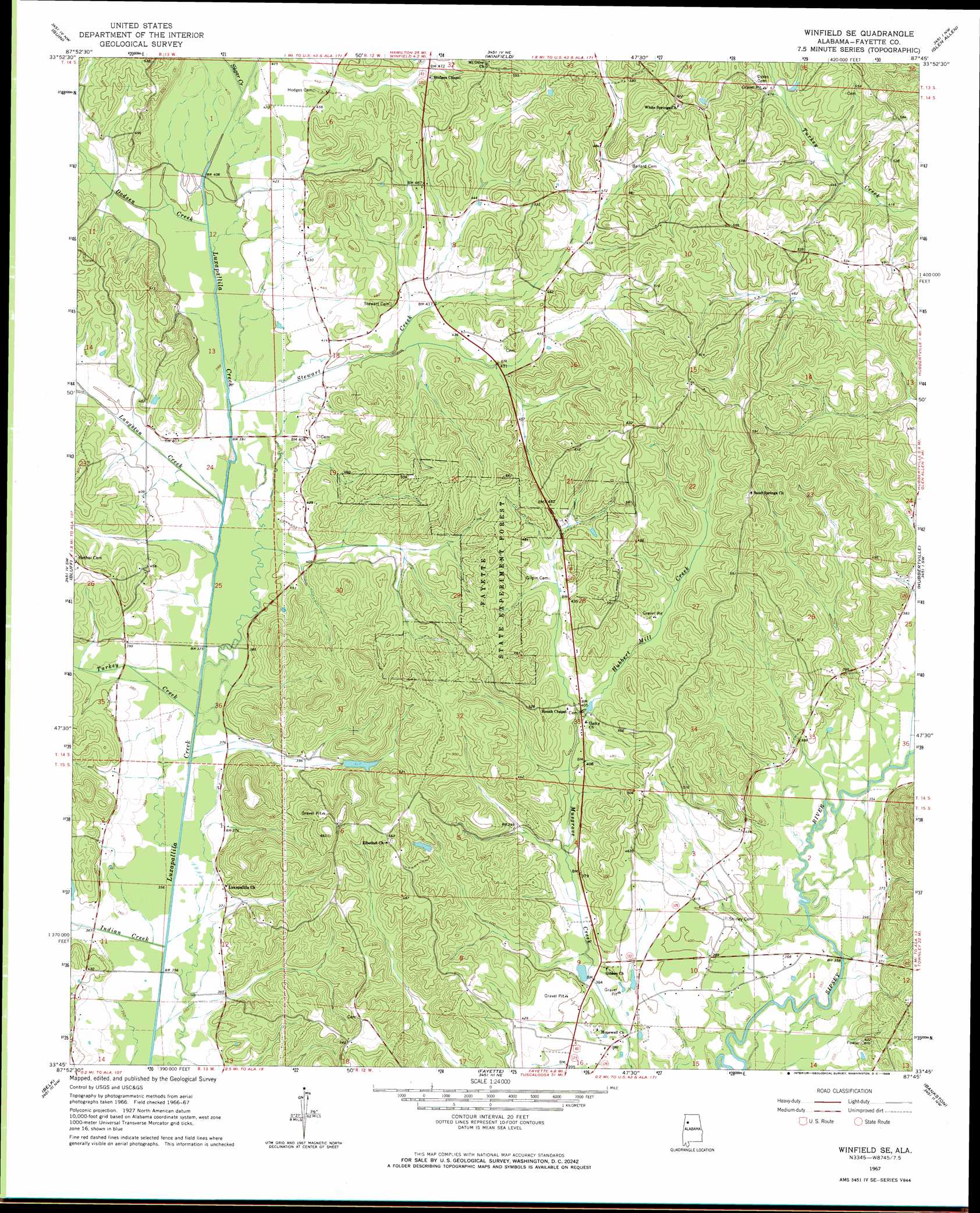
USGS Topo Quad 33087g7 - 1:24,000 scale
| Topo Map Name: | Winfield Se |
| USGS Topo Quad ID: | 33087g7 |
| Print Size: | ca. 21 1/4" wide x 27" high |
| Southeast Coordinates: | 33.75° N latitude / 87.75° W longitude |
| Map Center Coordinates: | 33.8125° N latitude / 87.8125° W longitude |
| U.S. State: | AL |
| Filename: | o33087g7.jpg |
| Download Map JPG Image: | Winfield Se topo map 1:24,000 scale |
| Map Type: | Topographic |
| Topo Series: | 7.5´ |
| Map Scale: | 1:24,000 |
| Source of Map Images: | United States Geological Survey (USGS) |
| Alternate Map Versions: |
Winfield SE AL 1967, updated 1968 Download PDF Buy paper map Winfield SE AL 2011 Download PDF Buy paper map Winfield SE AL 2014 Download PDF Buy paper map |
1:24,000 Topo Quads surrounding Winfield Se
Henson Springs |
Hamilton Sw |
Brilliant |
Gold Mine |
Lynn |
Beaverton |
Guin |
Winfield |
Glen Allen |
Carbon Hill |
Vernon |
Bluff |
Winfield Se |
Hubbertville |
Howard |
Hightogy |
Belk |
Fayette |
Bankston |
Berry |
Millport |
Kennedy |
Newtonville |
New Lexington |
Berry Se |
> Back to 33087e1 at 1:100,000 scale
> Back to 33086a1 at 1:250,000 scale
> Back to U.S. Topo Maps home
Winfield Se topo map: Gazetteer
Winfield Se: Dams
Killingsworth Lake Dam elevation 128m 419′Watkins Lake Dam elevation 130m 426′
Winfield Se: Forests
Fayette State Experiment Forest elevation 164m 538′Winfield Se: Oilfields
Bethel Church Gas Field elevation 116m 380′Sand Springs Oil Field (historical) elevation 175m 574′
Studhorse Creek Gas Field elevation 136m 446′
Winfield Se: Populated Places
Stewart elevation 135m 442′Winfield Se: Reservoirs
Killingsworth Lake elevation 128m 419′Watkins Lake elevation 130m 426′
Winfield Se: Streams
Dodsen Creek elevation 119m 390′Hubbert Mill Creek elevation 121m 396′
Indian Creek elevation 107m 351′
Langston Creek elevation 114m 374′
Stewart Creek elevation 116m 380′
Sugar Creek elevation 125m 410′
Turkey Creek elevation 110m 360′
Winfield Se digital topo map on disk
Buy this Winfield Se topo map showing relief, roads, GPS coordinates and other geographical features, as a high-resolution digital map file on DVD: