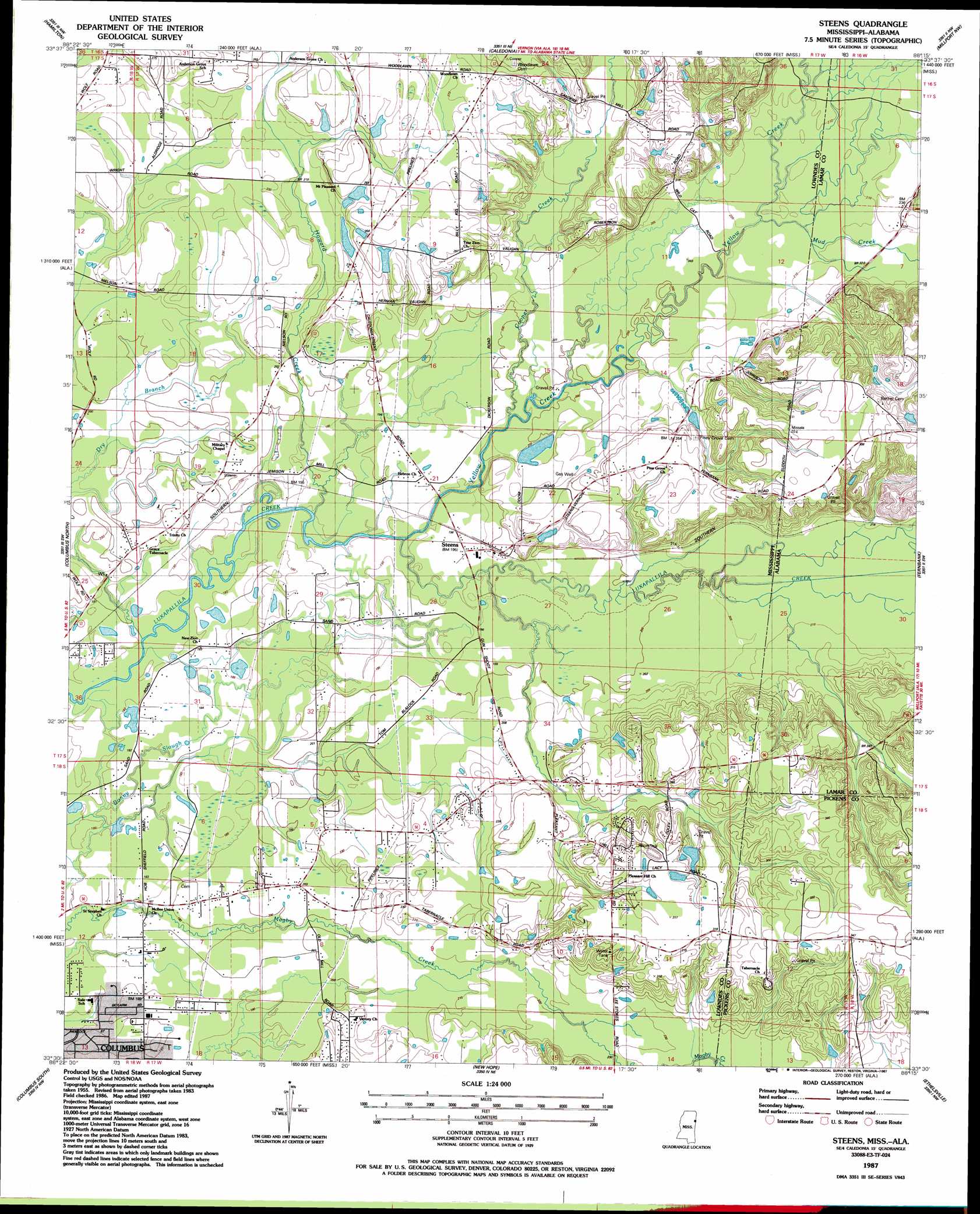
Steens Topo Map Mississippi
To zoom in, hover over the map of Steens
USGS Topo Quad 33088e3 - 1:24,000 scale
| Topo Map Name: | Steens |
| USGS Topo Quad ID: | 33088e3 |
| Print Size: | ca. 21 1/4" wide x 27" high |
| Southeast Coordinates: | 33.5° N latitude / 88.25° W longitude |
| Map Center Coordinates: | 33.5625° N latitude / 88.3125° W longitude |
| U.S. States: | MS, AL |
| Filename: | o33088e3.jpg |
| Download Map JPG Image: | Steens topo map 1:24,000 scale |
| Map Type: | Topographic |
| Topo Series: | 7.5´ |
| Map Scale: | 1:24,000 |
| Source of Map Images: | United States Geological Survey (USGS) |
| Alternate Map Versions: |
Steens MS 1987, updated 1987 Download PDF Buy paper map Steens MS 2012 Download PDF Buy paper map Steens MS 2015 Download PDF Buy paper map |
1:24,000 Topo Quads surrounding Steens
Aberdeen |
Amory Sw |
Amory Se |
Sulligent Sw |
Vernon |
Strong |
Hamilton |
Caledonia |
Millport Nw |
Hightogy |
Waverly |
Columbus North |
Steens |
Fernbank |
Millport |
Bent Oak |
Columbus South |
New Hope |
Ethelsville |
Reform |
Crawford East |
Trinity |
Forreston |
Reform Sw |
Carrollton |
> Back to 33088e1 at 1:100,000 scale
> Back to 33088a1 at 1:250,000 scale
> Back to U.S. Topo Maps home
Steens topo map: Gazetteer
Steens: Airports
Hopper Field elevation 92m 301′Steens: Dams
Khan Catfish Pond Dam elevation 69m 226′Odom Lake Dam elevation 67m 219′
Steens: Parks
Columbus Raceway elevation 91m 298′Steens: Populated Places
Coles Subdivision elevation 67m 219′Doyle Estates elevation 86m 282′
Ellis Subdivision elevation 70m 229′
Labelle Estates elevation 95m 311′
Lacy Subdivision elevation 94m 308′
Melco Subdivision elevation 70m 229′
Remunda Estates elevation 57m 187′
Steens elevation 58m 190′
Woodlawn elevation 88m 288′
Steens: Reservoirs
Jamisons Mill Pond elevation 59m 193′Steens: Streams
Brush Creek elevation 57m 187′Cooper Creek elevation 57m 187′
Dry Branch elevation 52m 170′
Flood Branch elevation 58m 190′
Howard Creek elevation 55m 180′
Mud Creek elevation 62m 203′
Mud Creek elevation 62m 203′
Yellow Creek elevation 54m 177′
Steens digital topo map on disk
Buy this Steens topo map showing relief, roads, GPS coordinates and other geographical features, as a high-resolution digital map file on DVD: