Waverly Topo Map Mississippi
To zoom in, hover over the map of Waverly
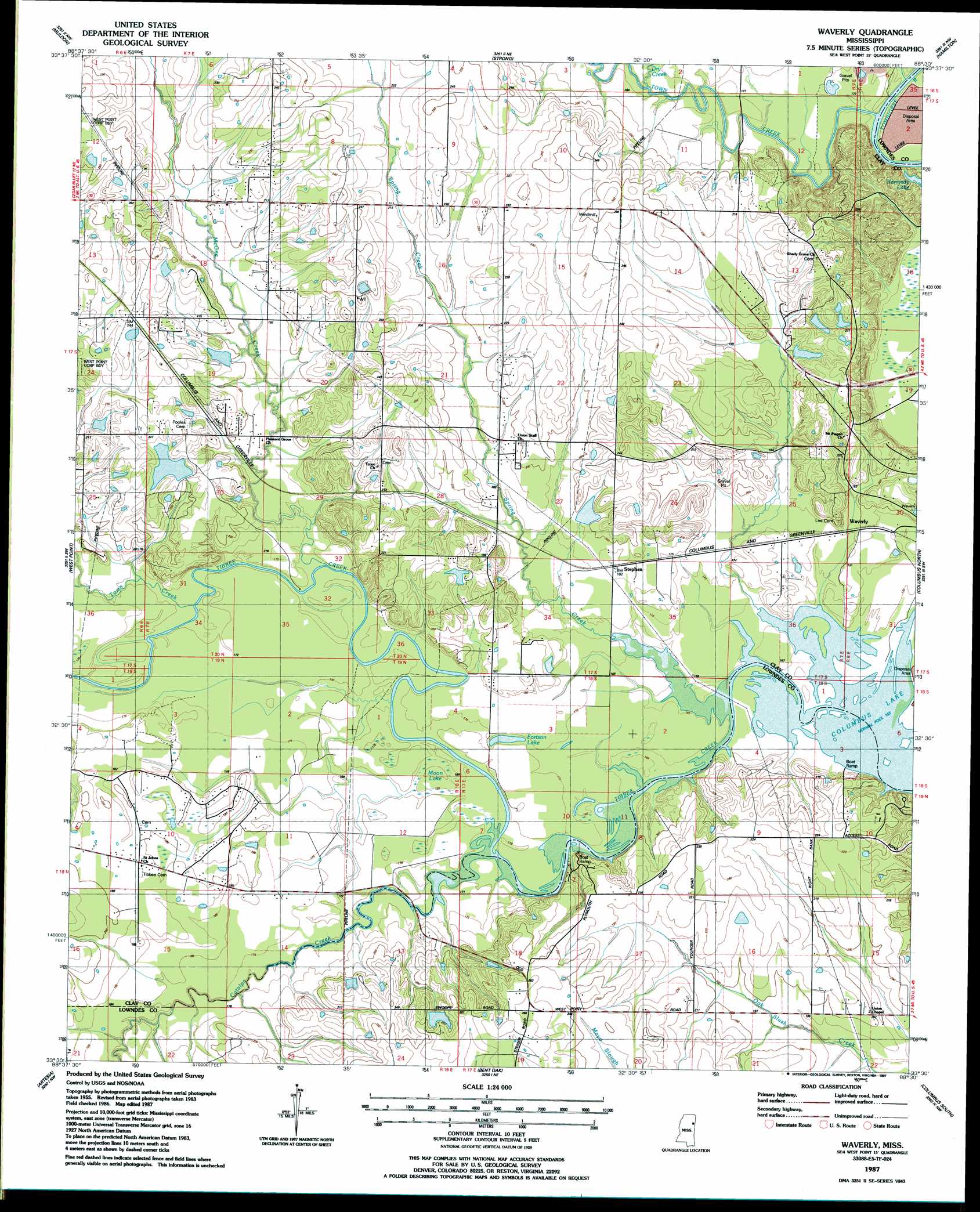
USGS Topo Quad 33088e5 - 1:24,000 scale
| Topo Map Name: | Waverly |
| USGS Topo Quad ID: | 33088e5 |
| Print Size: | ca. 21 1/4" wide x 27" high |
| Southeast Coordinates: | 33.5° N latitude / 88.5° W longitude |
| Map Center Coordinates: | 33.5625° N latitude / 88.5625° W longitude |
| U.S. State: | MS |
| Filename: | o33088e5.jpg |
| Download Map JPG Image: | Waverly topo map 1:24,000 scale |
| Map Type: | Topographic |
| Topo Series: | 7.5´ |
| Map Scale: | 1:24,000 |
| Source of Map Images: | United States Geological Survey (USGS) |
| Alternate Map Versions: |
Waverly MS 1987, updated 1987 Download PDF Buy paper map Waverly MS 2012 Download PDF Buy paper map Waverly MS 2015 Download PDF Buy paper map |
1:24,000 Topo Quads surrounding Waverly
Trebloc |
Prairie |
Aberdeen |
Amory Sw |
Amory Se |
Palo Alto |
Muldon |
Strong |
Hamilton |
Caledonia |
Cedar Bluff |
West Point |
Waverly |
Columbus North |
Steens |
Starkville |
Artesia |
Bent Oak |
Columbus South |
New Hope |
Bluff Lake |
Crawford West |
Crawford East |
Trinity |
Forreston |
> Back to 33088e1 at 1:100,000 scale
> Back to 33088a1 at 1:250,000 scale
> Back to U.S. Topo Maps home
Waverly topo map: Gazetteer
Waverly: Cliffs
Red Bluff elevation 52m 170′Waverly: Crossings
Rocky Ford (historical) elevation 50m 164′Waverly: Dams
Harrell Lake Dam elevation 61m 200′Kellogg Lake Dam elevation 61m 200′
Mississippi No Name 156 Dam elevation 57m 187′
Mississippi No Name 157 Dam elevation 59m 193′
Mississippi No Name 158 Dam elevation 57m 187′
Williams Lake Dam elevation 61m 200′
Waverly: Lakes
Fortson Lake elevation 52m 170′Waverly: Parks
Town Creek Recreation Area elevation 59m 193′Waverly: Populated Places
Plymouth (historical) elevation 63m 206′Stephen elevation 55m 180′
Waverly elevation 55m 180′
Waverly: Streams
Catalpa Creek elevation 50m 164′Dry Creek elevation 51m 167′
McGee Creek elevation 50m 164′
Spring Creek elevation 50m 164′
Town Creek elevation 51m 167′
Town Creek elevation 51m 167′
Waverly: Swamps
Moon Lake elevation 52m 170′Waverly digital topo map on disk
Buy this Waverly topo map showing relief, roads, GPS coordinates and other geographical features, as a high-resolution digital map file on DVD: