Caledonia Topo Map Mississippi
To zoom in, hover over the map of Caledonia
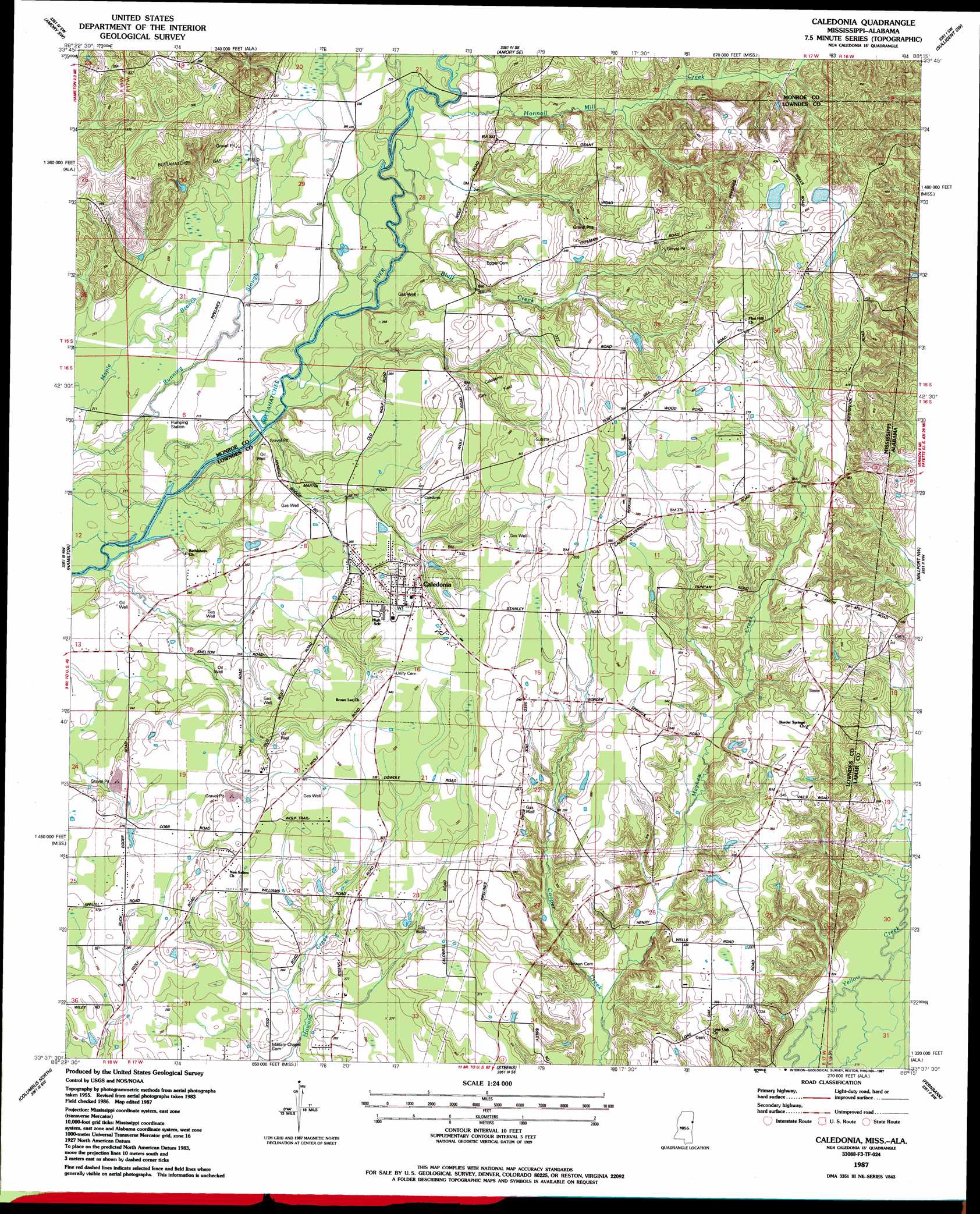
USGS Topo Quad 33088f3 - 1:24,000 scale
| Topo Map Name: | Caledonia |
| USGS Topo Quad ID: | 33088f3 |
| Print Size: | ca. 21 1/4" wide x 27" high |
| Southeast Coordinates: | 33.625° N latitude / 88.25° W longitude |
| Map Center Coordinates: | 33.6875° N latitude / 88.3125° W longitude |
| U.S. States: | MS, AL |
| Filename: | o33088f3.jpg |
| Download Map JPG Image: | Caledonia topo map 1:24,000 scale |
| Map Type: | Topographic |
| Topo Series: | 7.5´ |
| Map Scale: | 1:24,000 |
| Source of Map Images: | United States Geological Survey (USGS) |
| Alternate Map Versions: |
Caledonia MS 1987, updated 1987 Download PDF Buy paper map Caledonia MS 2012 Download PDF Buy paper map Caledonia MS 2015 Download PDF Buy paper map |
1:24,000 Topo Quads surrounding Caledonia
Wren |
Amory |
Greenwood Springs |
Sulligent |
Beaverton |
Aberdeen |
Amory Sw |
Amory Se |
Sulligent Sw |
Vernon |
Strong |
Hamilton |
Caledonia |
Millport Nw |
Hightogy |
Waverly |
Columbus North |
Steens |
Fernbank |
Millport |
Bent Oak |
Columbus South |
New Hope |
Ethelsville |
Reform |
> Back to 33088e1 at 1:100,000 scale
> Back to 33088a1 at 1:250,000 scale
> Back to U.S. Topo Maps home
Caledonia topo map: Gazetteer
Caledonia: Crossings
Gallagher Ferry (historical) elevation 63m 206′Kolbs Ferry (historical) elevation 63m 206′
Caledonia: Dams
Ambrose Lake Dam elevation 125m 410′Caledonia: Oilfields
Buttahatchee Gas Field elevation 88m 288′Caledonia Gas Field elevation 92m 301′
Caledonia: Populated Places
Border Springs (historical) elevation 107m 351′Caledonia elevation 102m 334′
Flint Hill elevation 128m 419′
Caledonia: Streams
Bluff Creek elevation 64m 209′Cut Bank Creek elevation 65m 213′
Honnoll Mill Creek elevation 66m 216′
Mayhew Creek elevation 74m 242′
Caledonia digital topo map on disk
Buy this Caledonia topo map showing relief, roads, GPS coordinates and other geographical features, as a high-resolution digital map file on DVD: