Millport Nw Topo Map Alabama
To zoom in, hover over the map of Millport Nw
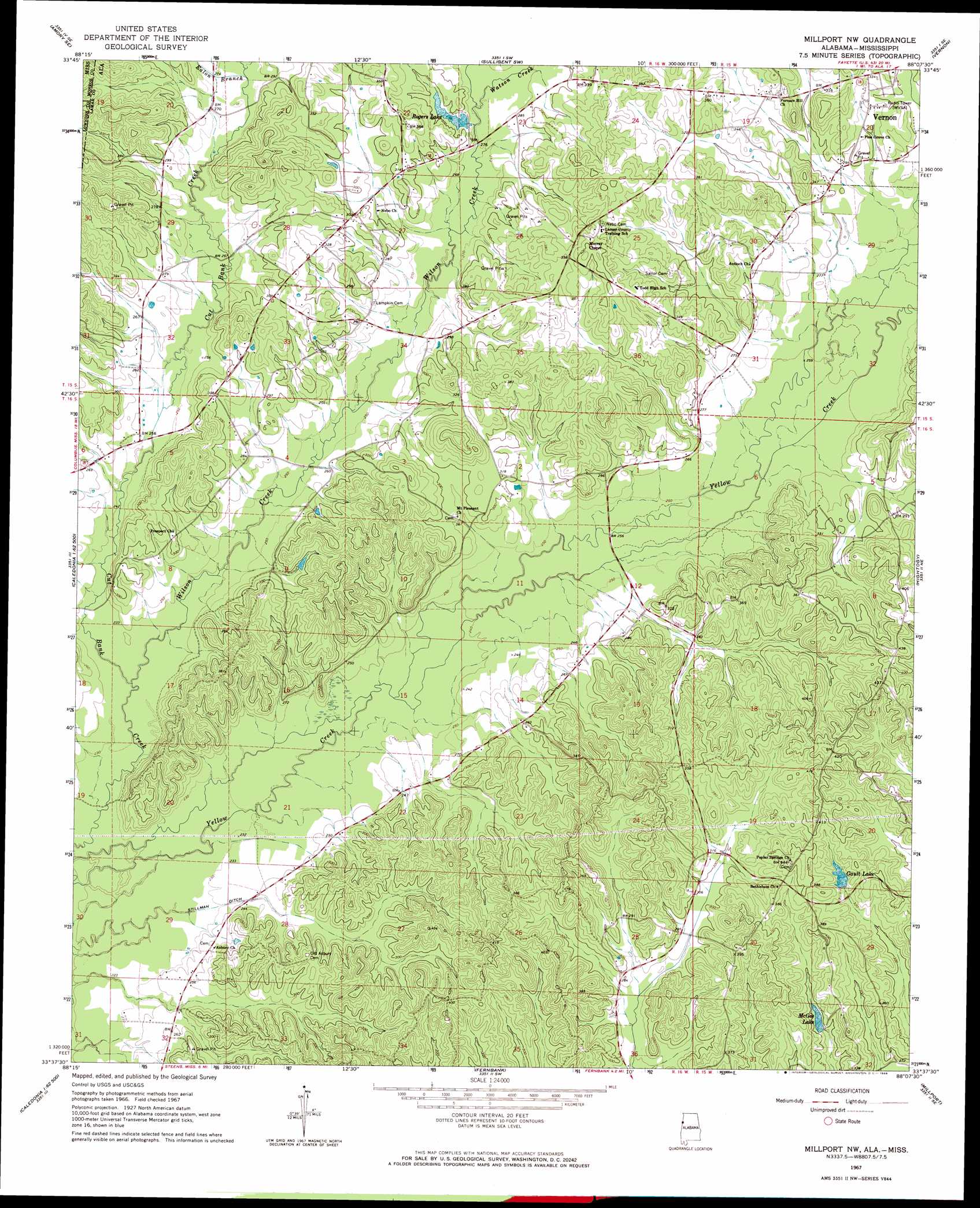
USGS Topo Quad 33088f2 - 1:24,000 scale
| Topo Map Name: | Millport Nw |
| USGS Topo Quad ID: | 33088f2 |
| Print Size: | ca. 21 1/4" wide x 27" high |
| Southeast Coordinates: | 33.625° N latitude / 88.125° W longitude |
| Map Center Coordinates: | 33.6875° N latitude / 88.1875° W longitude |
| U.S. States: | AL, MS |
| Filename: | o33088f2.jpg |
| Download Map JPG Image: | Millport Nw topo map 1:24,000 scale |
| Map Type: | Topographic |
| Topo Series: | 7.5´ |
| Map Scale: | 1:24,000 |
| Source of Map Images: | United States Geological Survey (USGS) |
| Alternate Map Versions: |
Millport NW AL 1967, updated 1968 Download PDF Buy paper map Millport NW AL 1967, updated 1982 Download PDF Buy paper map Millport NW AL 1967, updated 1986 Download PDF Buy paper map Millport NW AL 2011 Download PDF Buy paper map Millport NW AL 2014 Download PDF Buy paper map |
1:24,000 Topo Quads surrounding Millport Nw
Amory |
Greenwood Springs |
Sulligent |
Beaverton |
Guin |
Amory Sw |
Amory Se |
Sulligent Sw |
Vernon |
Bluff |
Hamilton |
Caledonia |
Millport Nw |
Hightogy |
Belk |
Columbus North |
Steens |
Fernbank |
Millport |
Kennedy |
Columbus South |
New Hope |
Ethelsville |
Reform |
Palmetto |
> Back to 33088e1 at 1:100,000 scale
> Back to 33088a1 at 1:250,000 scale
> Back to U.S. Topo Maps home
Millport Nw topo map: Gazetteer
Millport Nw: Canals
Stillman Ditch elevation 69m 226′Millport Nw: Dams
Gault Lake Dam elevation 104m 341′McGee Dam elevation 83m 272′
Rogers Dam elevation 91m 298′
Millport Nw: Oilfields
McGee Lake Gas Field elevation 90m 295′Molloy Gas Field elevation 76m 249′
Star Oil and Gas Field elevation 76m 249′
Yellow Creek Gas Field elevation 71m 232′
Yellow Creek Oil Field elevation 93m 305′
Millport Nw: Populated Places
Molloy elevation 94m 308′Star elevation 81m 265′
Millport Nw: Reservoirs
Gault Lake elevation 103m 337′McGee Lake elevation 85m 278′
Rogers Lake elevation 89m 291′
Millport Nw: Streams
Ealon Branch elevation 84m 275′Watson Creek elevation 91m 298′
Wilson Creek elevation 69m 226′
Millport Nw digital topo map on disk
Buy this Millport Nw topo map showing relief, roads, GPS coordinates and other geographical features, as a high-resolution digital map file on DVD: