Merigold Topo Map Mississippi
To zoom in, hover over the map of Merigold
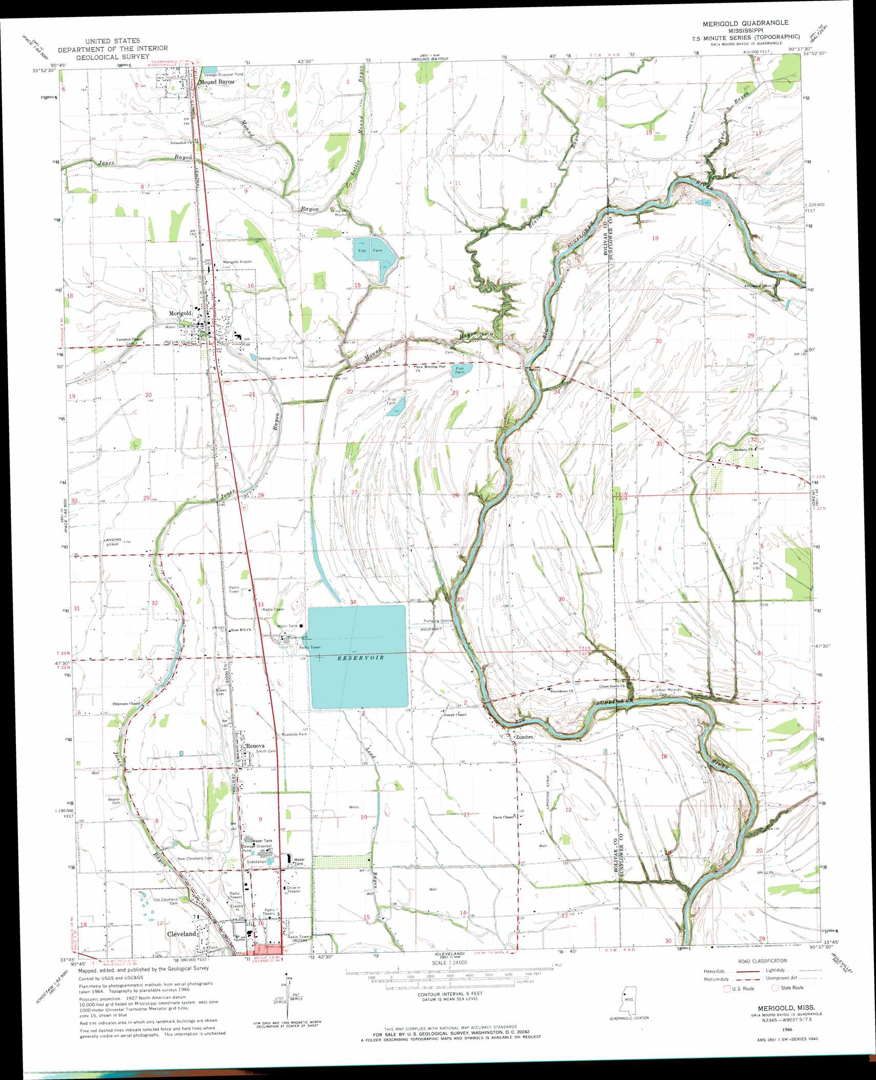
USGS Topo Quad 33090g6 - 1:24,000 scale
| Topo Map Name: | Merigold |
| USGS Topo Quad ID: | 33090g6 |
| Print Size: | ca. 21 1/4" wide x 27" high |
| Southeast Coordinates: | 33.75° N latitude / 90.625° W longitude |
| Map Center Coordinates: | 33.8125° N latitude / 90.6875° W longitude |
| U.S. State: | MS |
| Filename: | o33090g6.jpg |
| Download Map JPG Image: | Merigold topo map 1:24,000 scale |
| Map Type: | Topographic |
| Topo Series: | 7.5´ |
| Map Scale: | 1:24,000 |
| Source of Map Images: | United States Geological Survey (USGS) |
| Alternate Map Versions: |
Merigold MS 1966, updated 1967 Download PDF Buy paper map Merigold MS 2012 Download PDF Buy paper map Merigold MS 2015 Download PDF Buy paper map |
1:24,000 Topo Quads surrounding Merigold
Laconia |
Round Lake |
Duncan |
Mattson |
Tutwiler |
Gunnison |
Shelby |
Mound Bayou |
Baltzer |
Rome |
Beulah |
Pace |
Merigold |
Drew |
Brooks |
Lobdell |
Skene |
Cleveland |
Ruleville |
Rattlesnake Bayou |
Stringtown |
Shaw |
Boyer |
Sunflower |
Bear Gut Bayou |
> Back to 33090e1 at 1:100,000 scale
> Back to 33090a1 at 1:250,000 scale
> Back to U.S. Topo Maps home
Merigold topo map: Gazetteer
Merigold: Airports
Dorr Field elevation 44m 144′Merigold: Dams
Merigold Sewage Lagoon Dam elevation 43m 141′Mississippi Power and Light Pond Dam elevation 41m 134′
Merigold: Populated Places
Merigold elevation 44m 144′Renova elevation 42m 137′
Zumbro elevation 42m 137′
Merigold: Streams
Beaver Bayou elevation 36m 118′Hyde Bayou elevation 35m 114′
Little Mound Bayou elevation 40m 131′
Mound Bayou elevation 34m 111′
Merigold digital topo map on disk
Buy this Merigold topo map showing relief, roads, GPS coordinates and other geographical features, as a high-resolution digital map file on DVD: