Mound Bayou Topo Map Mississippi
To zoom in, hover over the map of Mound Bayou
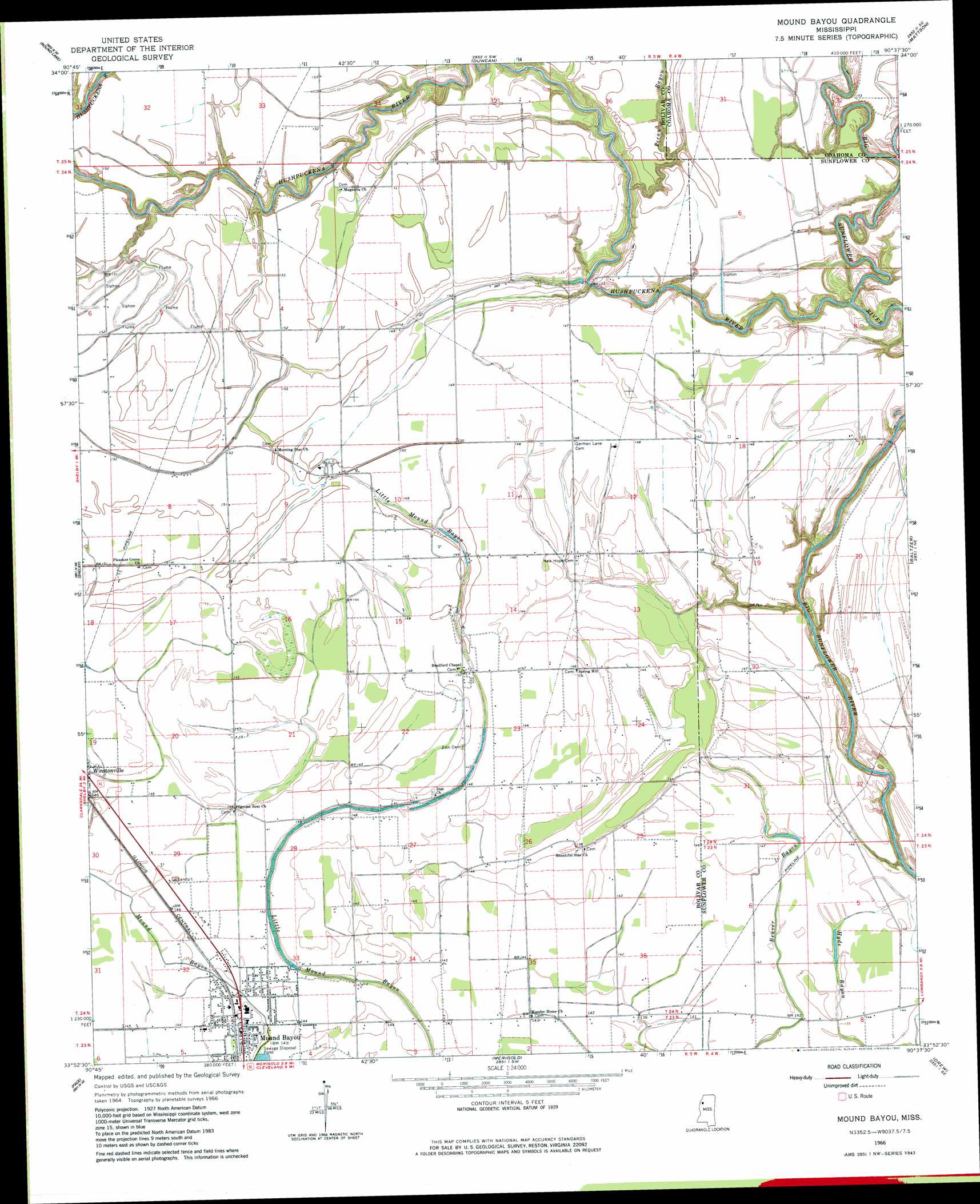
USGS Topo Quad 33090h6 - 1:24,000 scale
| Topo Map Name: | Mound Bayou |
| USGS Topo Quad ID: | 33090h6 |
| Print Size: | ca. 21 1/4" wide x 27" high |
| Southeast Coordinates: | 33.875° N latitude / 90.625° W longitude |
| Map Center Coordinates: | 33.9375° N latitude / 90.6875° W longitude |
| U.S. State: | MS |
| Filename: | o33090h6.jpg |
| Download Map JPG Image: | Mound Bayou topo map 1:24,000 scale |
| Map Type: | Topographic |
| Topo Series: | 7.5´ |
| Map Scale: | 1:24,000 |
| Source of Map Images: | United States Geological Survey (USGS) |
| Alternate Map Versions: |
Mound Bayou MS 1966, updated 1967 Download PDF Buy paper map Mound Bayou MS 1966, updated 1982 Download PDF Buy paper map Mound Bayou MS 2012 Download PDF Buy paper map Mound Bayou MS 2015 Download PDF Buy paper map |
1:24,000 Topo Quads surrounding Mound Bayou
Mellwood |
Rena Lara |
Sherard |
Clarksdale |
Sabino |
Laconia |
Round Lake |
Duncan |
Mattson |
Tutwiler |
Gunnison |
Shelby |
Mound Bayou |
Baltzer |
Rome |
Beulah |
Pace |
Merigold |
Drew |
Brooks |
Lobdell |
Skene |
Cleveland |
Ruleville |
Rattlesnake Bayou |
> Back to 33090e1 at 1:100,000 scale
> Back to 33090a1 at 1:250,000 scale
> Back to U.S. Topo Maps home
Mound Bayou topo map: Gazetteer
Mound Bayou: Dams
Charles Heinz Catfish Ponds Dam elevation 45m 147′Mound Bayou Sewage Lagoon Dam elevation 42m 137′
Mound Bayou: Lakes
Barrows Lake (historical) elevation 45m 147′Goose Lake (historical) elevation 44m 144′
Mound Bayou: Populated Places
Mound Bayou elevation 43m 141′Mound Bayou: Streams
Hushpuckena River elevation 36m 118′Pecan Bayou elevation 43m 141′
Mound Bayou digital topo map on disk
Buy this Mound Bayou topo map showing relief, roads, GPS coordinates and other geographical features, as a high-resolution digital map file on DVD: